A map showing the distance to points of interest from a high rise residential building
Client: Fairfield Residential
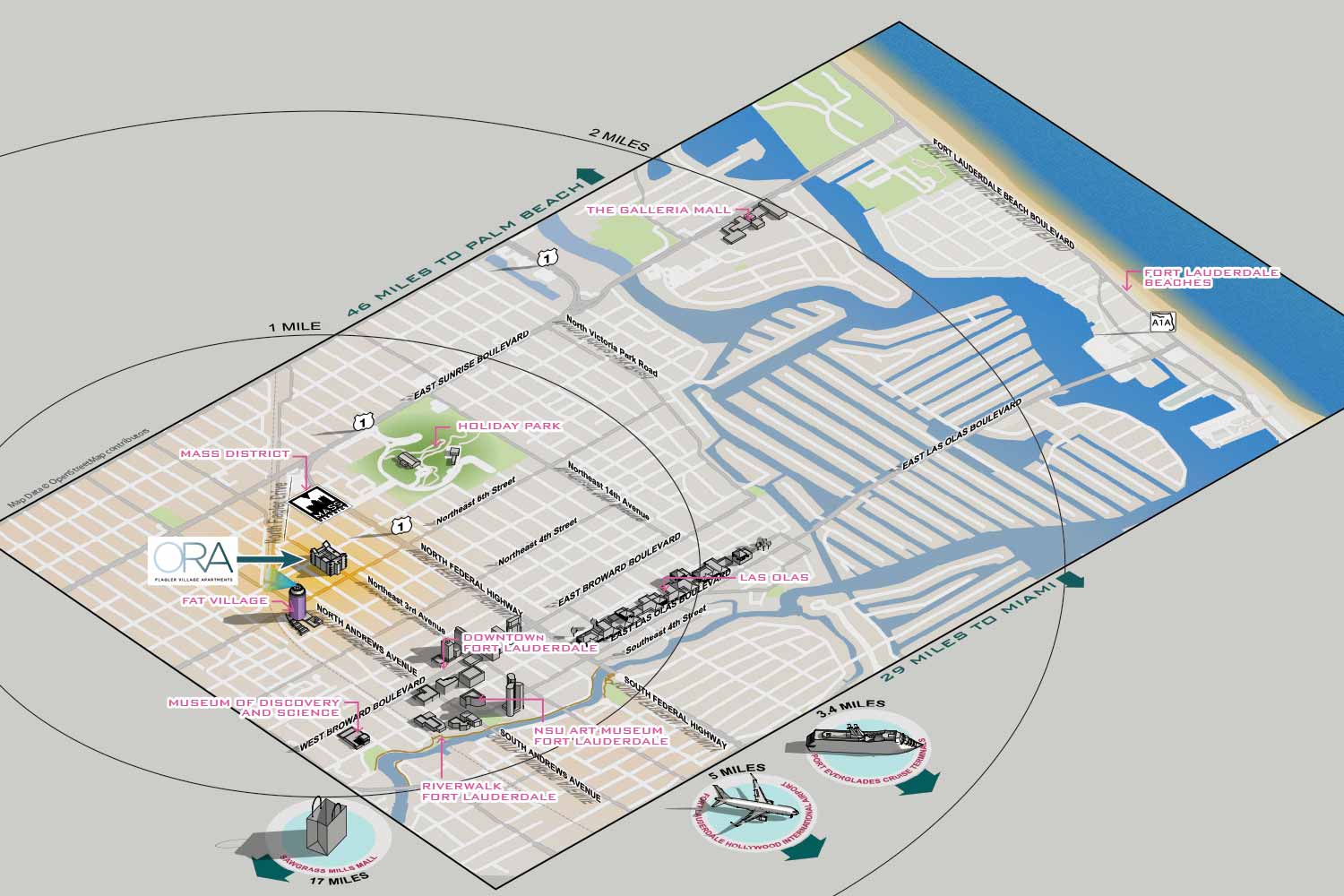
This project was to show the geographical advantages of living in a residence tower in Fort Lauderdale's Flagler Village neighborhood. The client requested I make a relatively conventional street map with some 3D points of interest. The points of interest were to be labeled so that potential residents could see at a glance what a convenient location the condos are.
The property is in an artsy part of town near both the MASS District and FAT Village which are local arts districts. The architecture of the building and their promotional website have a classy, minimalist, high tech feel with a limited color palette that suits the area well. For consistency I carried that look over into the map.


WHAT IS GEODATA:
Geodata is digital information about geographical locations and features that can be used to create detailed and accurate maps. This data can include street names, coordinates, topography, land use, demographics, and a wide variety of other location-based information. When combined and analyzed, geodata provides a foundation for creating maps that are both precise and informative. Software that integrates and visualizes this data is commonly referred to as a Geographic Information System, or GIS.
While the maps in my portfolio were not created using advanced GIS platforms like ArcGIS, I do use geodata as a key resource in conjunction with professional illustration tools such as Adobe Illustrator and SketchUp. High-density areas with complex street networks or numerous features require reliable external data to ensure accuracy, because manually tracing streets or locations from other sources is both time-consuming and prone to error. By incorporating geodata, I can produce maps that are more precise, efficient to create, and fully customized to the client’s needs.
Even when using geodata, every map I create maintains a distinct artistic style. I apply emphasis where needed, simplify complex areas for clarity, and incorporate a visual aesthetic that aligns with the client’s goals. Geodata is a powerful tool, but it is not the right choice for every project. When it is used strategically, it allows me to create maps that are accurate, functional, and visually engaging, combining technical precision with creative design.