A map showing the distance to points of interest from the Broward County Convention Center
Illustration and design by John Potter - Escape Key Graphics
Creative Direction by Thom Hart - Aqua Marketing & Communications, Inc.
Creative Direction by Thom Hart - Aqua Marketing & Communications, Inc.
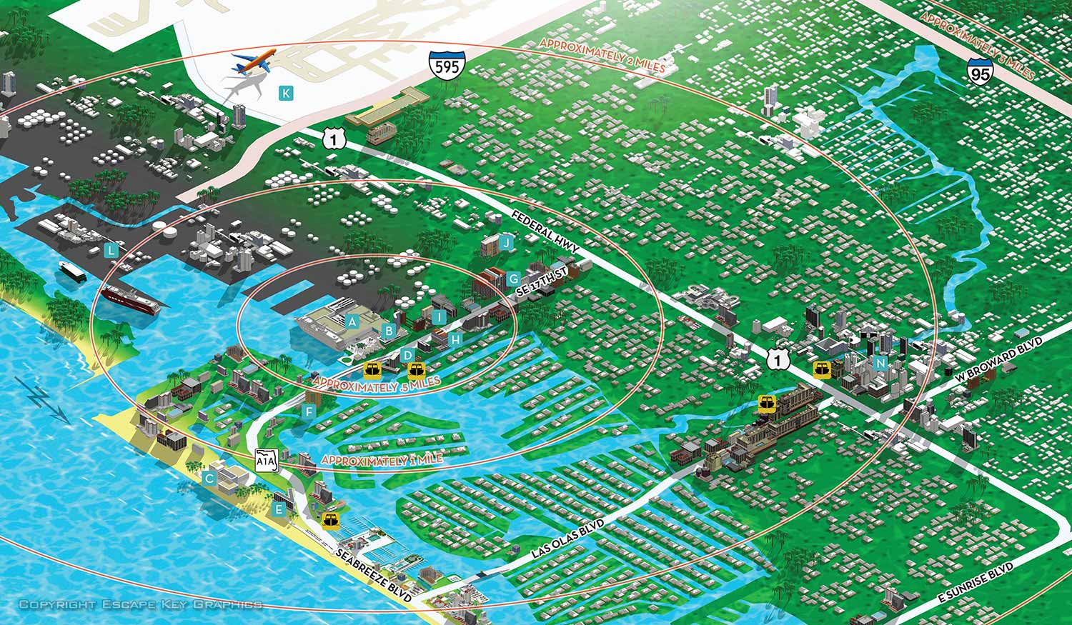
This map shows the greater Fort Lauderdale are and the way it relates to the Broward County Convention Center.
I seldom create a large area map like this. The goal is frequently to have points of interest enlarged and some arbitrary scaling yet still retain an accurate map. These two ideas are contrary and usually cant be reconciled.
On this project my client understood the challenges and limitations and was willing to work within those restrictions. I was delighted and I'm happy to have an example of something that can be done given the opportunity.
TOWN AND CITY MAPS:
(and maps of similar areas)

Fort Lauderdale Map

Points of Interest Map

Medora, ND Map

Sunset Harbour, Miami

Treasure Cay Resort and Marina

City block in Dania Beach

Jamestown, RI Map

Bahia Mar Map

Keenesburg, CO

Newport Yachting Center

The Waterfront & City Commons

Red Bluff, CA

Minot, ND

17th St Causeway area

Sea Isle and Genting Marina

Collins Ave in Miami Beach Map

Large Resort in Pompano Beach

Island Map

Downtown West Palm Beach

Downtown Miami