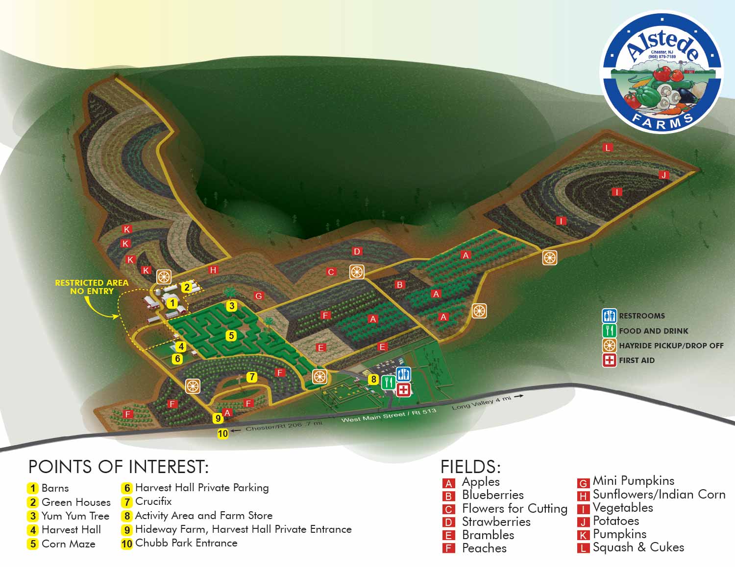
Agribusiness Illustrated Map - Illustrated Maps of a "You Pick" Farm
Agribusiness Illustrated Map - The two maps I have been developing for Alstede Farms are now complete. Alstede Farms is an agritourism business in Chester, New Jersey that features "pick your own" as well as a farm market and many other fun things to do and see.
One map highlights fields and crops that are presently available for "pick your own" and kind of a big picture overview. The map of the fields will change with the picking seasons. The second map is a close-up of the front of the farm where the farm market, garden shop and animals are. I used white space a little more creatively than usual on these map designs. I screen captured much of the process of the map's construction and created a video from it. This is one of my first HD videos. I hope you enjoy it.
If you are interested in visiting Alstede Farms please visit their website at AlstedeFarms.com.
For more about my map designs visit my site...attractionmaps.net

EXPLORE MY PORTFOLIOS
- Illustration: Find custom illustration, book covers, illustrated maps, and architectural rendering.
- Fine Art: Browse original paintings and drawings, the Custom Halftone Series, and murals.
- Graphic Design & Motion: See my graphic design work, plus motion design and animated illustrations.
- Maps by industry: Illustrated maps tailored for boat shows, resorts, marinas, real estate, transit & parking, towns & cities, parks, and wayfinding.
- Other project types: Also available: cover art, vehicle & vinyl wraps, proposal renderings, and street art.
- Techniques: Explore work in vector, isometric & axonometric, painting, black & white, GeoData, overhead, and halftone styles. Recently I have also begun to use AI for some specific solutions.
- Software: Primary tools: Photoshop, Illustrator, SketchUp Pro, and InDesign. Motion work uses Premiere Pro & After Effects.
