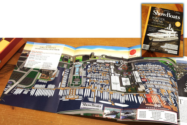
Boat Show Map as Magazine Illustration - Illustrated Map of Bahia Mar Marina
Be sure and check out the illustrated map foldout I created in the the November issue of ShowBoats International Magazine available in bookstores and on news stands now. I love the paper stock of the magazine and it gives a completely different feel to the map than you get from the program or the folding maps. I'm very flattered to have my work in such a professional, high quality publication.
This map rendering was created from a digital 3D model that can be viewed or rendered from multiple angles and enlargements. I have used the same technique to create illustrated maps of many other marinas and venues for boat shows and many other applications. These maps are easier to follow and more approachable than CAD drawings or site plans. Public response to the maps has consistently been positive and my clients find themselves free from so many questions about bathroom locations, vendor and exhibitor locations and the like.
If you have a venue you would like illustrated please contact me.
To see more maps of Bahia Mar created for the Fort Lauderdale International Boat Shows visit this page.