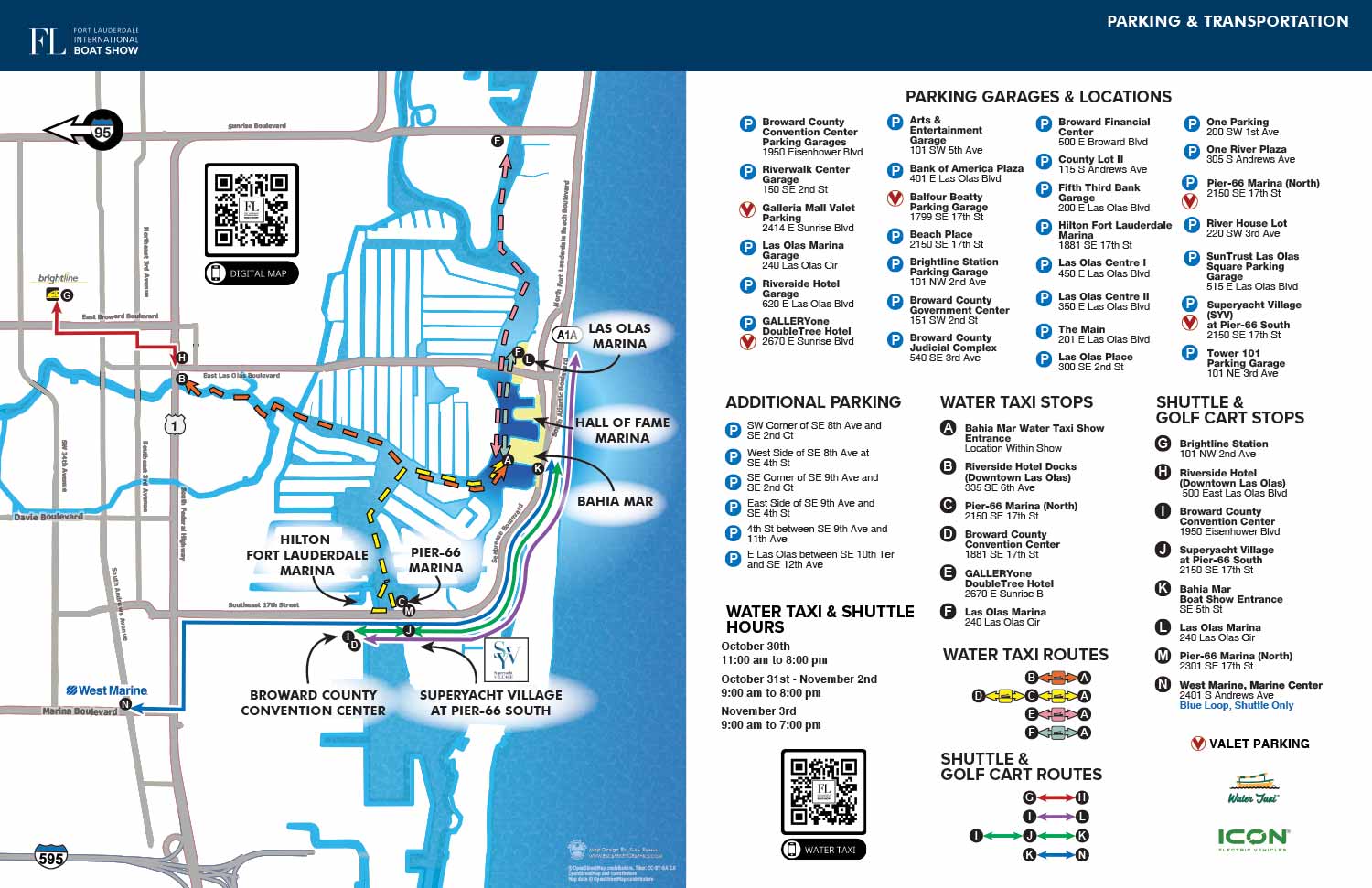
2024 FLIBS Parking and Transit Map
Project Management by Emma Wright - Informa Marketing
For more (and more recent) information about the 2024 Fort Lauderdale International Boat Show visit their official site at FLIBS.com. Scroll down to where it says Seven Locations.
I am the guy who designs and illustrates the maps used for the show.

I've just finished the transit map for the 2024 Fort Lauderdale International Boat Show.
This map shows shuttle bus routes and stops, Water Taxi stops as well as parking. It's a great aid for guests and exhibitors at the event. I suggest you used this map to make a plan before you leave for the show. It can make your day more pleasant and less stressful.
If you would like to see more of my maps please see my portfolio.


