2020 FLIBS Transit Map with new detail maps
Design by John Potter - Escape Key Graphics
![]()
I've just finished the transit map for the 2020 Fort Lauderdale International Boat Show. Like last year it shows shuttle bus routes and stops, Water Taxi stops and Uber and Lyft stops as well as parking. This year also features two smaller detail maps. One is of show center at Bahia Mar and Las Olas Marina. The second is the area around 17th Street Causeway with Pier66 and The Hilton Marina. These maps should make it easier than ever to locate pick up and drop off locations. I used Geodata to create all of these maps and ensure their accuracy.
See the map as it appears on the official show site. If you would like to see more of my maps please see my portfolio.

Water Taxi Map

Transportation & Parking Map

Miami Yacht Show Transit

Illustrated Map of Marinas

Parking Map Using GeoData

Transit Map

Music Festival Transit Map

Boat Show Transit Map
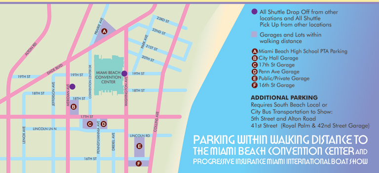
Miami Conv. Ctr. Parking

Transportation & Parking Map