Real Estate Development Map for Web Use
Illustration and Design by John Potter - Escape Key Graphics
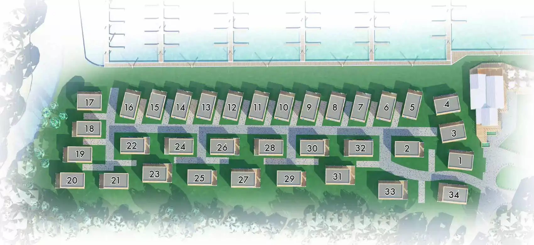
This is a small project but a significant one none the less. My client was in need of a simple but stylish overhead map providing and overview of lodges available in a residential development they have under construction in Windsor, England. They want to user the map as one of the informational assets on their cool new web site (still in development).
Contact me if you need a similar map or any other map or illustration for that matter.

Room Layout

Facade Rendering

Golf Resort Map

Golf Resort Map

Points of Interest Map

Illustrated Residential Resort

Miami Neighborhood Map

Beach Resort Siteplan

Color Resort Siteplan
PORTFOLIO GALLERIES
- Illustration work: Start with custom illustration and cover design, then view illustrated maps and architectural renderings.
- Fine art: Discover original paintings and drawings, the Custom Halftone Series, and mural projects.
- Design & motion: Check out the graphic design gallery, then move on to motion graphics and animated illustration.
- Maps by sector: I produce illustrated maps for boat shows, resorts, marinas, real estate, transit & parking, towns & cities, parks, and wayfinding systems.
- More creative services: Additional offerings include cover illustration, vehicle wraps, proposal renderings, and street art.
- Artistic methods: My work spans vector art, isometric & axonometric views, traditional painting, black & white illustration, GeoData mapping, overhead perspectives, and halftone effects.
- Preferred software: I rely on Photoshop, Illustrator, SketchUp Pro, and InDesign, plus Premiere Pro & After Effects for motion projects.