Illustrated Hiking Map
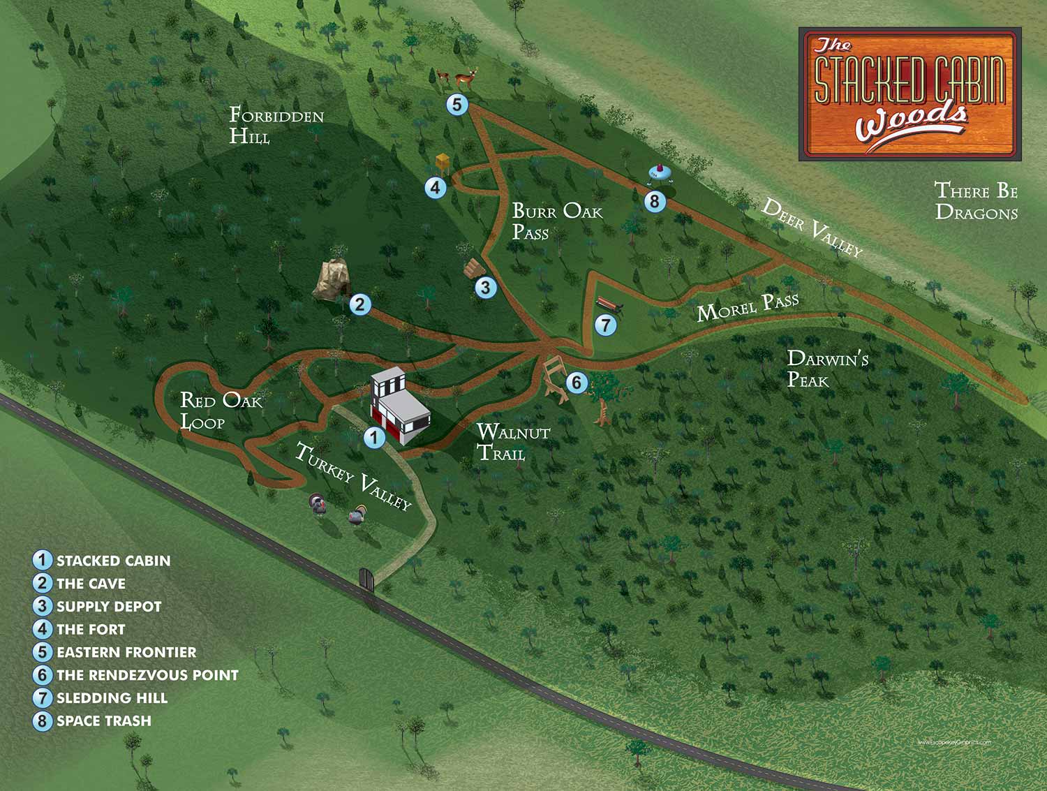
This illustrated map was commissioned as a personalised gift, created for a client to present to a friend’s family. Out of respect for their privacy, no names are included. The map is rendered in an axonometric style, offering a three dimensional perspective of the hiking trail and surrounding landscape, even though there are few buildings present.
The trail is brought to life with playful spot illustrations, including wild turkeys, deer, and even a whimsical flying saucer, transforming the hiking route into a charming and imaginative adventure. Points of interest are clearly marked using a numbered dot system, while areas of the forest are given inventive and fanciful names, adding personality and a sense of exploration. This combination of accuracy, creativity, and storytelling makes the map both a functional guide and a unique, memorable keepsake.


ILLUSTRATED PARK MAPS:
Illustrated park maps play an important role in helping visitors feel comfortable, informed, and confident as they explore a space. If you manage a botanical garden, work for a Parks and Recreation department, or oversee a public attraction, clear wayfinding is a key part of creating a positive guest experience. A well designed map reduces confusion, supports accessibility, and allows visitors to focus on enjoying the park rather than trying to figure out where they are.
The term park covers a wide range of destinations, from neighborhood ball fields and community parks to large nature preserves, wildlife sanctuaries, botanical gardens, theme parks, and agritourism venues. Over the years I have illustrated maps for many types of parks, each with its own layout, audience, and goals. In every case, the objective is the same: to present geographic information in a way that is easy to understand, visually engaging, and appropriate for the setting.
Each illustrated park map is tailored to the specific site and its visitors. Some projects call for a more realistic representation of the landscape, while others benefit from a lighter, more playful illustration style. Factors such as size, visitor flow, signage needs, and branding all influence the final approach. When you contact me about a park map, we will discuss your goals and challenges in detail and determine the style and level of detail that best supports your venue and your guests.
EXPLORE MY WORK
- Illustration: Discover custom illustrations, book covers, illustrated maps, and architectural renderings.
- Fine Art: Browse original paintings and drawings, view the Custom Halftone Series, or check out mural projects.
- Graphic Design & Motion: See the graphic design collection, then dive into motion design and animated illustrations.
- Maps by industry: View illustrated maps tailored for boat shows, resorts, marinas, real estate, transportation, towns, parks, and wayfinding.
- More project types: Explore cover art, vehicle wraps, proposal renderings, and street art.
- Techniques & styles: Work spans vector, isometric, painting, black-and-white, GeoData, overhead maps, and halftones.
- Software expertise: Primary tools include Photoshop, Illustrator, SketchUp Pro, and InDesign, plus Premiere Pro & After Effects for motion.