
Illustrated Map of Keenesburg, Colorado
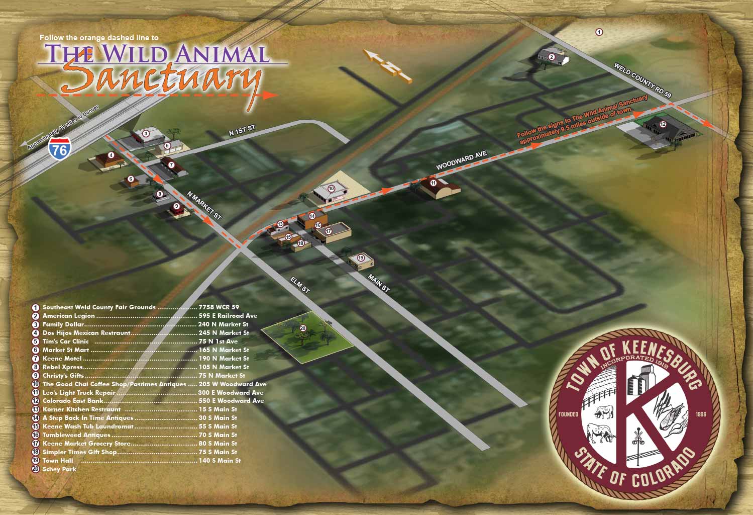
A Detailed Illustration of a Small Town’s Heart
This map of Keenesburg, Colorado, represents a focused approach to illustrated cartography. Rather than trying to capture an entire region, the project concentrated on the downtown area, where the town’s character and community life are centered. The goal was to highlight what makes Keenesburg special for both residents and visitors alike.
Highlighting Points of Interest
The town of Keenesburg commissioned this map to put its downtown landmarks front and center. The illustration brings attention to the key destinations that define the local experience. This includes civic buildings like the Town Hall, local businesses along Main Street, and community gathering spots. Each point of interest is rendered with care so that viewers can easily pick out their destination, making the map as practical as it is charming.
Balancing Art and Accuracy
Creating an illustrated map of a small downtown comes with its own set of creative decisions. The scale of a few city blocks allows for a high level of detail while keeping the illustration clear and readable. Buildings and landmarks are drawn with a realistic sense of proportion, staying true to the actual layout of the town. This method helps the viewer understand the space as it is, turning a simple street grid into an engaging visual story.
A Signature Approach to Town Maps
This map is part of a larger body of work that includes illustrated maps for towns, neighborhoods, and cities. Each project has its own character based on the area it covers. For a downtown like Keenesburg's, the process is straightforward: the focus is on clarity and charm. The result is a piece that works as both a functional guide and a keepsake for the community. If you are interested in seeing more of this approach, you can browse the full portfolio of illustrated maps on the Escape Key Graphics website.
(and maps of similar areas)


TOWN, CITY & NEIGHBORHOOD MAPS:
I've have created many illustrated maps over the years showing downtowns, neighborhoods and sometimes whole cities. These maps vary in nature based on the area involved. Most span an area of a few city blocks or the equivalent. At that scale I can include a fair amount of detail and use accurate scales for buildings and such and you can still tell what you are looking at clearly. In a smaller area I can provide even more detail to the illustration, but when you need to see many, many city blocks I usually have to switch to a less literal rendering approach. I may have to take license with exaggerated scales of buildings or cartoon like renderings of points of interest. This makes for a less literal illustrated map.
With the first scale of maps at a few city blocks I have a standard, tried and true method that I've used many times. This is not to say that I am inflexible or not open to new ideas but generally speaking I can get down to work right away on one of these maps without much conversation. Assuming, of course, that the client wants a similar illustrated map to previous ones I've made.
With the larger scale maps the client has many options right off and I need to ensure that I give them what they want. This necessitates a little more conversation and consulting before I begin.I also create overhead maps including street maps. These range from the simplified to the extremely detailed. Now using Geodata (computerized geographical data that can be used to create maps and add information to those maps) I can add levels of detail, and accuracy that would have been impossible (for me at least) a few years ago.
PORTFOLIO SELECTIONS
- Custom illustration & covers: Featuring bespoke illustration, book and magazine covers, hand-drawn maps, and building renderings.
- Fine art & murals: Including one-of-a-kind paintings and drawings, the Custom Halftone Series, and large-scale murals.
- Design & motion media: Covering graphic design, plus video and motion and animated illustration.
- Mapping by application: Tailored maps for marine events, hospitality, waterfront, property, transit, municipal, recreation, and navigation needs.
- Additional creative work: Includes editorial covers, vehicle graphics, concept renderings, and public art.
- Mediums & formats: Ranging from digital vector and isometric projection to traditional paint, line art, GIS-based, aerial-style, and halftone.
- Software expertise: Proficient in Photoshop, Illustrator, SketchUp, InDesign, and Premiere/After Effects for motion. More recently I have worked with AI.