Illustrated Map of a Yacht Club and Adjacent Neighborhood - Highlighting Local Businesses
For information about Sunset Harbour Yacht Club see SunsetHarbourYC.com
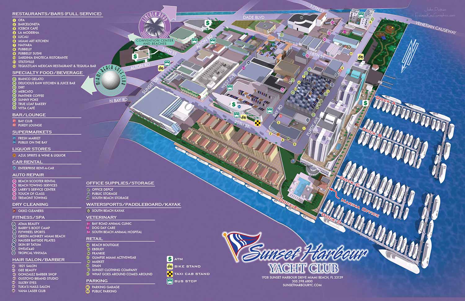
This illustrated neighborhood map presents Sunset Harbour Marina alongside the surrounding streets, waterfront, and nearby businesses, offering viewers a clear sense of place at a highly readable scale. The area was well suited to this type of map, allowing all elements to be shown accurately and in proper proportion. The result is a visually engaging overview that helps visitors and boaters understand the layout of the marina and its connection to the larger Sunset Harbour neighborhood.
Major points of interest were identified using a numbered key, making it easy for viewers to locate specific destinations without cluttering the illustration. Recurring elements such as restrooms, parking, and other standard amenities were indicated with icons that only needed to be keyed once. This approach improves legibility and prevents visual confusion between unique destinations and commonly repeated features, especially in busy environments like marinas and waterfront districts.
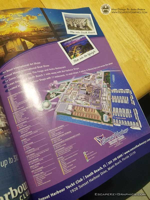
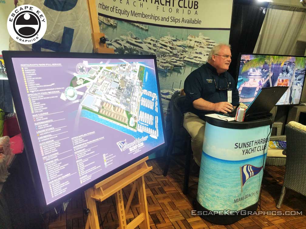
In addition to the printed version, I developed an interactive digital version of the map for the client’s website. The same artwork has also been used as signage and as a printed handout, demonstrating how a single, thoughtfully designed illustrated map can serve multiple marketing and wayfinding purposes across different platforms.
The Sunset Harbour Yacht Club serves as the visual anchor of the composition. Color choices and deco inspired spot illustrations were used to convey a distinctly Miami atmosphere while maintaining clarity and usability. The map has appeared in event programs and as on site signage at venues such as the Palm Beach International Boat Show, helping reinforce the identity of Sunset Harbour to both local visitors and an international boating audience.


(and maps of similar areas)


TOWN, CITY & NEIGHBORHOOD MAPS:
I've have created many illustrated maps over the years showing downtowns, neighborhoods and sometimes whole cities. These maps vary in nature based on the area involved. Most span an area of a few city blocks or the equivalent. At that scale I can include a fair amount of detail and use accurate scales for buildings and such and you can still tell what you are looking at clearly. In a smaller area I can provide even more detail to the illustration, but when you need to see many, many city blocks I usually have to switch to a less literal rendering approach. I may have to take license with exaggerated scales of buildings or cartoon like renderings of points of interest. This makes for a less literal illustrated map.
With the first scale of maps at a few city blocks I have a standard, tried and true method that I've used many times. This is not to say that I am inflexible or not open to new ideas but generally speaking I can get down to work right away on one of these maps without much conversation. Assuming, of course, that the client wants a similar illustrated map to previous ones I've made.
With the larger scale maps the client has many options right off and I need to ensure that I give them what they want. This necessitates a little more conversation and consulting before I begin.I also create overhead maps including street maps. These range from the simplified to the extremely detailed. Now using Geodata (computerized geographical data that can be used to create maps and add information to those maps) I can add levels of detail, and accuracy that would have been impossible (for me at least) a few years ago.
BROWSE MY WORK
- Illustration: Browse custom illustrations, book cover art, illustrated maps, and architectural renderings.
- Fine art: View original paintings and drawings, the Custom Halftone Series, and mural commissions.
- Graphic design & motion: See design projects, then watch motion reels and animated pieces.
- Maps by use case: Explore illustrated maps created for boat shows, resorts, marinas, real estate, transportation & parking, cities & towns, parks, and wayfinding.
- Specialty projects: Also check out cover design, vinyl & vehicle wraps, proposal renderings, and street art.
- Style & technique: Discover vector, isometric, painterly, monochrome, data-driven, bird's-eye, and halftone approaches.
- Tools I use: Everyday software includes Photoshop, Illustrator, SketchUp, and InDesign; motion work relies on Premiere & After Effects.