Windy City Boat & Yacht Show - Illustrated Map - 2026
Client: Informa Markets
For information about the Windy City Boat & Yacht Show and to ensure you're seeing the latest maps and information visit WindyCityBYS.com
About The Show
I am pleased and excited to be part of the debut year of The Windy City Boat & Yacht Show in Chicago, Illinois. The event takes place at the beautiful Burnham Harbor, located immediately south of Soldier Field. This puts the show close to the Field Museum, Shedd Aquarium, and Adler Planetarium, with easy access from the 18th Street Metra Rail Station. Water taxis will also be available for attendees.
 (Photo property of Chicago Harbors)
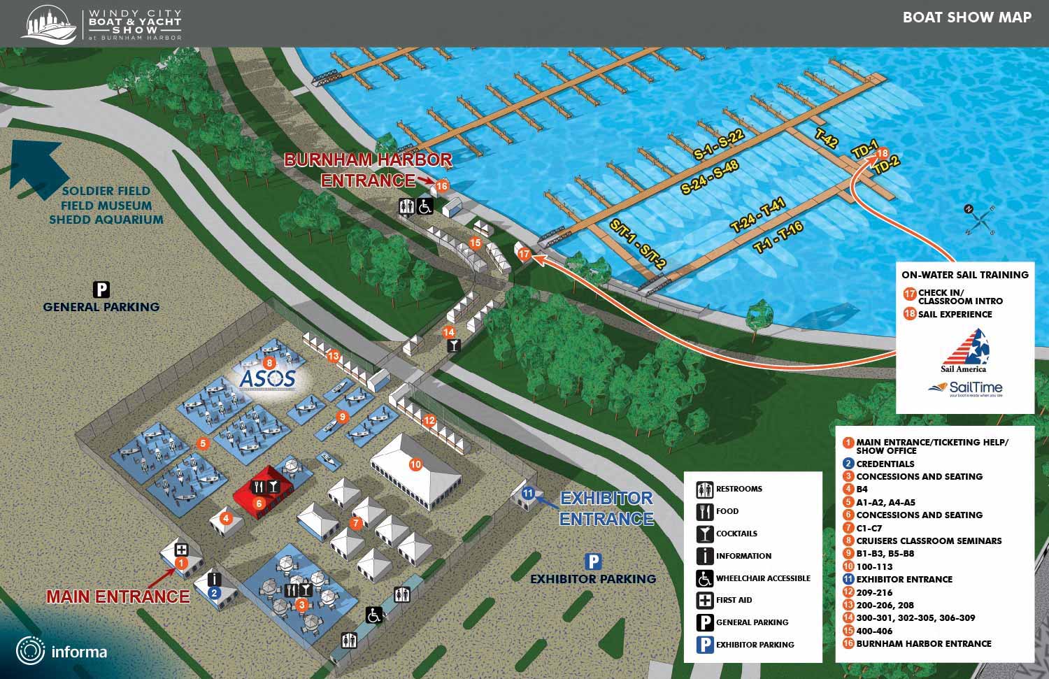
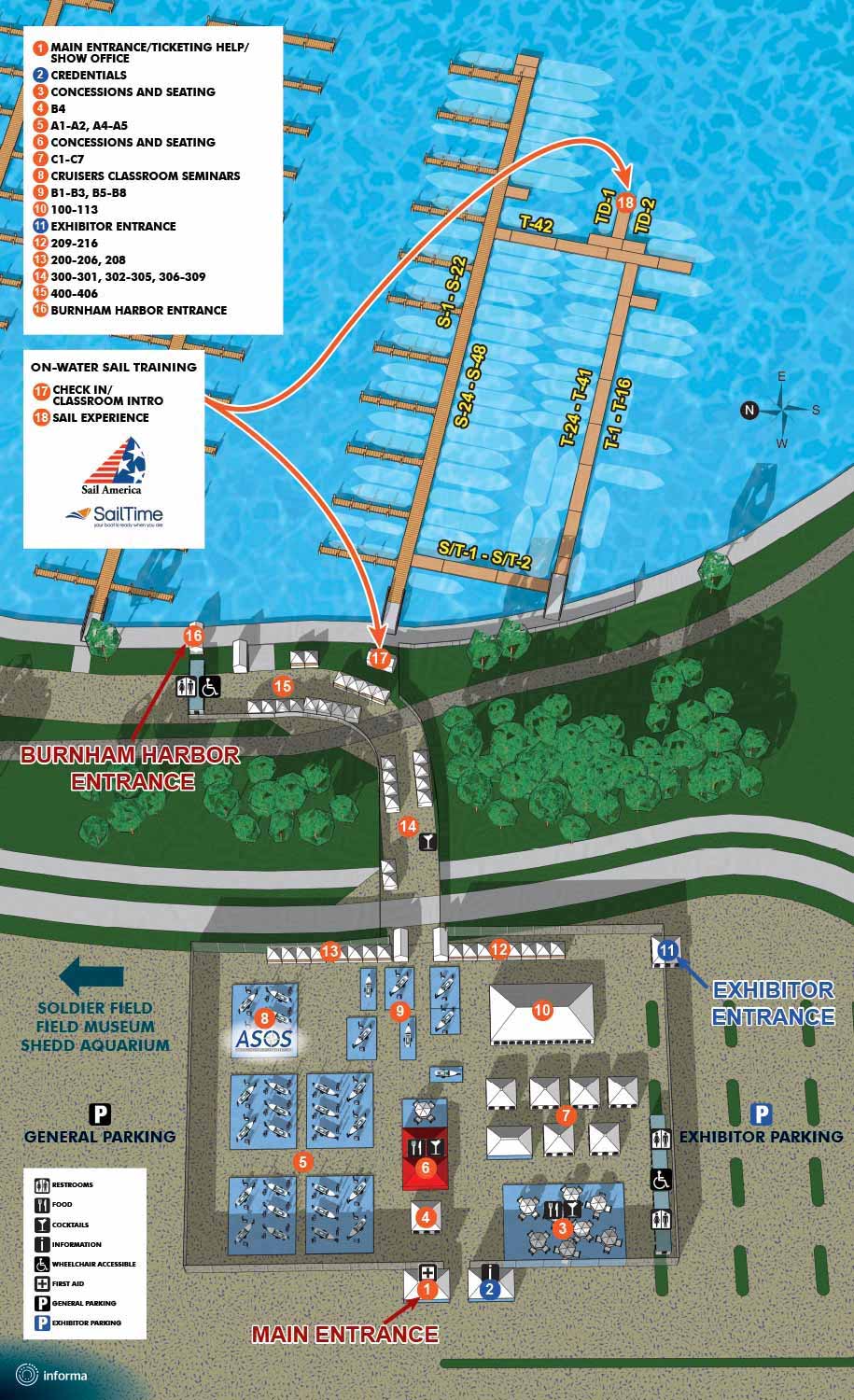
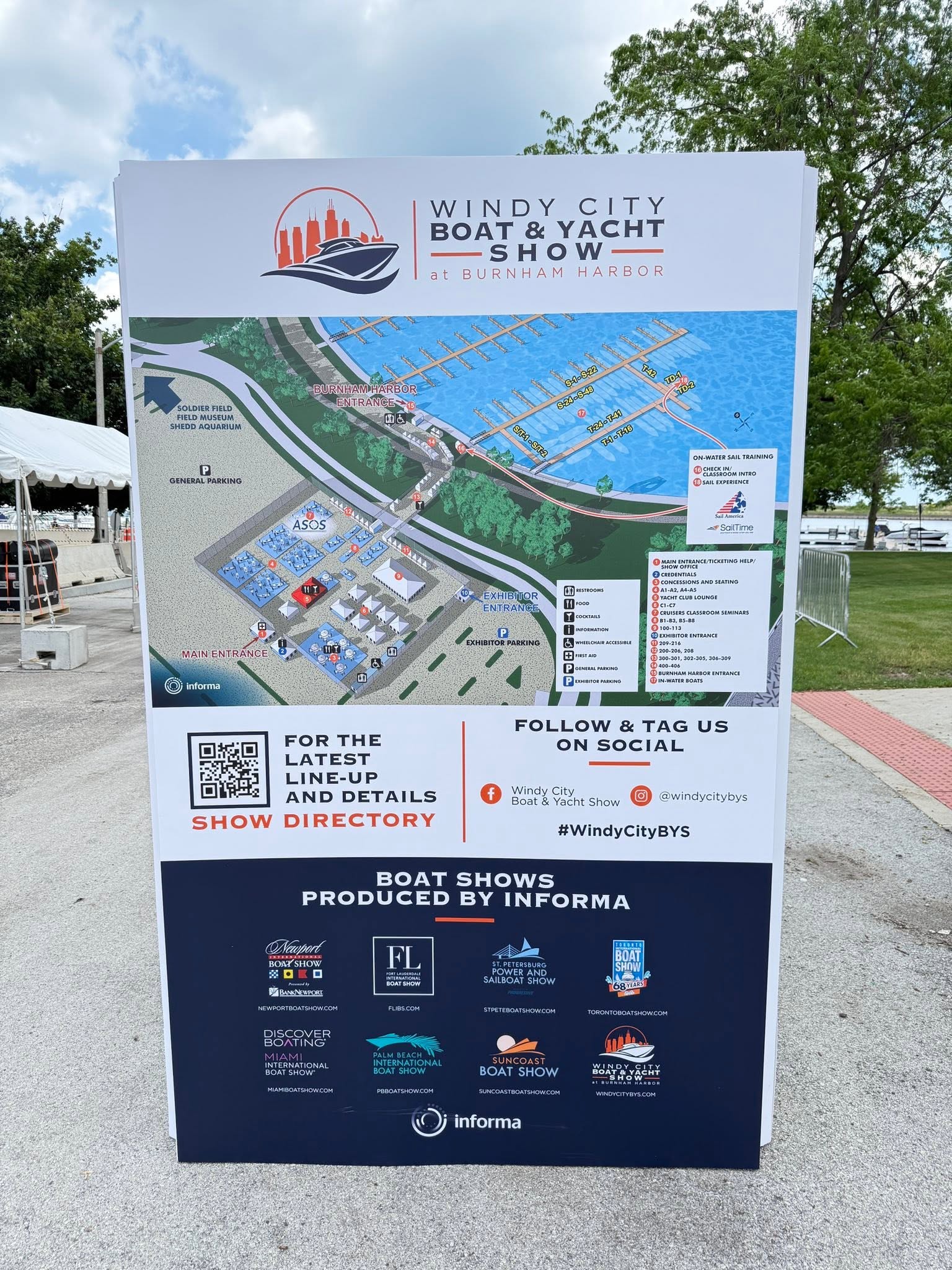
The show features a stunning lineup of in water boats up to 75 feet, ranging from cutting edge powerboats to elegant sailboats, including both new models and brokerage vessels. On land, exhibits will showcase the latest in marine technology, luxury accessories, safety gear, and must have boating essentials. Whether you are a dedicated boater or just looking for a great day out, this promises to be a fantastic event.
Making the Map
As is my standard practice for shows run by Informa, this map is based on a three dimensional digital model I created. I knew about this show long before the plans were solidified, so I started working ahead of time and built a model that includes a larger area than appears in the final map. I expect this extra information may prove useful in the future as the show inevitably grows.
I used the model to render images, which I then refined and recomposed in Adobe Photoshop. I added the map keys, graphical icons and other graphical elements using Adobe Illustrator. I have used this technique for many years on other major events, including the Fort Lauderdale International Boat Show, the Miami International Boat Show, and the Palm Beach International Boat Show. This specific map shares many characteristics with the Suncoast Boat Show map in terms of scale and setup, so I applied similar methods of dock numbering and keying to ensure clarity.
Uses
This map will serve multiple purposes. It will appear on the official show website, within the phone app, in printed materials, and on event signage. This approach maximizes the potential of the visual asset. The map functions not only as a practical tool for finding your way around but also as an aspirational graphic that allows guests to imagine their experience before they arrive.
I am genuinely excited to see boat shows emerging in Chicago. I feel confident that this growing market will continue to flourish. The Great Lakes offer more than 94,000 square miles of freshwater cruising, with plenty of opportunities for diving, sailing, fishing, and touring. Boating serves as a wonderful way to step away from the city and enjoy nature for the day.
Some of this year's show sponsors:
Sail America
SailTime
ASOS (The Annapolis School of Seamanship)
Maps For The Windy City Boat & Yacht Show:
- About The Windy City Boat & Yacht Show
- The Windy City Boat & Yacht Show: 2026
MAPS FOR BOAT SHOWS IN CHICAGO:


EXPLORE MY WORK
- Illustration: Discover custom illustrations, book covers, illustrated maps, and architectural renderings.
- Fine Art: Browse original paintings and drawings, view the Custom Halftone Series, or check out mural projects.
- Graphic Design & Motion: See the graphic design collection, then dive into motion design and animated illustrations.
- Maps by industry: View illustrated maps tailored for boat shows, resorts, marinas, real estate, transportation, towns, parks, and wayfinding.
- More project types: Explore cover art, vehicle wraps, proposal renderings, and street art.
- Techniques & styles: Work spans vector, isometric, painting, black-and-white, GeoData, overhead maps, and halftones.
- Software expertise: Primary tools include Photoshop, Illustrator, SketchUp Pro, and InDesign, plus Premiere Pro & After Effects for motion.