Civic Art - illustration of a city facility
Artist, Illustrator: John Potter - Escape Key Graphics
Client: City of Pembroke Pines
Project Management by Holly Bonkowski - Assistant Director of Cultural Arts - City of Pembroke Pines


 If you are using a device other than your phone to view this you can scan the QR code and you can test it with the image above. This will also save you some data if you have a WIFI connection right now.
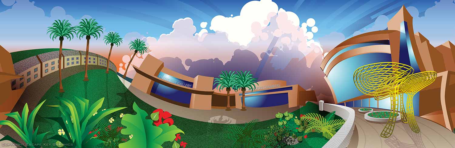
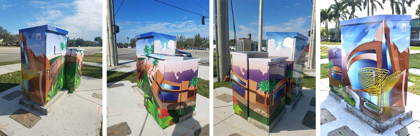
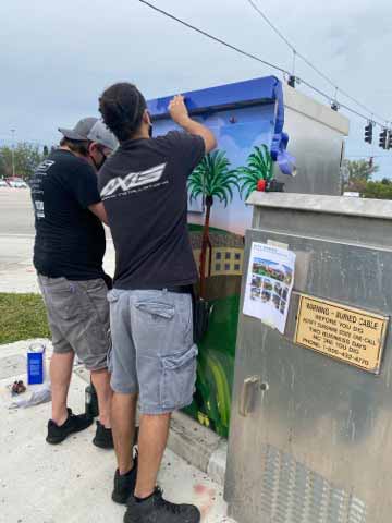
This is one in a series of vinyl wrap illustrations I created for The City of Pembroke Pines, Florida. The illustrations are being used to beautify utility boxes at intersections throughout the city.
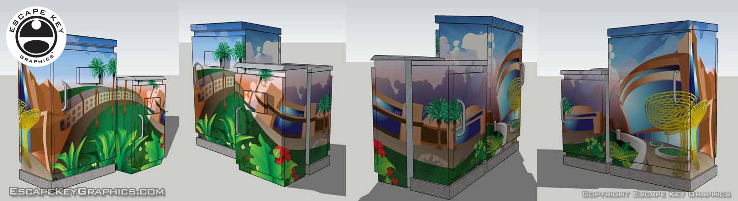
Once a location was established I went on site and measured the box. I created both a flat, scale, projection drawing of the box and created a 3D model in Sketchup. The model allowed me to see how the sketch would really fit wrapped around the boxes and the flattened projection was necessary to create final art that wraps seamlessly around the boxes.
This specific box is at the intersection of Pines Boulevard and Flamingo Road on the southeast corner.
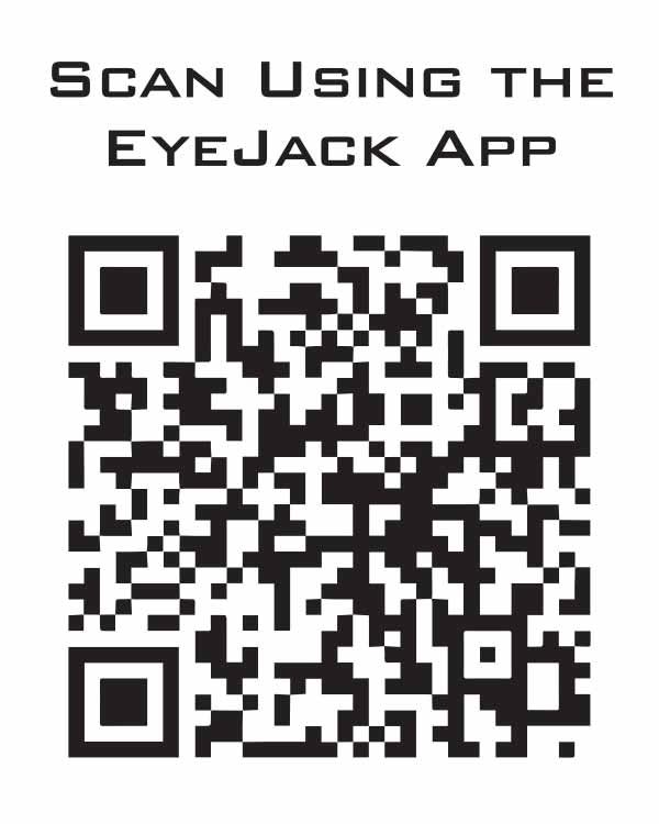
This box features an augmented reality feature. To view the augmented reality you will need to install the EyeJack app on your smart phone. Note that I am not tech support or affiliated with EyeJack (although they seem pretty cool). Also note that results can vary on site depending on lighting etc.
There is a QR Code on the box you can scan with the app to download the necessary file to your phone.
 .
.EyeJack augmented reality in action on site:
CITY OF PEMBROKE PINES UTILITY BOX ILLUSTRATIONS:


(Created using Adobe Illustrator)


PORTFOLIO SELECTIONS
- Custom illustration & covers: Featuring bespoke illustration, book and magazine covers, hand-drawn maps, and building renderings.
- Fine art & murals: Including one-of-a-kind paintings and drawings, the Custom Halftone Series, and large-scale murals.
- Design & motion media: Covering graphic design, plus video and motion and animated illustration.
- Mapping by application: Tailored maps for marine events, hospitality, waterfront, property, transit, municipal, recreation, and navigation needs.
- Additional creative work: Includes editorial covers, vehicle graphics, concept renderings, and public art.
- Mediums & formats: Ranging from digital vector and isometric projection to traditional paint, line art, GIS-based, aerial-style, and halftone.
- Software expertise: Proficient in Photoshop, Illustrator, SketchUp, InDesign, and Premiere/After Effects for motion.