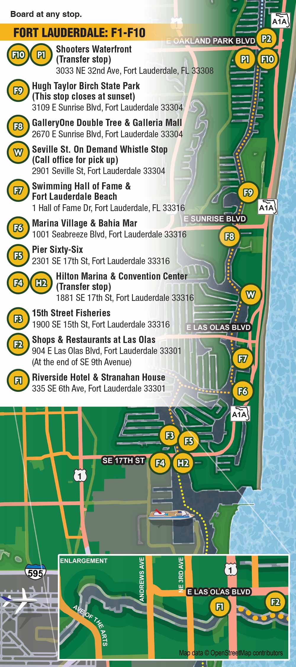
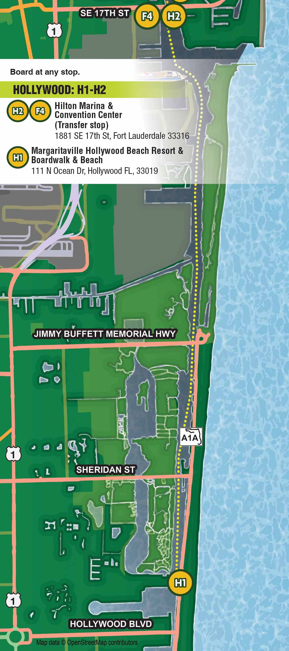
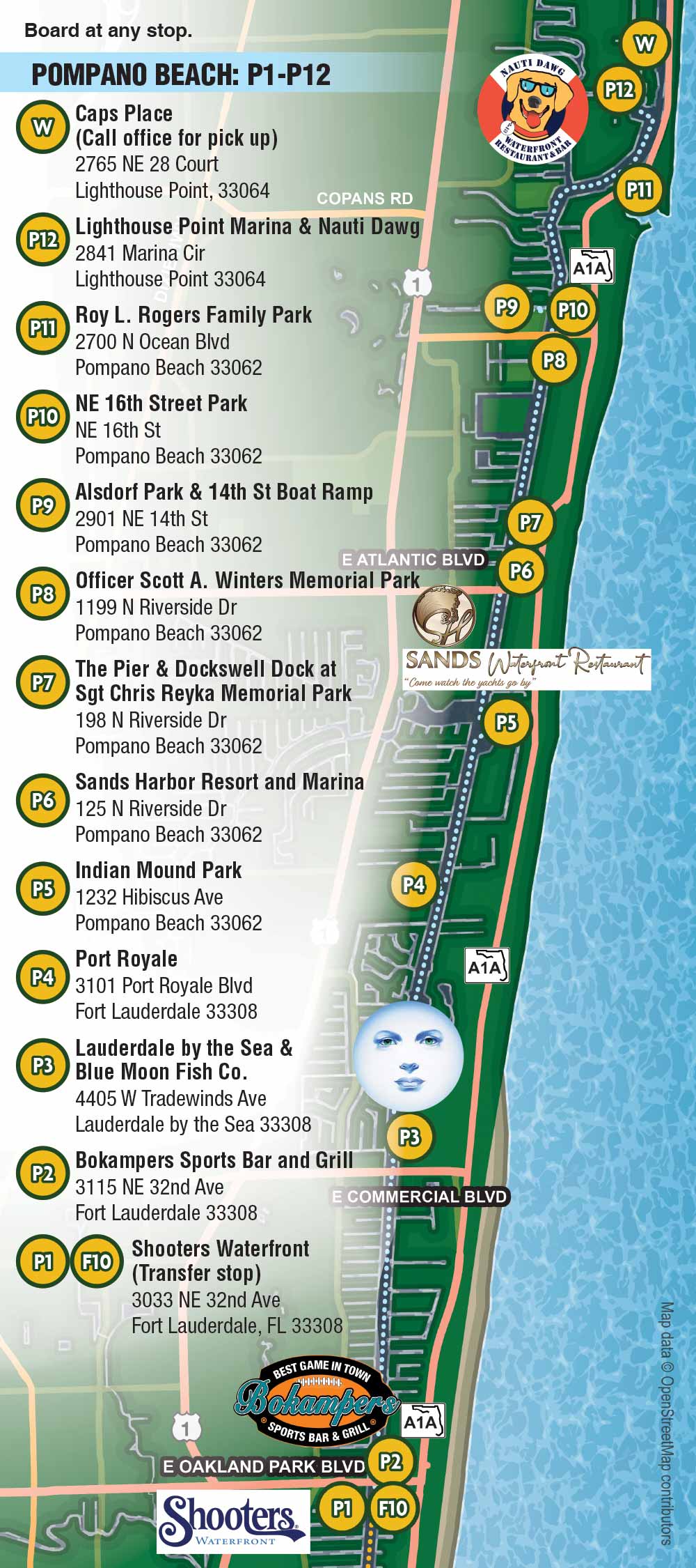
Water Taxi Route Maps
Client: Mad 4 Marketing / Water Taxi
For information about Water Taxi and for the latest map please visit WaterTaxi.com
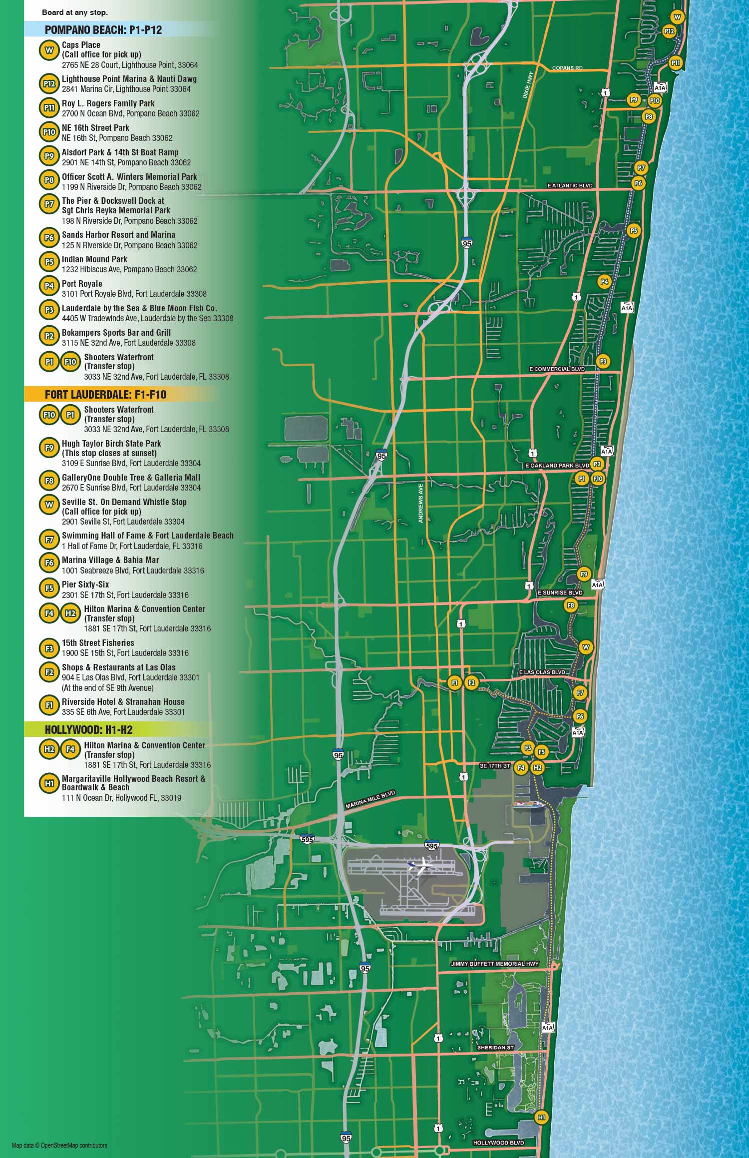
I created a series of illustrated maps for Water Taxi in South Florida that prioritize accuracy, clarity, and usability. Unlike previous maps I designed for the service, these were intended to be more precise and conventional, reflecting the need for detailed route information and accurate stop locations. The goal was to produce a single master map showing all routes and stops, which could then be adapted into a large map for web and print use, as well as individual maps for each of the three routes.
To ensure accuracy and detail, I used open source geographic data from OpenStreetMap, which provides a reliable foundation for placement and layout. The result is a set of maps that are both informative and visually appealing. By combining clear, factual information with a professional illustrated style, these maps make it easier for passengers to plan their trips and navigate the waterways with confidence.
These maps serve as valuable orientation tools for anyone using Water Taxi’s service, offering a clear view of routes while also highlighting the experience of traveling along South Florida’s intracoastal waterways. The illustrations help make the service accessible, enjoyable, and memorable, while demonstrating how a well-designed map can support both practical use and marketing needs.
If you would like a similar map please Contact Me.
OVERHEAD MAPS:


PORTFOLIOS
- Illustration Portfolio: Start here for custom illustration and book covers. You can also browse illustrated maps and architectural rendering.
- Fine Art: I offer original paintings and drawings, including my Custom Halftone Series. You will also find mural work here.
- Graphic Design & Motion: View my graphic design portfolio. After that, explore motion design and animated illustrations.
- Maps by application: I create illustrated maps for boat shows, resorts, marinas, real estate, transportation, transit and parking, towns and cities, parks, and wayfinding.
- Additional project types: I also produce cover illustration, vehicle and vinyl wraps, proposal renderings, and street art.
- Illustration methods: My techniques include vector, isometric and axonometric, painting, black and white, GeoData maps, overhead maps, and custom halftones.
- Software portfolios: I work primarily in Adobe Photoshop, Adobe Illustrator, SketchUp Pro, and Adobe InDesign. For motion projects, I use Premiere Pro and After Effects.