Illustrated Tourism Map
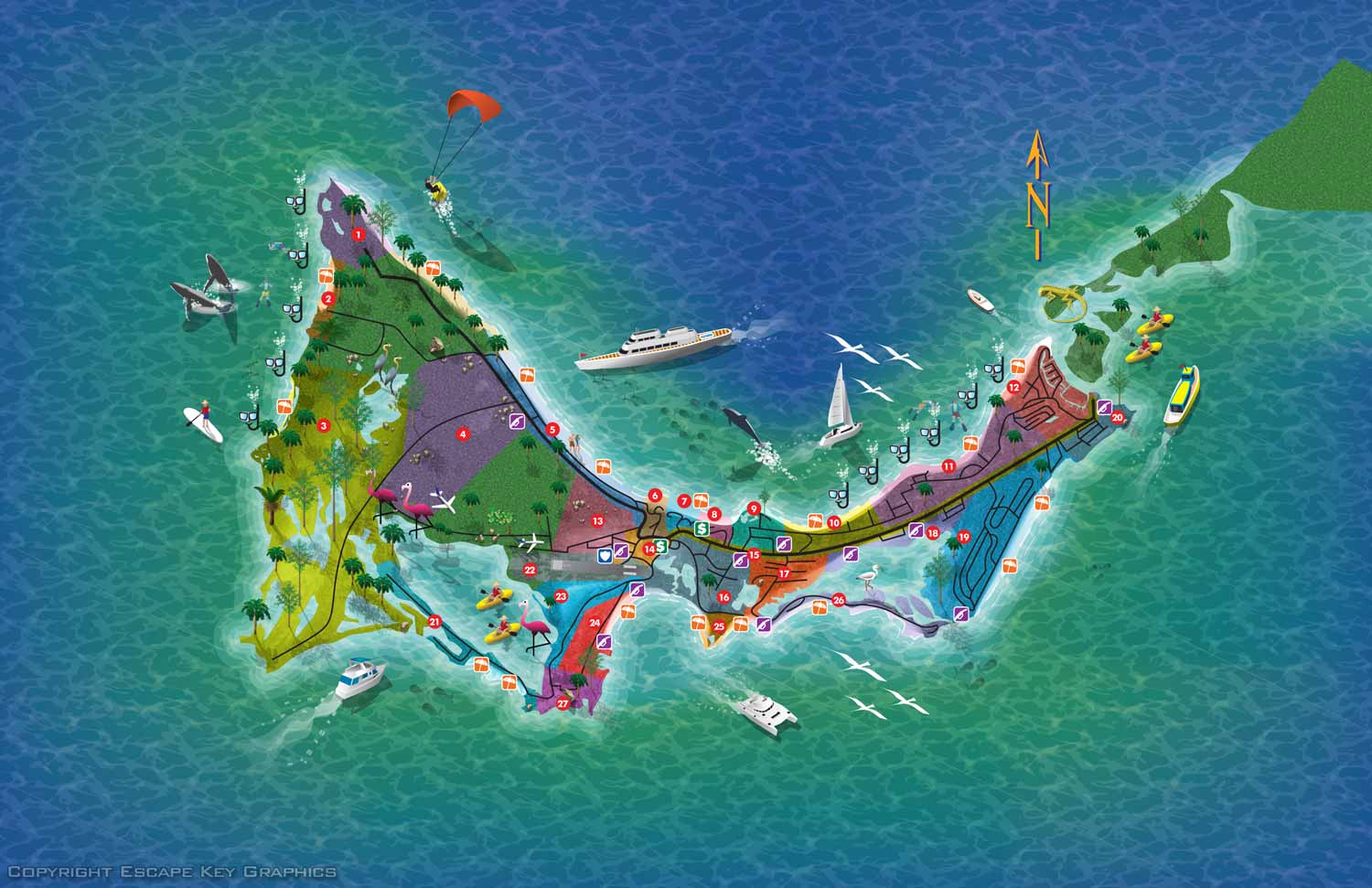
This illustrated tourism map was created to help visitors explore and enjoy a popular island destination. The design presents key points of interest, attractions, natural features, and travel routes as spot illustrations in a way that is both informative and visually engaging. By using an aerial perspective and thoughtful labeling, the map makes it easier for visitors to understand the layout of the island and plan their day with confidence.
The illustration combines clear, accurate geospatial information with an inviting artistic style. Major landmarks, beaches, parks, dining areas, and cultural sites are shown in a way that feels approachable and easy to read. This kind of map works well in brochures, visitor centers, websites, and travel guides, helping tourists orient themselves and discover new places they might otherwise miss. The use of color and visual balance contributes to a design that attracts attention while remaining practical.
Custom tourism maps like this one are valuable tools for destinations that want to enhance visitor experience and strengthen their visual identity. A well designed illustrated map helps visitors feel comfortable and engaged, and it can become a memorable part of their travel journey. Clients who hire an artist for map illustration benefit from work that is tailored to their specific location, audience, and marketing goals.
If you are looking for a professional artist to illustrate a custom map for your destination, resort, or attraction, this project demonstrates how detailed illustration and thoughtful design can support both wayfinding and promotional needs.


MAPS IN THE BAHAMAS:


MAPS IN THE CARIBBEAN:

BROWSE MY WORK
- Illustration: Browse custom illustrations, book cover art, illustrated maps, and architectural renderings.
- Fine art: View original paintings and drawings, the Custom Halftone Series, and mural commissions.
- Graphic design & motion: See design projects, then watch motion reels and animated pieces.
- Maps by use case: Explore illustrated maps created for boat shows, resorts, marinas, real estate, transportation & parking, cities & towns, parks, and wayfinding.
- Specialty projects: Also check out cover design, vinyl & vehicle wraps, proposal renderings, and street art.
- Style & technique: Discover vector, isometric, painterly, monochrome, data-driven, bird's-eye, and halftone approaches.
- Tools I use: Everyday software includes Photoshop, Illustrator, SketchUp, and InDesign; motion work relies on Premiere & After Effects.