Illustrated Public Park Maps
Client: Miami Dade County
County Park Hiking Trail Maps
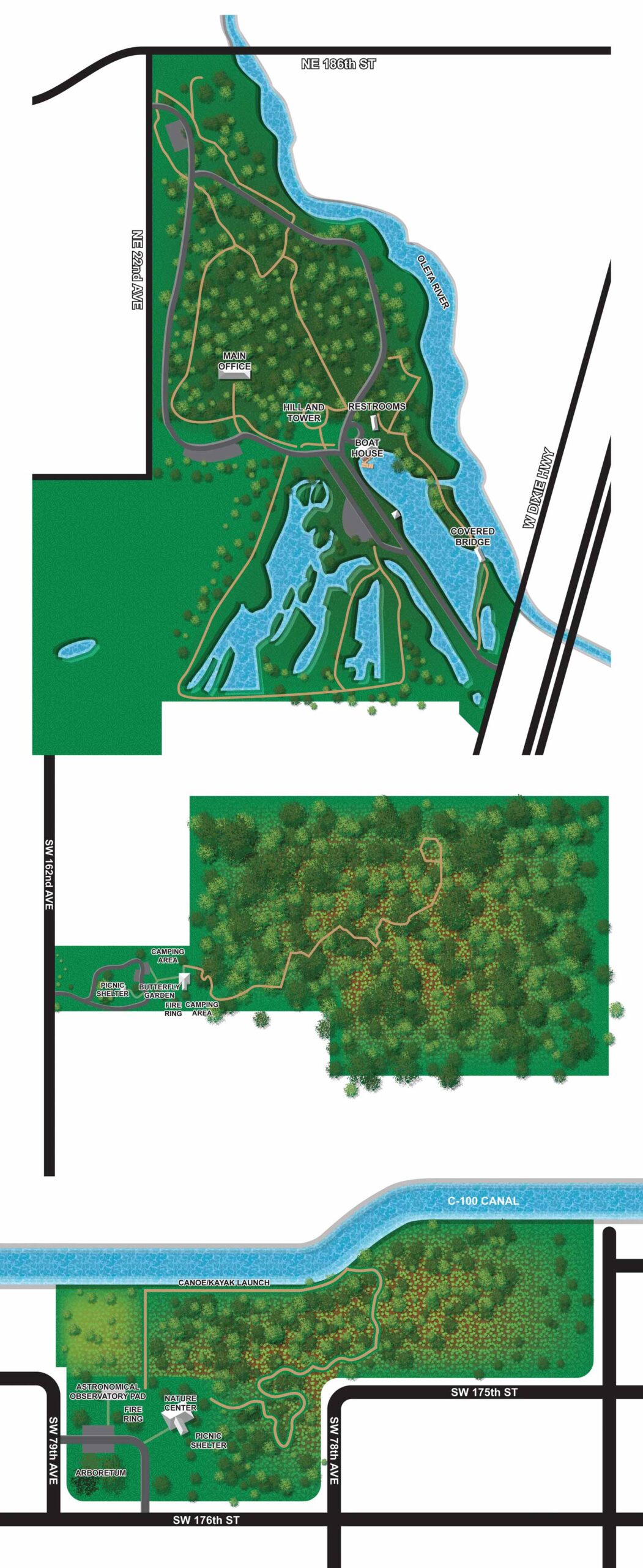
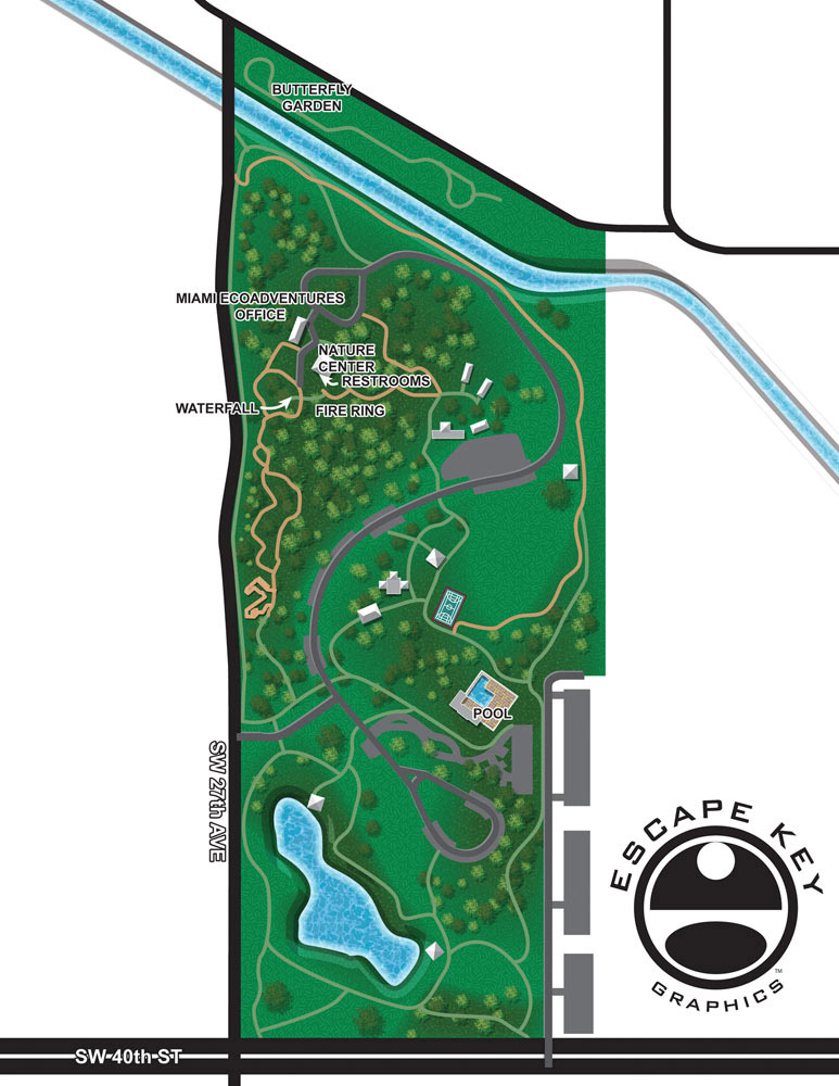
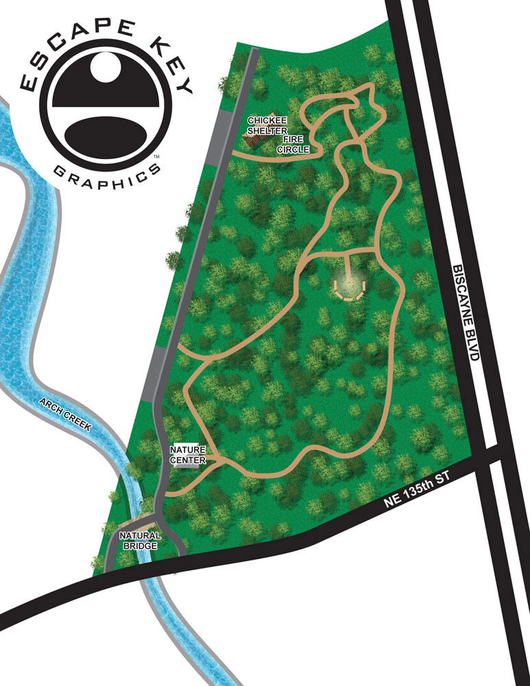
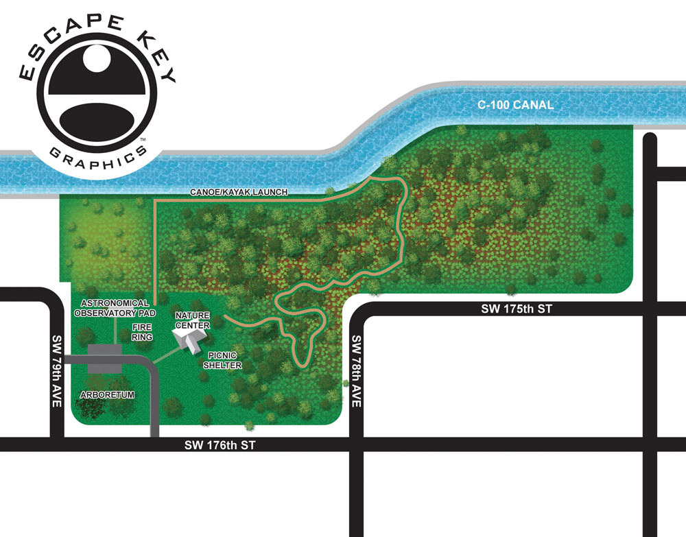
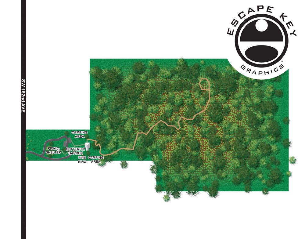
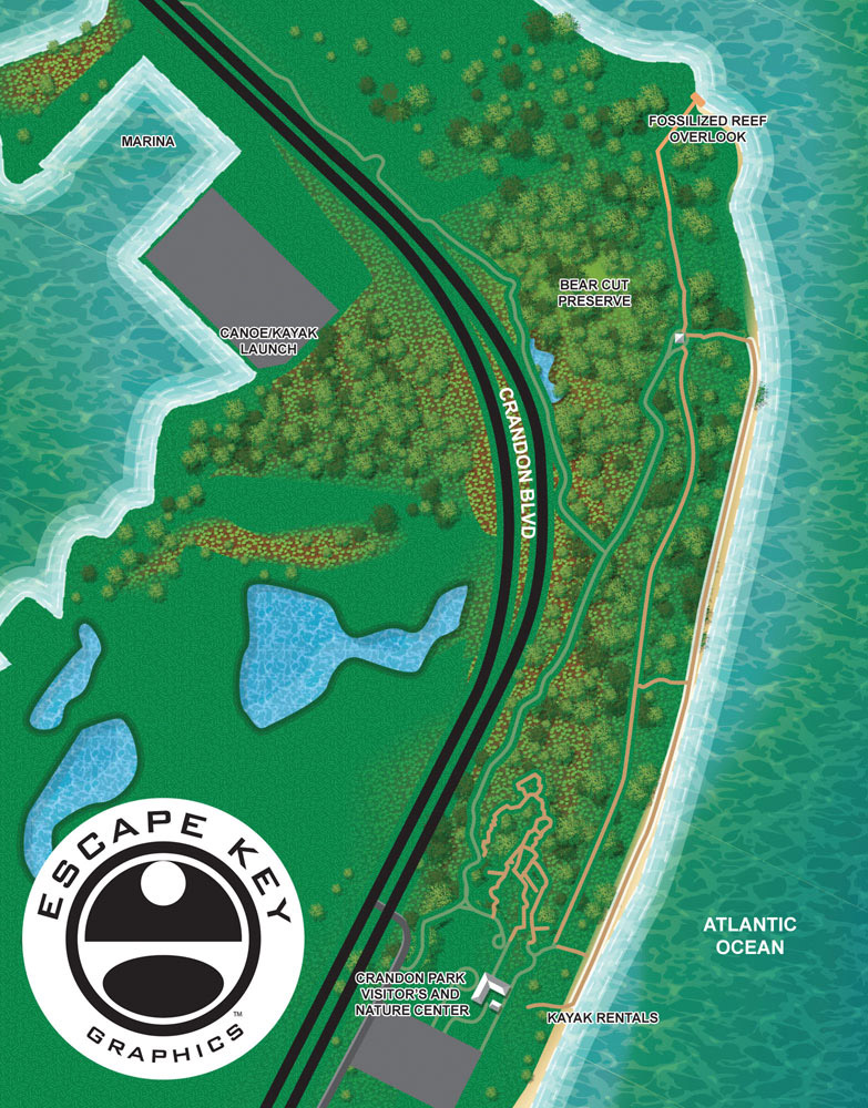
These illustrated hiking trail maps were created for the Miami Dade County Parks and Recreation Department and feature trail systems across six county parks. The goal of the project was to provide clear, easy to understand overhead maps that help visitors navigate park trails while enjoying a visually appealing design. These maps were developed to support multiple uses, including integration into a mobile phone app and other digital and printed materials.
The county requested a clean overhead style that balances simplicity with illustration. Rather than overwhelming users with excessive detail, the maps focus on trail layout, access points, and key features that hikers need to orient themselves quickly. This approach makes the maps especially effective for use on mobile devices, where clarity and readability are essential.
Trail Maps Structure
Creating trail maps like these requires careful attention to accuracy, scale, and user experience. Each park presented its own layout and challenges, but the consistent visual language helps users move easily from one park map to another. The overhead perspective makes the trail networks familiar and intuitive, similar to how people naturally read traditional maps.
Illustrated hiking trail maps are a valuable resource for parks, nature preserves, and outdoor recreation areas. They improve wayfinding, enhance visitor safety, and encourage exploration while reinforcing the identity of the park system. This project highlights how custom map illustration can support public agencies, outdoor spaces, and digital platforms with clear and engaging visual communication.


EXPLORE MY PORTFOLIOS
- Illustration: Find custom illustration, book covers, illustrated maps, and architectural rendering.
- Fine Art: Browse original paintings and drawings, the Custom Halftone Series, and murals.
- Graphic Design & Motion: See my graphic design work, plus motion design and animated illustrations.
- Maps by industry: Illustrated maps tailored for boat shows, resorts, marinas, real estate, transit & parking, towns & cities, parks, and wayfinding.
- Other project types: Also available: cover art, vehicle & vinyl wraps, proposal renderings, and street art.
- Techniques: Explore work in vector, isometric & axonometric, painting, black & white, GeoData, overhead, and halftone styles.
- Software: Primary tools: Photoshop, Illustrator, SketchUp Pro, and InDesign. Motion work uses Premiere Pro & After Effects.