St. Petersburg Power & Sailboat Show Map, 2015
Client: Show Management
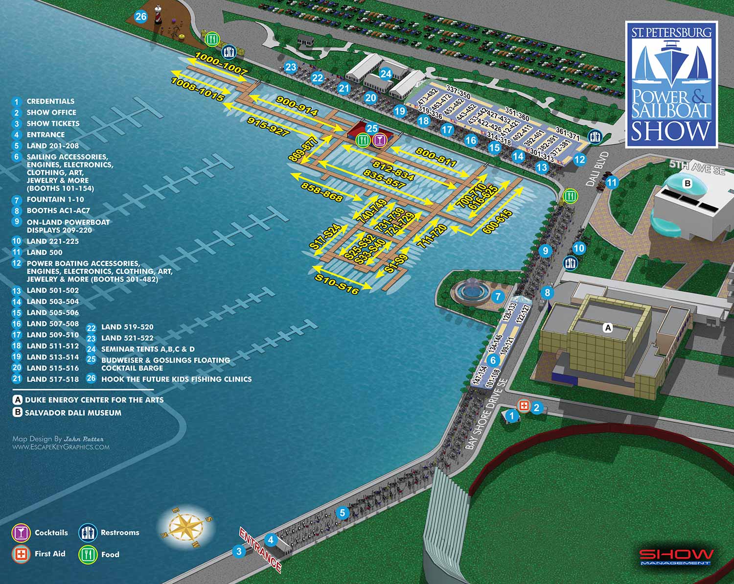
A notable change for the 2015 St. Petersburg International Power and Sailboat Show was a northward expansion of the event footprint. This required a corresponding expansion of the three dimensional digital model that serves as the ongoing foundation for my illustrations of this show. While extending the model to accommodate the new area, I also took the opportunity to expand the overall scene. The model was built out so that it no longer has defined borders, instead allowing the illustrated environment to bleed off all sides of the page. This adjustment created a slightly more immersive and realistic visual presentation.
The established keying method and number spanning systems for identifying exhibitors remained consistent for user familiarity. The necessary updates involved changes to floating dock and boat silhouette positions, along with some minor alterations to land based displays.
A minimal need for major structural redesign in a given year is often an indicator of a solid, effective foundational design. Returning visitors typically appreciate the comfort and ease of a familiar layout. I maintain this continuity by using the same core three dimensional digital model as the basis for the map each season. This systematic approach allows me to preserve the overall look and feel of the illustration while efficiently updating only the specific elements that require revision.
For this particular show, the client typically provides either a CAD file of the venue layout or annotated notes. When working with a CAD file, I conduct a detailed review to identify any discrepancies from the previous year's plan. For a smaller show with relatively few changes, the client may simply provide handwritten notes directly on a printed copy of the prior year's map. After updating the base illustration, I require finalized text for any revisions to the map key and exhibitor number spans. These text updates may also be delivered as simple annotations if the changes are minor.
The marine event industry is inherently dynamic. Last minute adjustments are a common occurrence, with new exhibitors confirming their participation and sponsors altering their plans close to the event date. It is standard practice for clients to include disclaimers on their materials noting that information is subject to change after printing or publication. This fluid working environment is a primary reason many illustrators might hesitate to take on such projects. Successfully creating accurate and timely boat show maps requires a graphic artist who is not only precise but also efficient and highly adaptable to evolving requirements.
Illustrated event maps fulfill a distinct role by enabling potential attendees to clearly visualize their experience before arrival. Instead of relying on generic stock photography, guests can examine an accurate and detailed representation of the actual event layout. These maps effectively communicate the event's scale and physical setting while delivering practical information about amenities, including restroom locations, food and beverage access, and transportation or parking options. Consequently, illustrated maps function as both aesthetically pleasing graphics and genuinely useful informational and marketing resources.
For more examples of my illustrative cartography, please visit my Maps Portfolio.
St. Petersburg Power & Sailboat Show Maps
- About St. Petersburg Power & Sailboat Show
- 2026 | 2025 | 2024 | 2023 | 2022 | 2021 | 2019 | 2018 | 2017 | 2016 | 2015 | 2014 | 2013 | 2012 | 2011


