Illustrated City Map - Tourist map of a town
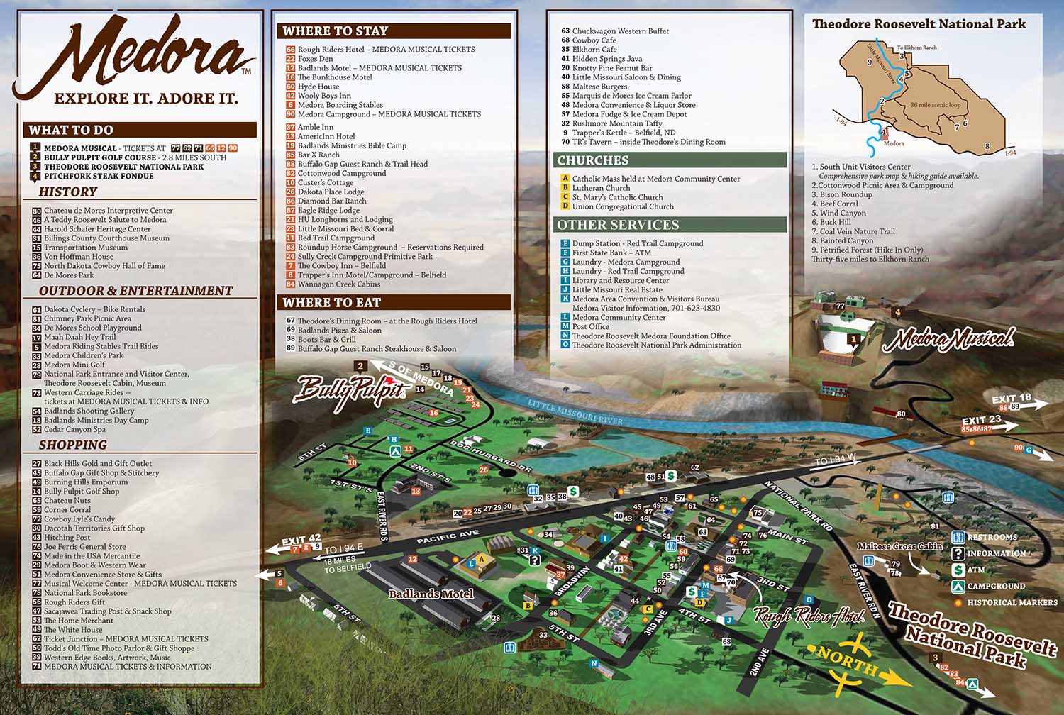
This illustrated city map of Medora, North Dakota was created for the Theodore Roosevelt Medora Foundation to help visitors navigate and experience one of the most distinctive destinations in the American West. Located in the North Dakota Badlands, Medora is known for its historic character, dramatic landscape, and popular attractions rooted in cowboy and Old West culture. The Medora Musical remains one of the town’s biggest draws, attracting visitors from across the country, and the map was designed to support tourism by making the town easy to understand and explore.
From the beginning, it was clear that a three dimensional modeling approach would be better suited to this project than a traditional isometric illustration. Medora’s varied terrain, surrounding bluffs, and rolling hills presented an opportunity to use depth and perspective to create a more engaging and informative map. The flexibility of a three dimensional workflow allowed me to test many viewing angles and compositions before arriving at the final perspective. More than twenty variations were explored to ensure the layout balanced clarity, accuracy, and visual appeal.
The unique geography of the Badlands became a central feature of the illustration. Elevation changes, hills, and rock formations were emphasized to give viewers a strong sense of place while still keeping the town layout easy to read. The skyline and foreground bluff elements were added later in the process and helped frame the scene, adding visual interest without distracting from wayfinding.
Illustrated city maps like this are valuable tools for tourism organizations, visitor centers, and cultural destinations. They combine practical navigation with storytelling, helping visitors feel oriented and excited about exploring a place. This Medora map demonstrates how thoughtful illustration and spatial design can enhance the visitor experience while supporting branding and outreach goals for a destination.
 An animated gif showing some of the process. If you missed the beginning just wait.It will restart.
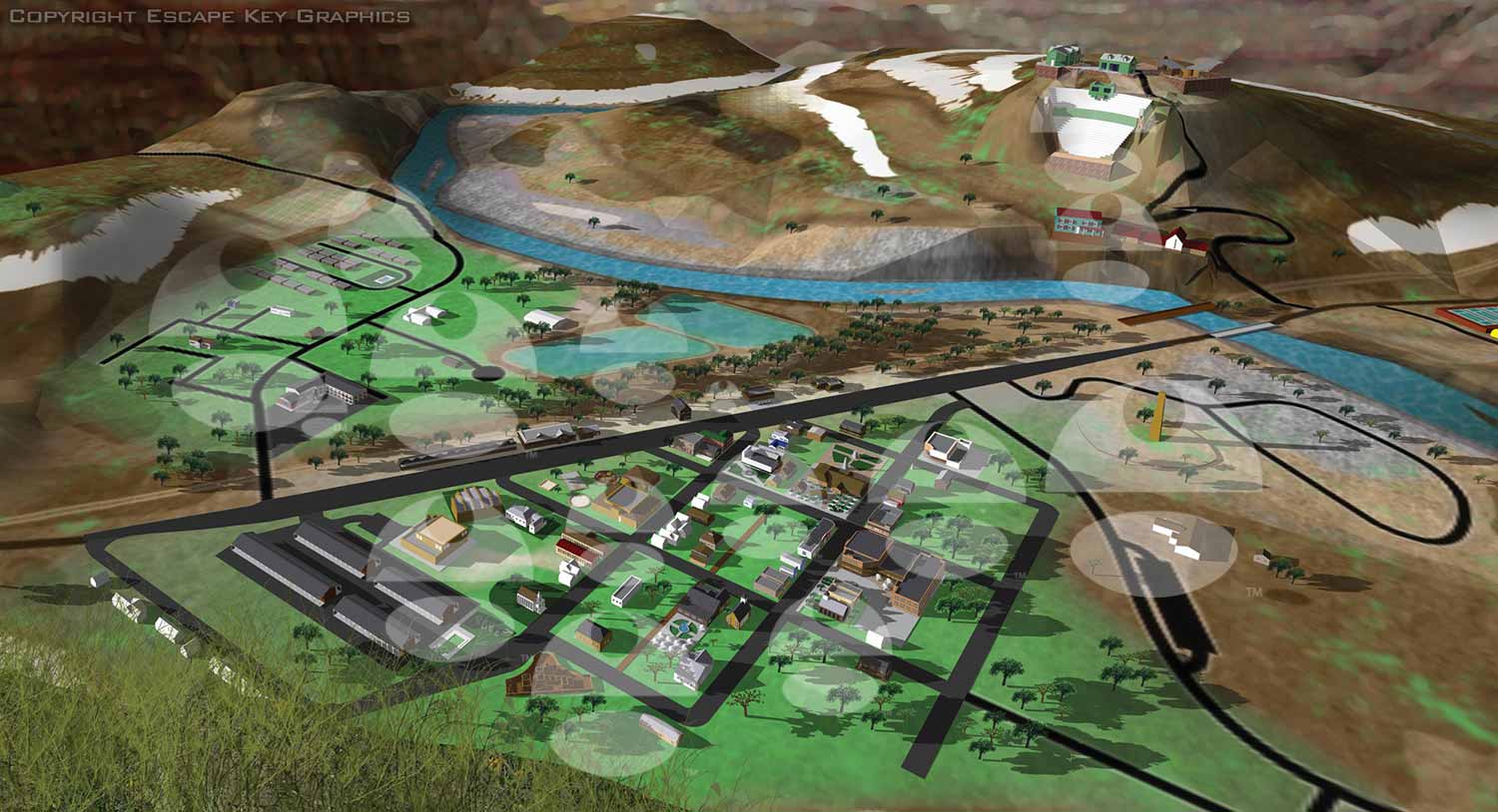 Illustration without the map key
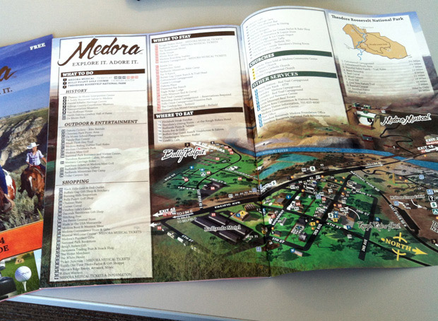 Printed map
Escape Key Graphics is based in South Florida but has clients worldwide. Contact me for a quote on your next project.
If you would like to see more about my background please visit my LinkedIn Profile.
(and maps of similar areas)


PORTFOLIOS
- Illustration Portfolio: Start here for custom illustration and book covers. You can also browse illustrated maps and architectural rendering.
- Fine Art: I offer original paintings and drawings, including my Custom Halftone Series. You will also find mural work here.
- Graphic Design & Motion: View my graphic design portfolio. After that, explore motion design and animated illustrations.
- Maps by application: I create illustrated maps for boat shows, resorts, marinas, real estate, transportation, transit and parking, towns and cities, parks, and wayfinding.
- Additional project types: I also produce cover illustration, vehicle and vinyl wraps, proposal renderings, and street art.
- Illustration methods: My techniques include vector, isometric and axonometric, painting, black and white, GeoData maps, overhead maps, and custom halftones.
- Software portfolios: I work primarily in Adobe Photoshop, Adobe Illustrator, SketchUp Pro, and Adobe InDesign. For motion projects, I use Premiere Pro and After Effects.