
ShowBoats International Magazine Illustrated Map - Fort Lauderdale International Boat Show 2015
Client: ShowBoats International Magazine
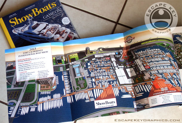
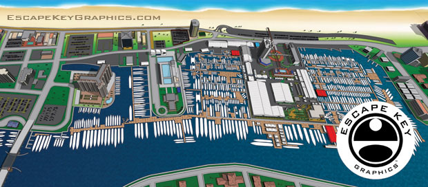
ShowBoats International Magazine Feature: FLIBS 2015 Illustrated Map
My illustrated map of the Fort Lauderdale International Boat Show is featured as a foldout in the November 2015 issue of ShowBoats International Magazine. The exceptional print quality and premium paper stock do full justice to the artwork, matching the high standard of the entire 314 page publication. It was a distinct pleasure to collaborate on this project with the magazine's outstanding Art Director, Dan Brooks.
The map is rendered from the same three dimensional digital model that serves as the core geographic asset for my work on this venue at the Fort Lauderdale International Boat Show. The creation of this accurate model would not be possible without the cooperation of the show's producer, Show Management. I undertake any derivative commercial work based on this model only with their explicit consent, ensuring full respect for the intellectual property involved.
This feature stands as a testament to the inherent versatility of the digital model I developed and continuously update. The model allows me to generate precise maps from virtually any perspective or magnification. The opportunity to apply this resource in creating a unique piece for a prestigious publication like ShowBoats International Magazine was both a professional pleasure and a true honor.
To view more of my cartography and illustration projects, please visit my Map Portfolio.


PORTFOLIO GALLERIES
- Illustration work: Start with custom illustration and cover design, then view illustrated maps and architectural renderings.
- Fine art: Discover original paintings and drawings, the Custom Halftone Series, and mural projects.
- Design & motion: Check out the graphic design gallery, then move on to motion graphics and animated illustration.
- Maps by sector: I produce illustrated maps for boat shows, resorts, marinas, real estate, transit & parking, towns & cities, parks, and wayfinding systems.
- More creative services: Additional offerings include cover illustration, vehicle wraps, proposal renderings, and street art.
- Artistic methods: My work spans vector art, isometric & axonometric views, traditional painting, black & white illustration, GeoData mapping, overhead perspectives, and halftone effects. Recently I have also begun to utilize AI in some cases.
- Preferred software: I rely on Photoshop, Illustrator, SketchUp Pro, and InDesign, plus Premiere Pro & After Effects for motion projects.
