Fort Lauderdale International Boat Show 2026 - Marinas Map
Client: Informa Markets
For more (and more up to date) information about the 2026 Fort Lauderdale International Boat Show visit their official site at FLIBS.com.
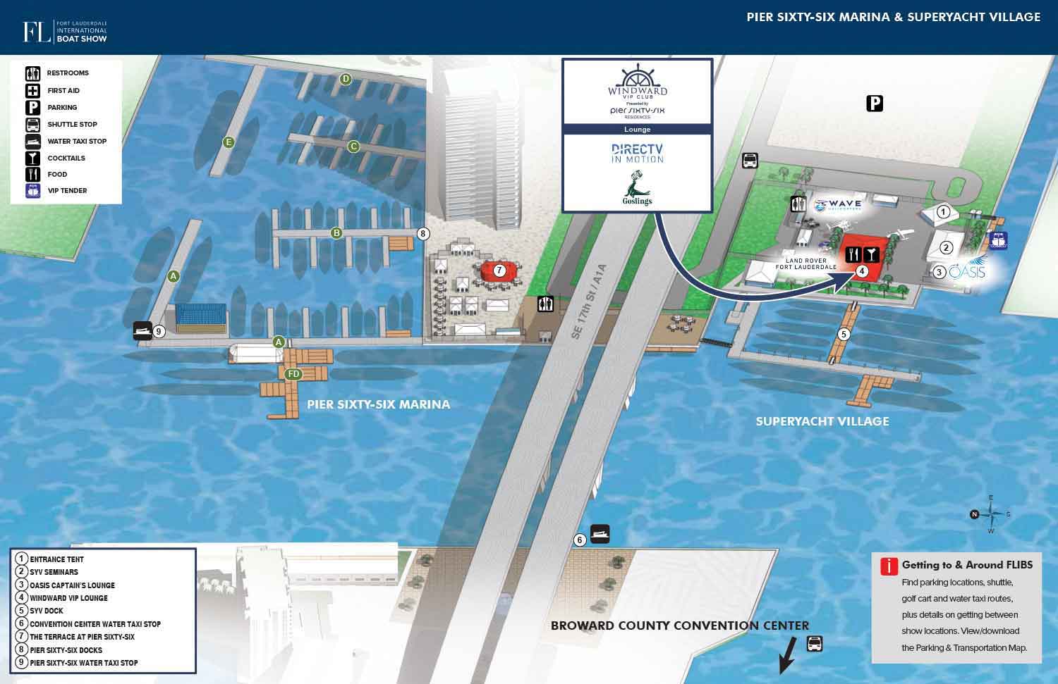
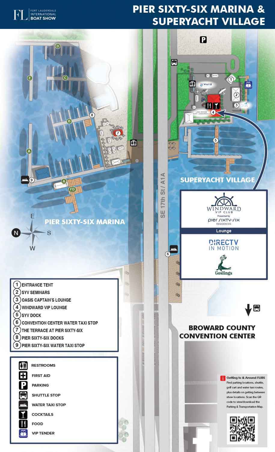
For 2026, I have updated the map showing the marinas and Broward County Convention Center locations around the famous 17th Street Causeway Bridge in Fort Lauderdale, Florida. This 3D aerial view map for the 2026 Fort Lauderdale International Boat Show illustrates the Pier Sixty-Six Marina and Superyacht Village and the general location of the Broward County Convention Center. This area of the boat show is known for its impressive superyachts, luxury exhibitors, and elevated hospitality. Reflective of this, I also made detailed maps of the Superyacht Village specifically for the Windward VIP Club and Oasis Lounge.
The map can be viewed as layers with the semi-realistic illustration as the base, with icons and an icon key layered on top, as well as a general points of interest map key and corresponding numbered icons. Also on top is some basic labeling like street names (or name in this case) and a short list of VIP Club sponsors. Also included are a graphical header and basic transportation information.
More Than a Map: A Strategic Asset for Every Stage of Your Event
A custom map like this delivers value long before the first guest arrives. During the promotional phase, it serves as a powerful marketing tool offering a concrete, visually engaging preview that generic stock imagery simply cannot replicate. It helps build excitement, supports itinerary planning, and communicates the true scale and prestige of the event, ultimately encouraging attendance.
Your Onsite Navigational Companion
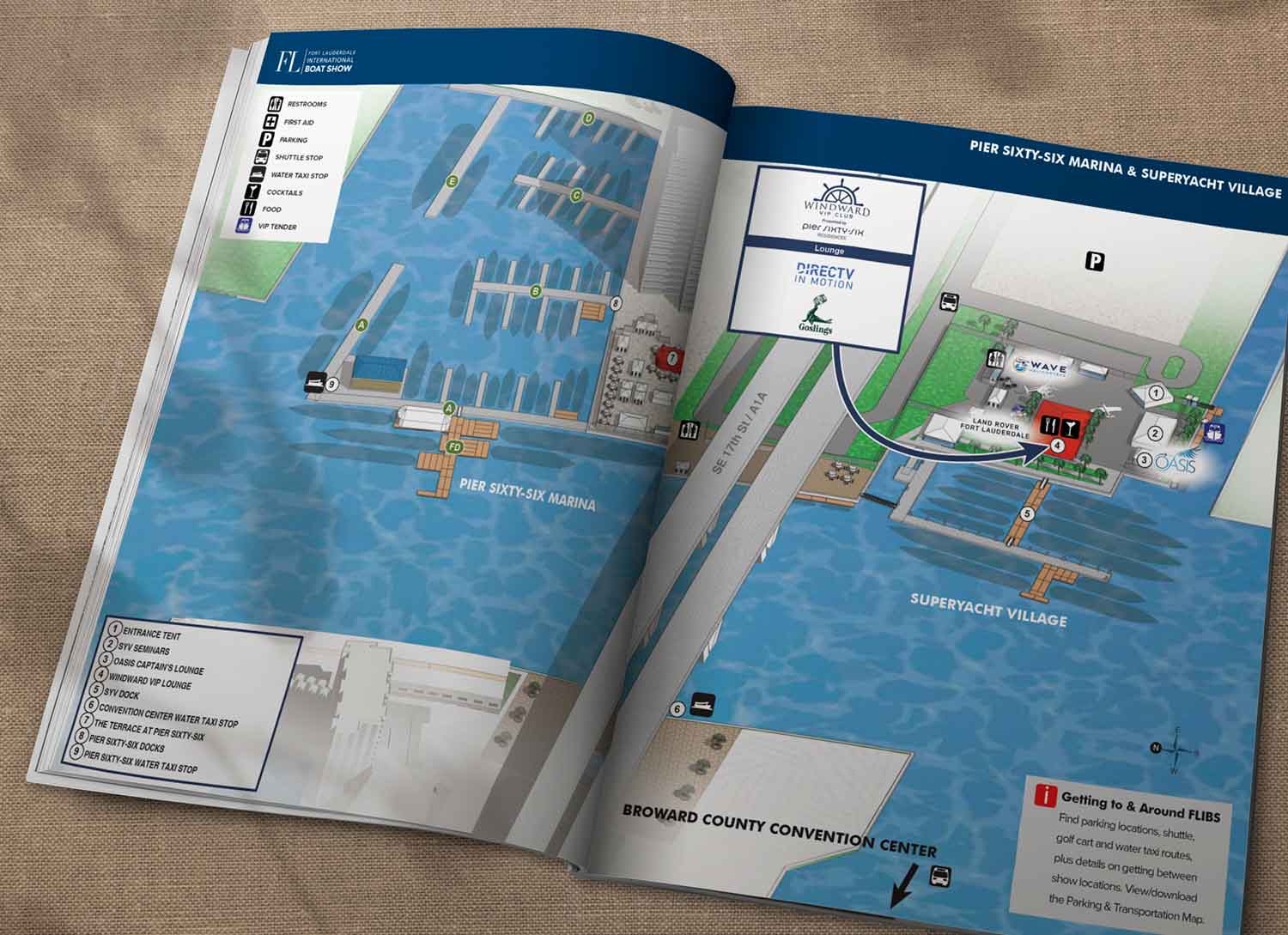
Once the event is underway, the map becomes an essential guide. It directs thousands of visitors through official show programs, digital apps, and onsite signage, making navigation effortless and enhancing the overall experience. Clear, intuitive wayfinding reduces confusion and allows attendees to focus on enjoying the event.
Elevating Your Event with Custom Cartography
This project demonstrates how illustrated cartography can enhance both the functionality and the perceived value of a world-class event. By transforming complex venue layouts into polished, versatile visual assets, we help you streamline logistics and elevate your brand. An Escape Key Graphics map is more than a navigational aid—it is a foundational piece of your event’s communication strategy, designed to support your goals and impress your audience.
Fort Lauderdale International Boat Show Maps 2026:
Bahia Mar, Hall of Fame & Las Olas Marina Map | Parking and Transportation Map | Pier Sixty-Six Marina and Superyacht Village Map | Broward County Convention Center MapFort Lauderdale International Boat Show Maps:
- About Fort Lauderdale International Boat Show
- Bahia Mar, Hall of Fame & Las Olas Marina Maps: 2026 | 2025 | 2024 | 2023 | 2022 | 2020 | 2019 | 2018 | 2017 | 2016 | 2015 | 2014 | 2013 | 2012 | 2011 | 2010
- Parking and Transportation Maps: 2026 | 2025 | 2024 | 2023 | 2022 | 2020 | 2019 | 2018 | 2015 Bus | 2015 Water Taxi | 2014 | 2013 | 2012 | 2011
- Broward County Convention Center Maps: 2026 | 2025 | 2024 | 2023 | 2022 | 2017 Sailfish Pavilion | 2017 | 2016 Sailfish Pavilion | 2016 | 2015 Sailfish Pavilion | 2015 | 2014 Sailfish Pavilion | 2014 | 2013 Sailfish Pavilion | 2013 | 2012 | 2011 | 2010
- 17th St Marinas Maps: 2026 | 2025 | 2024 | 2023 | 2022 | 2019 | 2016
- Show Directory Layouts: 2025 | 2024 | 2023 | 2022
- Video: 2013 54th Annual
- Illustrations (not maps): 2014A | 2014B


PORTFOLIO GALLERIES
- Illustration work: Start with custom illustration and cover design, then view illustrated maps and architectural renderings.
- Fine art: Discover original paintings and drawings, the Custom Halftone Series, and mural projects.
- Design & motion: Check out the graphic design gallery, then move on to motion graphics and animated illustration.
- Maps by sector: I produce illustrated maps for boat shows, resorts, marinas, real estate, transit & parking, towns & cities, parks, and wayfinding systems.
- More creative services: Additional offerings include cover illustration, vehicle wraps, proposal renderings, and street art.
- Artistic methods: My work spans vector art, isometric & axonometric views, traditional painting, black & white illustration, GeoData mapping, overhead perspectives, and halftone effects. Recently I have also begun to utilize AI in some cases.
- Preferred software: I rely on Photoshop, Illustrator, SketchUp Pro, and InDesign, plus Premiere Pro & After Effects for motion projects.