
Mount Pleasant Residential Park Map
Client: Tingdene Residential Parks
For information on Mount Pleasant Residential Park please visit Tingdene-Parks.net
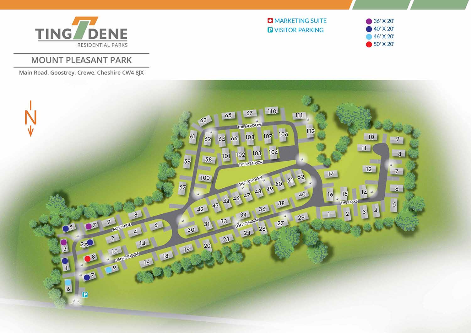
Mount Pleasant Residential Park is located approximately five miles south of the historic city of York, within the picturesque village of Acaster Malbis. Surrounded by open countryside, the park offers a peaceful rural setting while remaining conveniently close to the cultural attractions, shops, and services of York. This balance of village character and accessibility makes Mount Pleasant an appealing choice for residential living.
Escape Key Graphics created this illustrated overhead real estate map to clearly communicate the layout of the park and support easy navigation for residents, visitors, and prospective buyers. Individual plots are clearly numbered, with plot dimensions identified using a simple system of coloured reference markers. This approach allows key information to be understood quickly without overcrowding the illustration, ensuring the map remains clear and easy to use.
Simple and consistent graphic icons are used to identify park amenities such as parking areas and the marketing suite. Designed to support both practical and promotional needs, the map functions effectively as on site signage and general wayfinding, while also serving as a refined marketing asset. The map presents the layout and features of Mount Pleasant Residential Park in a professional and approachable manner, helping convey the character, setting, and overall appeal of the park to those considering it as a place to live.


WORK FOR TINGDENE - COMBINED MARINA AND RESIDENTIAL PARK MAPS:


EXPLORE MY WORK
- Illustration: Discover custom illustrations, book covers, illustrated maps, and architectural renderings.
- Fine Art: Browse original paintings and drawings, view the Custom Halftone Series, or check out mural projects.
- Graphic Design & Motion: See the graphic design collection, then dive into motion design and animated illustrations.
- Maps by industry: View illustrated maps tailored for boat shows, resorts, marinas, real estate, transportation, towns, parks, and wayfinding.
- More project types: Explore cover art, vehicle wraps, proposal renderings, and street art.
- Techniques & styles: Work spans vector, isometric, painting, black-and-white, GeoData, overhead maps, and halftones.
- Software expertise: Primary tools include Photoshop, Illustrator, SketchUp Pro, and InDesign, plus Premiere Pro & After Effects for motion. I am also supplementing some projects with AI.