Illustrated Aerial View Campus Map - 2022 updated version
Client: American Maritime Officers' Star Center
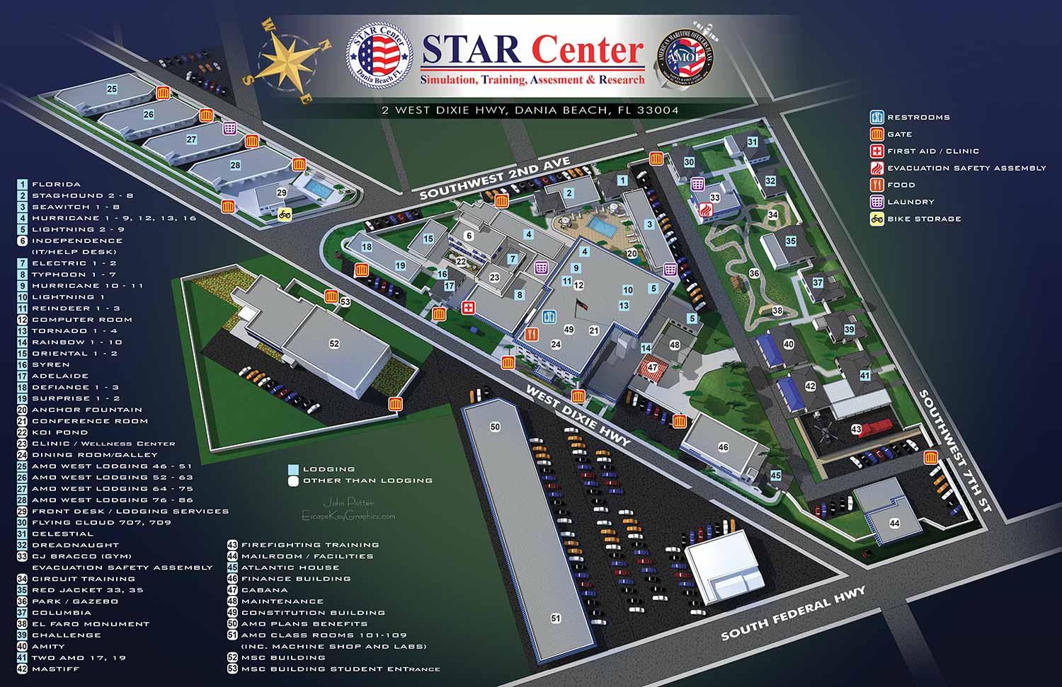
STAR Center is a not-for-profit maritime training school that is the top choice of inland and ocean-going professional mariners throughout the world. In short they train ship captains, engineers and the like.
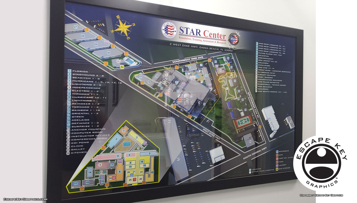
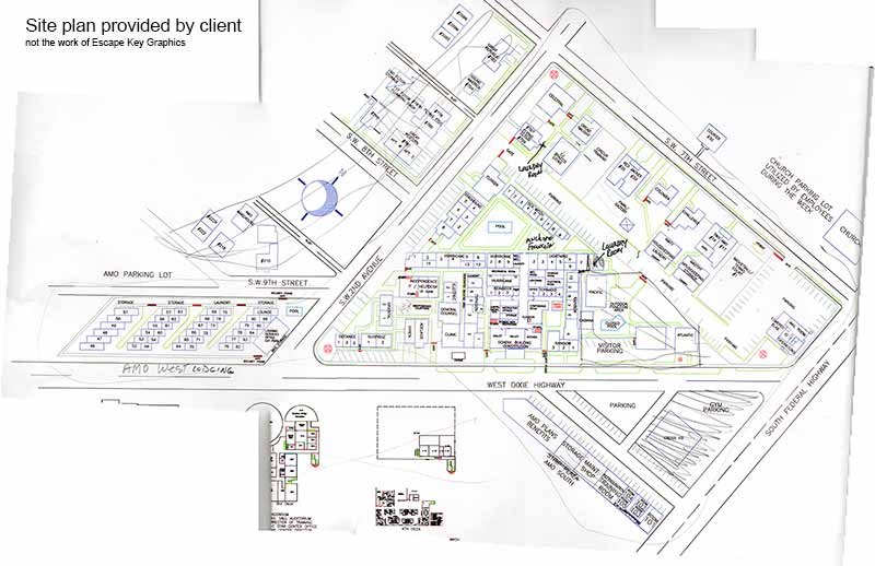
The map shows an aerial view of the campus as a 3D model, but clear enough and acute enough angle to easily use as a map. This also makes finding landmarks much easier since they appear more real on an illustrated map. This map also features a small inset overhead map to show the interior of a cluster of buildings. The client supplied me with a site plan (probably drawn in AutoCAD) printed on several sheets of paper which I scanned and tiled together as one image. I also used aerial/satellite imagery as a guide. The campus is local to me so I also visited, took photos and had a tour which was very helpful.
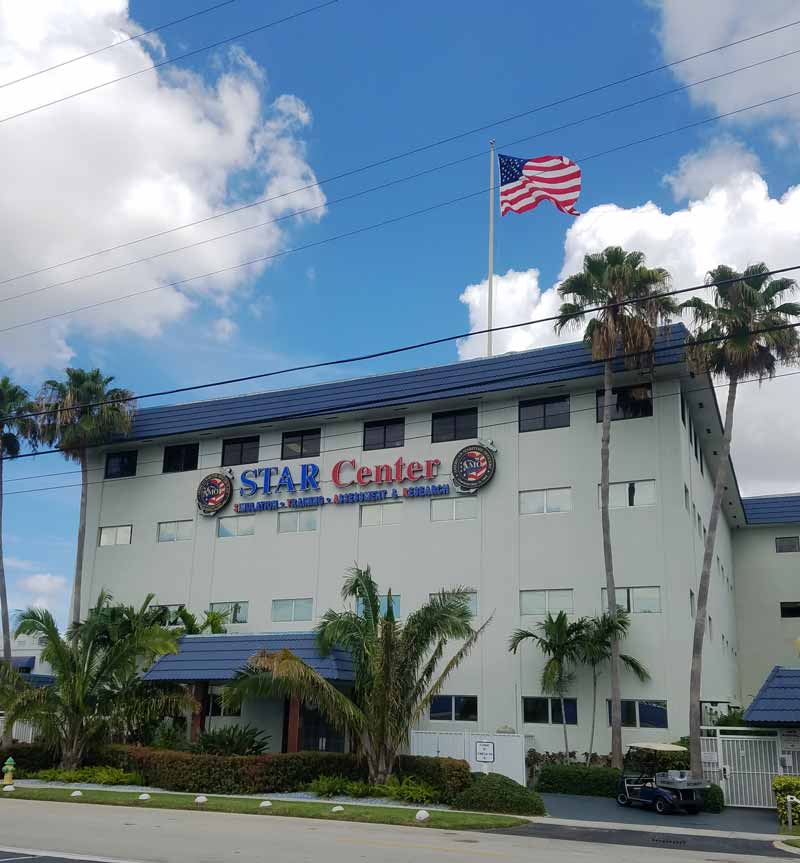
For more information about American Maritime Officers' Star Center visit their site at AMO-Union.org. American Maritime Officers is the largest union of U.S. merchant marine officers. American Maritime Officers members work aboard commercial, military sealift and government vessels in domestic and international deep-sea trades and missions, on the Great Lakes and in U.S. inland waterways and harbors. Their campus is conveniently located in Dania Beach, Florida close to the Fort Lauderdale/Hollywood International Airport.
I would love to create a map for your school, business, evil lair etc. Please contact me for your next illustrated map project.


WHAT IS SKETCHUP?:
SketchUp, originally developed by Google and now maintained by Trimble Inc., is a powerful 3D modeling program widely used across architecture, interior design, marine architecture, civil and mechanical engineering, and even film and video game production. While it is not intended for character design or organic modeling, SketchUp excels at creating precise, technical models using basic shapes, making it ideal for architectural renderings, site planning, and technical illustrations.
I first began using SketchUp in 2012 while creating the illustrated map for the St. Petersburg Power and Sailboat Show. At the time, I was seeking an efficient alternative to isometric drawing for map illustration. Since then, I have expanded its use across a variety of projects and now rely on SketchUp almost daily to create accurate, visually compelling 3D models for maps, buildings, and other technical illustrations.
SketchUp allows me to combine technical precision with artistic flexibility. Models created in SketchUp can be used as the foundation for detailed illustrations, integrated with Adobe Illustrator or Photoshop, or exported for presentation and visualization purposes. Its versatility makes it a valuable tool for projects that require accurate spatial representation, clear perspective, and a professional, polished look.
If you are interested in having a custom model or illustration created in SketchUp, please contact me for a quote. I can provide solutions for everything from complex architectural layouts to 3D maps and technical renderings tailored to your specific project needs.
PORTFOLIO SELECTIONS
- Custom illustration & covers: Featuring bespoke illustration, book and magazine covers, hand-drawn maps, and building renderings.
- Fine art & murals: Including one-of-a-kind paintings and drawings, the Custom Halftone Series, and large-scale murals.
- Design & motion media: Covering graphic design, plus video and motion and animated illustration.
- Mapping by application: Tailored maps for marine events, hospitality, waterfront, property, transit, municipal, recreation, and navigation needs.
- Additional creative work: Includes editorial covers, vehicle graphics, concept renderings, and public art.
- Mediums & formats: Ranging from digital vector and isometric projection to traditional paint, line art, GIS-based, aerial-style, and halftone.
- Software expertise: Proficient in Photoshop, Illustrator, SketchUp, InDesign, and Premiere/After Effects for motion.