
New 3D Map: Windward VIP Club Bahia Mar at the Fort Lauderdale International Boat Show 2026
Client: Windward VIP Cabana Club In Partnership With Visit Lauderdale
For more (and more up to date) information about the 2026 Fort Lauderdale International Boat Show Windward VIP Club visit their official page at FLIBS.com/experience/windwardvip/.
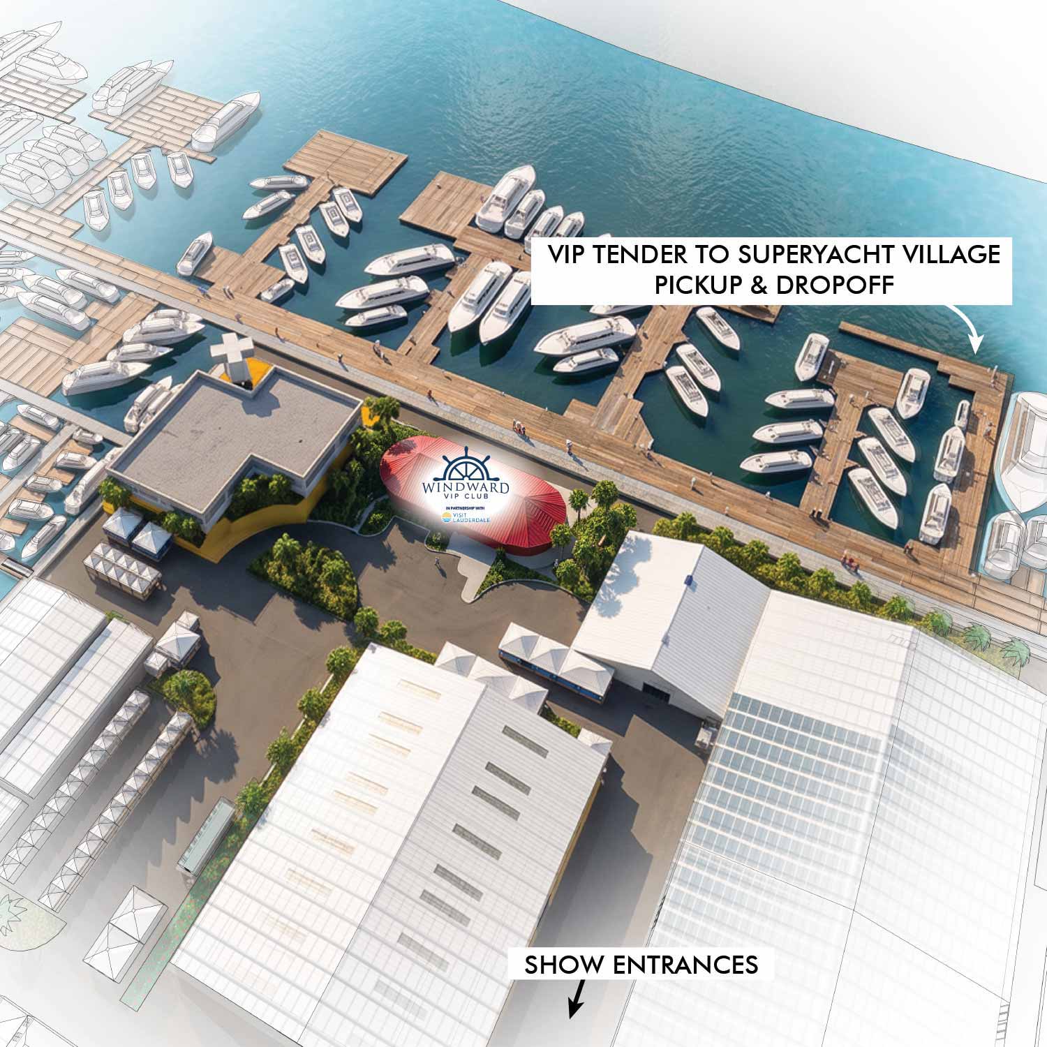
I'm pleased to share a new illustrated 3D map I created for the Windward VIP Cabana Club In Partnership With Visit Lauderdale at the Fort Lauderdale International Boat Show 2026.
Drawing on the Wahous Wilderness Lodge Resort Map
This project gave me the opportunity to build on the experience I gained creating the Wahous Wilderness Lodge resort map - an illustrated resort map that also involved integrating artificial intelligence into my illustration workflow.
AI-Assisted Illustration: How the Workflow Works
As with the Wahous project, I found that AI illustration tools work best when they have a strong foundation to build on. A map that would already pass as a finished illustration was necessary as a basis for the AI to simply add polish to. Had I relied on AI exclusively, the results would have been random and unpredictable. Even under these controlled circumstances, I had to do some manual editing of the AI-rendered image.
Accuracy, Scale and Detail in Illustrated Map Design
Having an accurate size and position for rendering reference is essential. This map also happens to be the perfect scale to take advantage of this workflow. This degree of subtlety, detail and nuance would be wasted at a much smaller scale.
Helping VIP Guests Navigate the Boat Show
This illustrated map will help VIP guests locate VIP tender access, and of course the VIP club itself.


EXPLORE MY PORTFOLIOS
- Illustration: Find custom illustration, book covers, illustrated maps, and architectural rendering.
- Fine Art: Browse original paintings and drawings, the Custom Halftone Series, and murals.
- Graphic Design & Motion: See my graphic design work, plus motion design and animated illustrations.
- Maps by industry: Illustrated maps tailored for boat shows, resorts, marinas, real estate, transit & parking, towns & cities, parks, and wayfinding.
- Other project types: Also available: cover art, vehicle & vinyl wraps, proposal renderings, and street art.
- Techniques: Explore work in vector, isometric & axonometric, painting, black & white, GeoData, overhead, and halftone styles. Recently I have also begun to use AI for some specific solutions.
- Software: Primary tools: Photoshop, Illustrator, SketchUp Pro, and InDesign. Motion work uses Premiere Pro & After Effects.
