Saltburn-by-the-Sea, U.K. Residential Park Map
Client: Tingdene Residential Parks
For information on Hazelgrove Residential Park please visit Tingdene-Parks.net
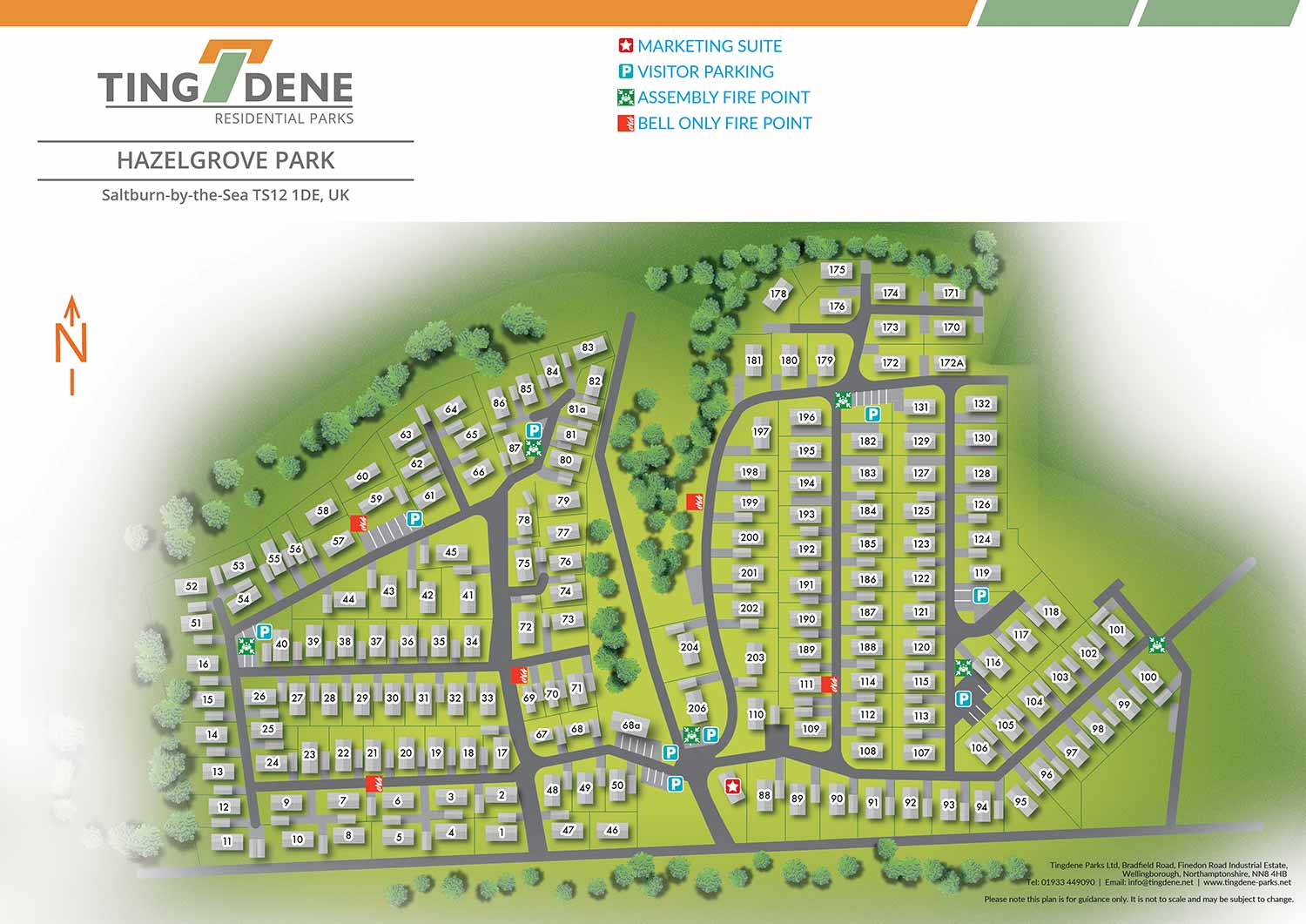
Hazelgrove Park is situated within easy walking distance of the seaside town of Saltburn by the Sea, where residents have access to a wide range of shops, cafés, and leisure facilities. The coastal location enhances the appeal of the park, offering nearby beaches, promenades, and local attractions while maintaining a comfortable and settled residential environment. This project represents a larger and more comprehensive map, expanding on a smaller subsection map previously created for the site.
Escape Key Graphics produced this illustrated overhead real estate map to clearly communicate the full layout of the park and support easy navigation for residents, visitors, and prospective buyers. Individual plots are clearly numbered, allowing key information to be understood quickly without overcrowding the illustration. Simple and consistent graphic icons are used to identify amenities such as parking, along with essential safety features including fire assembly points.
Designed to support both practical and promotional needs, the map functions effectively as on site signage and general wayfinding. At the same time, it serves as a refined marketing asset, presenting the layout and features of Hazelgrove Park in a professional and approachable manner. Clear visual communication helps convey the character, setting, and overall appeal of the residential park to those considering it as a place to live.


WORK FOR TINGDENE - COMBINED MARINA AND RESIDENTIAL PARK MAPS:


PORTFOLIO SELECTIONS
- Custom illustration & covers: Featuring bespoke illustration, book and magazine covers, hand-drawn maps, and building renderings.
- Fine art & murals: Including one-of-a-kind paintings and drawings, the Custom Halftone Series, and large-scale murals.
- Design & motion media: Covering graphic design, plus video and motion and animated illustration.
- Mapping by application: Tailored maps for marine events, hospitality, waterfront, property, transit, municipal, recreation, and navigation needs.
- Additional creative work: Includes editorial covers, vehicle graphics, concept renderings, and public art.
- Mediums & formats: Ranging from digital vector and isometric projection to traditional paint, line art, GIS-based, aerial-style, and halftone.
- Software expertise: Proficient in Photoshop, Illustrator, SketchUp, InDesign, and Premiere/After Effects for motion.