Maps Using Geodata Portfolio
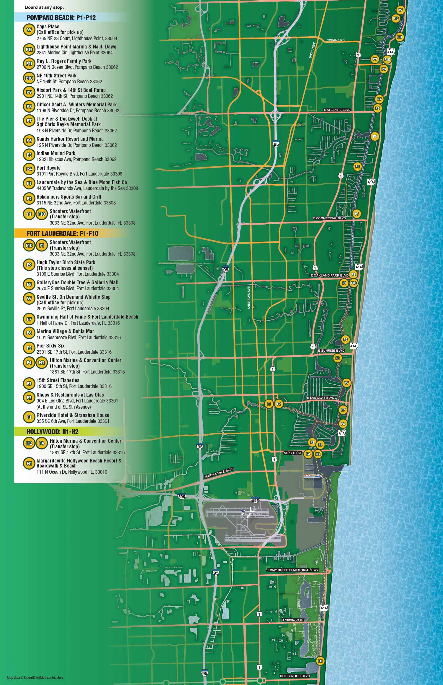
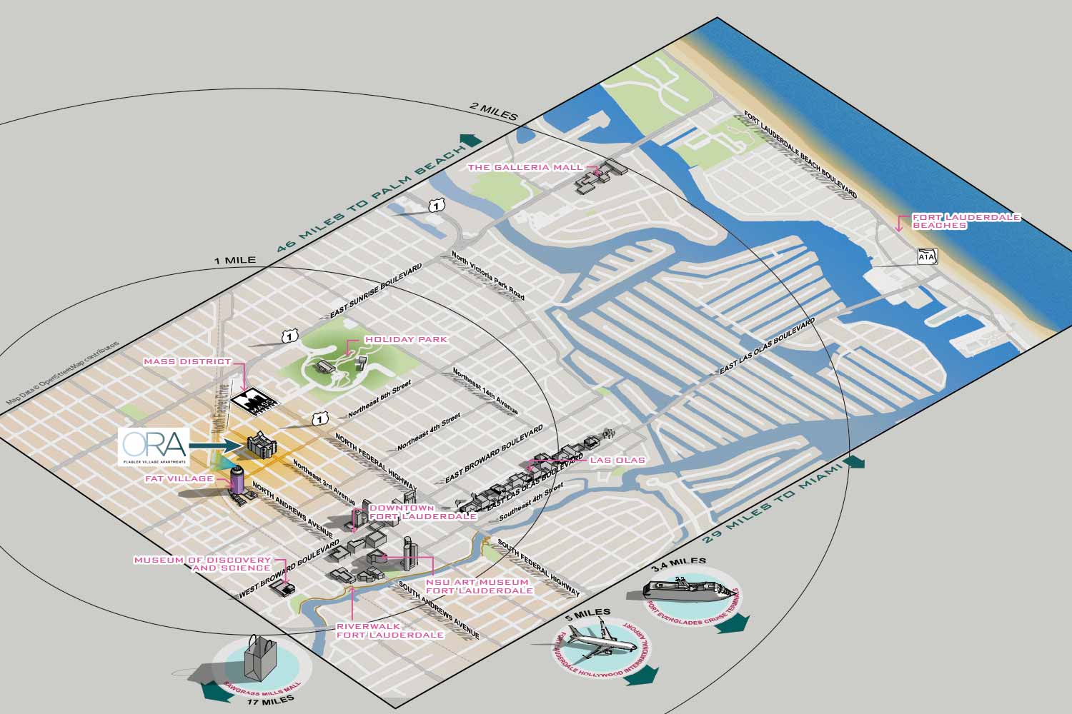 Geodata provides a precise digital foundation for modern mapmaking. This information, which includes geographic coordinates, street networks, topography, and points of interest, forms the essential skeleton for creating maps that are both accurate and informative. In my practice, I integrate this raw geospatial data with professional illustration tools to build custom maps that balance technical precision with clear visual communication.
My process begins with reliable geodata to ensure the underlying structure of a map like the shapes of neighborhoods, the curves of roads, the placement of landmarks is dimensionally correct. This is especially critical for complex environments like dense urban centers, extensive transit networks, or large event venues where manual drafting would be impractical and less accurate. I then use software like Adobe Illustrator to interpret, stylize, and elevate this data. The geodata informs the map's accuracy, while my design choices determine its clarity, emphasis, and overall aesthetic.
The result is a tailored map that serves a specific purpose. Whether it is guiding visitors through a parking system, illustrating transit routes and stops, or highlighting local points of interest for tourists, the final product is more than a data export. It is a designed artifact where unnecessary complexity is simplified, key information is highlighted, and the entire composition is rendered in a visual style that meets the client's objectives. This method is ideal for projects requiring a high degree of locational accuracy coupled with custom illustration, such as wayfinding systems, event guides, and informational brochures.
This portfolio showcases examples where strategic geodata integration supports the final illustrative map. If your project requires a map that is both precisely grounded and creatively presented, I can develop a solution tailored to your needs. Please review the work shown here and contact me to discuss your specific requirements.


PORTFOLIOS
- Illustration Portfolio: Start here for custom illustration and book covers. You can also browse illustrated maps and architectural rendering.
- Fine Art: I offer original paintings and drawings, including my Custom Halftone Series. You will also find mural work here.
- Graphic Design & Motion: View my graphic design portfolio. After that, explore motion design and animated illustrations.
- Maps by application: I create illustrated maps for boat shows, resorts, marinas, real estate, transportation, transit and parking, towns and cities, parks, and wayfinding.
- Additional project types: I also produce cover illustration, vehicle and vinyl wraps, proposal renderings, and street art.
- Illustration methods: My techniques include vector, isometric and axonometric, painting, black and white, GeoData maps, overhead maps, and custom halftones.
- Software portfolios: I work primarily in Adobe Photoshop, Adobe Illustrator, SketchUp Pro, and Adobe InDesign. For motion projects, I use Premiere Pro and After Effects.