
Making the Wahous Wilderness Lodge resort Map: A Topographic Journey
Clients: Wahous Wilderness Lodge
For information on Wahous Wilderness Lodge please visit their official site.
Behind the Map: Wahous Wilderness Lodge
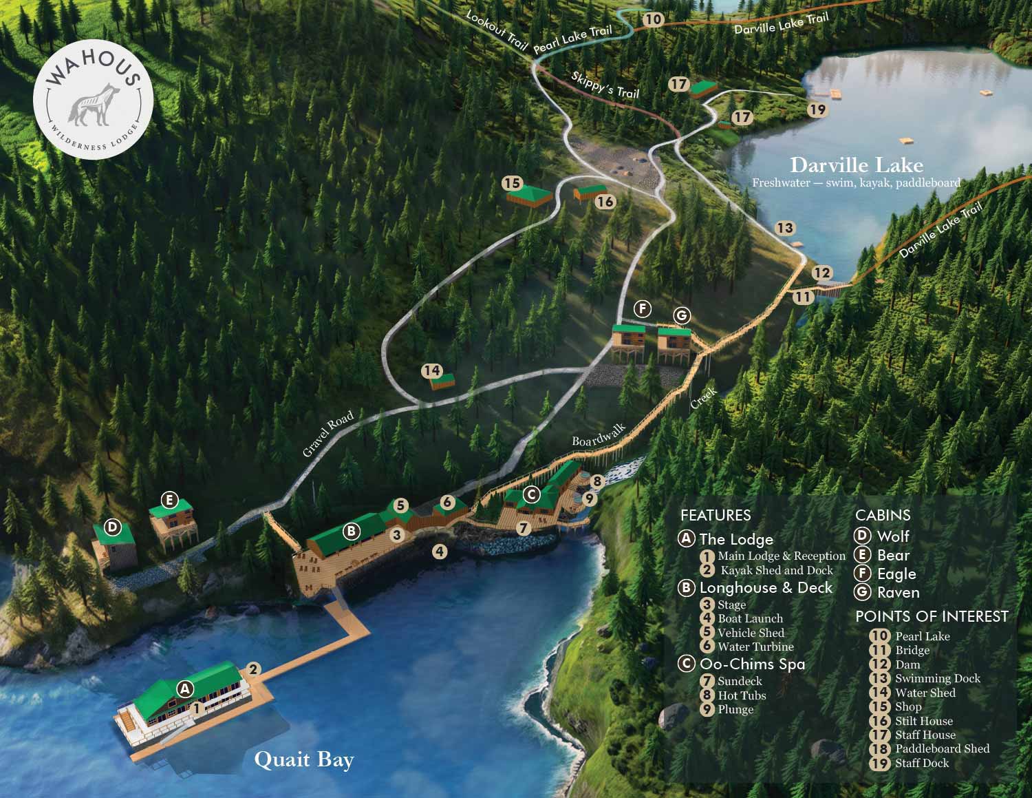
I just finished a new map for Wahous Wilderness Lodge, located on Vancouver Island in British Columbia. The lodge is accessible only by boat and is owned by members of the Ahousaht Nation, one of the Nuu-chah-nulth Indigenous peoples of the region. The setting is striking, with rugged coastline and dense forest meeting the water. The lodge runs on sustainable power and offers cabins, a spa, kayaks, paddleboards, and wildlife viewing.
A Remote Place, A Different Kind of Project
This was a project I had been waiting for, both because I felt personally aligned with it and because it gave me a chance to tackle some technical challenges I had wanted to take on. The venue is decidedly not flat. I have mapped hilly areas before, but I always managed to keep the primary map area flat for easier construction. For this project, I needed to build a truly topographic terrain to place the buildings and features on.
The Challenge of Terrain
I procured a topographic mesh from a data resource, but the resolution was lacking, so I ended up manually creating additional mesh to compensate. The final map looks much more accurate and realistic with enhanced shading than if I had kept it flat. That complex mesh also made the model heavier than usual, which pushed me to find new solutions.
When AI Helps and When It Does Not
I experimented with using artificial intelligence as a rendering aid. The results were unpredictable and came with plenty of hallucinations, but the speed and convenience were hard to beat. AI added textures and small details like rocks that I had not specifically requested, which was a pleasant surprise. That said, revisions were difficult, and I could not entrust critical areas to it. For now, artificial intelligence remains a supplemental tool, not a replacement.
The final product has a mood and atmosphere while still serving all the practical functions expected of a resort map. It combines the character of the place with the technical accuracy needed for a useful tool. This map will serve as both a wayfinding aid and a marketing piece for Wahous Wilderness Lodge, helping introduce visitors to Vancouver Island, Quait Bay, and this sacred territory.


EXPLORE MY WORK
- Illustration: Discover custom illustrations, book covers, illustrated maps, and architectural renderings.
- Fine Art: Browse original paintings and drawings, view the Custom Halftone Series, or check out mural projects.
- Graphic Design & Motion: See the graphic design collection, then dive into motion design and animated illustrations.
- Maps by industry: View illustrated maps tailored for boat shows, resorts, marinas, real estate, transportation, towns, parks, and wayfinding.
- More project types: Explore cover art, vehicle wraps, proposal renderings, and street art.
- Techniques & styles: Work spans vector, isometric, painting, black-and-white, GeoData, overhead maps, and halftones.
- Software expertise: Primary tools include Photoshop, Illustrator, SketchUp Pro, and InDesign, plus Premiere Pro & After Effects for motion. I am also supplementing some projects with AI.
