
The Sanctuary - A map of the Four Seasons Resort on the island of Lanai City, Hawaii
I illustrated and designed this map. For more, and the latest, information on Four Seasons Resort Lanai please visit their official site.
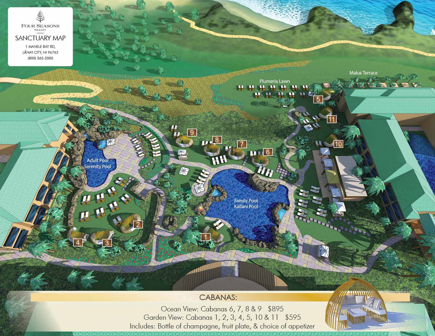
It is a genuine honor to have been commissioned for a second map by Four Seasons Resort Lanai. My previous project for them was a comprehensive overview of the entire resort. This new map offers a detailed focus on the courtyard area known as The Sanctuary, which features the pools and lounge chairs that are undoubtedly a center of activity for guests. This area is the vibrant heart of the resort, where the luxury of the property is most keenly experienced.
The Methodology
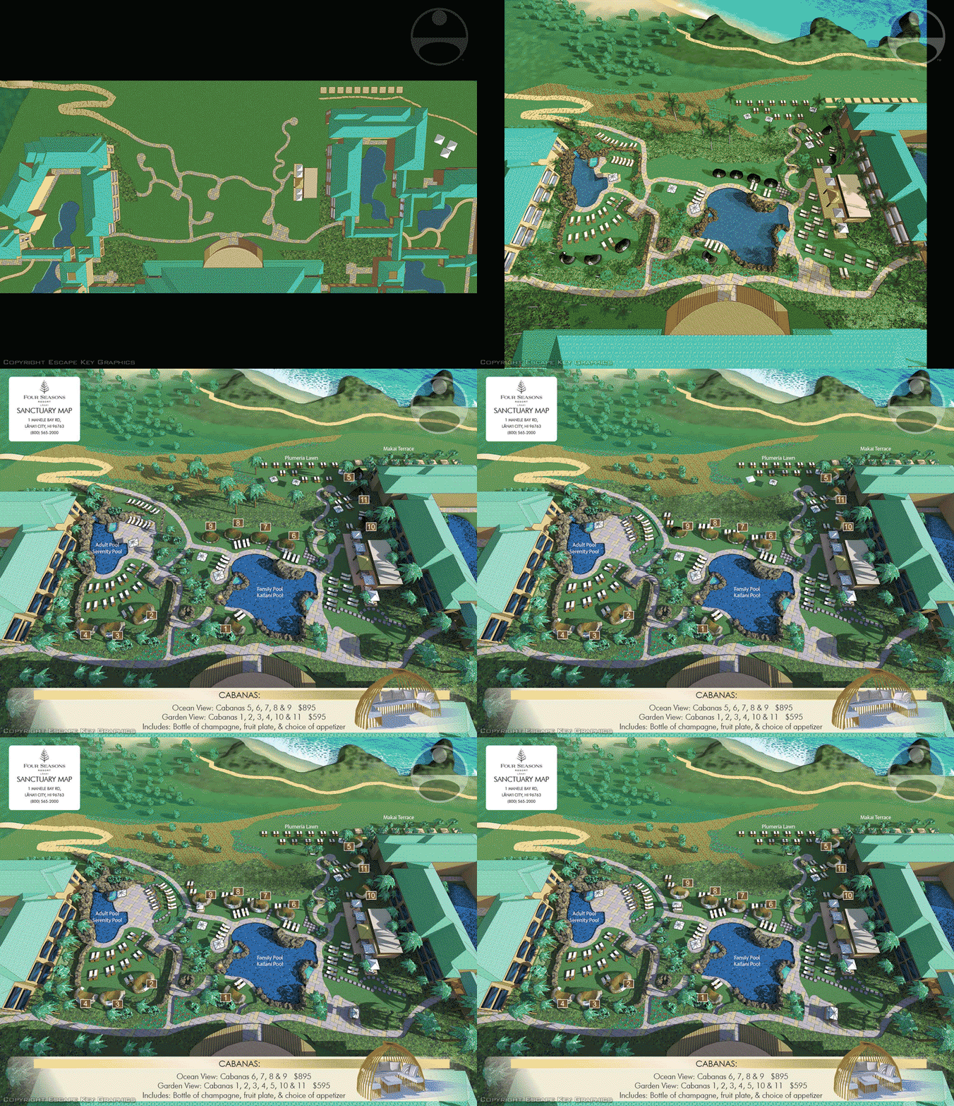
My process is built around constructing a detailed digital three-dimensional model of the property. This allows me to generate views from any angle and at any level of zoom, offering tremendous flexibility. Since The Sanctuary was already part of the larger model created for the comprehensive map, I initially anticipated simply rendering it from a new perspective.
The reality proved more challenging. The new map required a far greater level of detail and precision than the original model contained. While the existing model was an invaluable starting point, The Sanctuary essentially had to be rebuilt from the ground up to meet the demands of this focused view.
The Work
Ensuring that every element was perfectly scaled and positioned required significant time and effort. I studied the previous map they had in use, along with countless photos and videos. Any visual reference I could find was put to use. Even with all this research, the final refinements came through direct collaboration with the resort's staff via phone calls, emails, and text messages. Their expertise and eyes for detail were essential to the final accuracy.
The Complications
Four Seasons Resort Lanai required a look that is upscale and refined, a visual that matches their high-end luxury brand. To achieve the natural lighting and nuanced, realistic colors they wanted, I used a dedicated rendering engine separate from my modeling software. This engine produces superior results, but it is also extremely demanding on my computer's performance.
I was constantly pushing against those technical limits. For this map, I had to streamline the model by removing any geometry that would not be visible in the final view. This became a careful balancing act. Toward the end of the project, I often had to delete details to make room for new ones. For example, when I added new kiosk booths, I was able to compensate by removing unnecessary polygon details from the patio umbrellas, which kept the model manageable.
Looking ahead, it is exciting to think that a future update to the comprehensive map could incorporate all of this new, high-resolution detail. If that project materializes, I will need some creative solutions to handle the now incredibly complex model. I am already thinking through strategies like breaking the model into parts that can be rendered separately. Hopefully, by that time, I will also have upgraded my hardware and software.
In Summary
I hope you enjoy the new map of The Sanctuary. If you have a project that could benefit from a similar illustrated map, please do not hesitate to reach out. I would be happy to discuss how I can help bring your vision to life.


PORTFOLIO SELECTIONS
- Custom illustration & covers: Featuring bespoke illustration, book and magazine covers, hand-drawn maps, and building renderings.
- Fine art & murals: Including one-of-a-kind paintings and drawings, the Custom Halftone Series, and large-scale murals.
- Design & motion media: Covering graphic design, plus video and motion and animated illustration.
- Mapping by application: Tailored maps for marine events, hospitality, waterfront, property, transit, municipal, recreation, and navigation needs.
- Additional creative work: Includes editorial covers, vehicle graphics, concept renderings, and public art.
- Mediums & formats: Ranging from digital vector and isometric projection to traditional paint, line art, GIS-based, aerial-style, and halftone.
- Software expertise: Proficient in Photoshop, Illustrator, SketchUp, InDesign, and Premiere/After Effects for motion. More recently I have worked with AI.