
A map of the area around Home Ranch in Clark, CO
For information on Home Ranch please visit their official site.
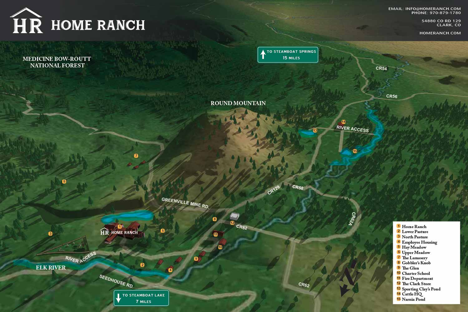
I seldom do maps that include topography but this map which covers a mountainous and largely natural really called for it. This is always challenging and strains the limits of most computers. I always expect slow speeds and an occasional crash while working this way.
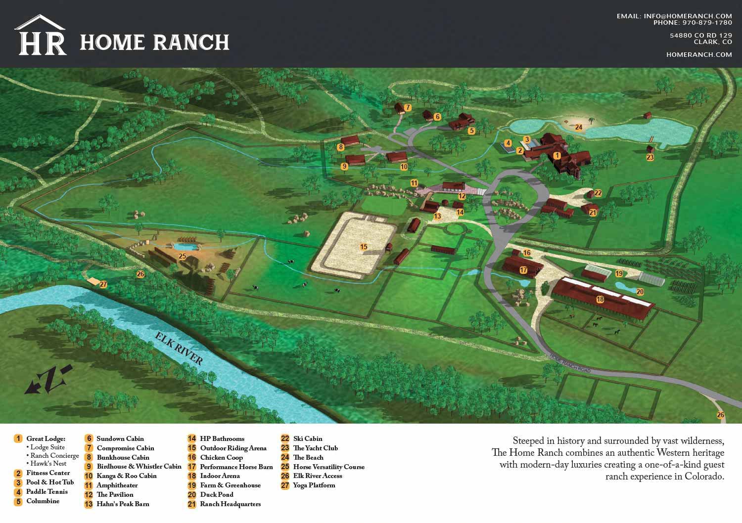
Also see the related map of the Home Ranch Resort actual venue:


ABOUT RESORT MAPS:
Clear wayfinding is essential to a positive guest experience, and a well designed resort map plays a major role in making that possible. When guests can easily locate amenities, lodging, dining, and recreation without confusion, they enjoy their stay more and place fewer demands on staff for directions. A custom illustrated resort map provides an immediate visual overview of the property, helping guests orient themselves quickly while reinforcing the resort’s brand and atmosphere.
I have created custom resort maps for a wide range of destinations, from waterfront properties and resort marinas to locations well inland. These projects include rustic cabin resorts set in wooded environments, luxury spa destinations adjacent to golf courses, and mixed use resort properties with complex layouts. In addition to full property maps, I have also produced detailed illustrated floor plans showing the interior layouts of rental apartments and resort accommodations, allowing guests to understand spaces before they arrive.
Clients consistently report that these illustrated maps become one of the most useful tools they provide to guests. They reduce confusion, minimize the need for staff to give repeated directions, and help visitors feel confident navigating the property on their own. Whether used in print, signage, mobile apps, or websites, custom resort illustrated maps offer both practical value and visual appeal, making them an effective investment for resorts focused on guest satisfaction and operational efficiency.
BROWSE MY WORK
- Illustration: Browse custom illustrations, book cover art, illustrated maps, and architectural renderings.
- Fine art: View original paintings and drawings, the Custom Halftone Series, and mural commissions.
- Graphic design & motion: See design projects, then watch motion reels and animated pieces.
- Maps by use case: Explore illustrated maps created for boat shows, resorts, marinas, real estate, transportation & parking, cities & towns, parks, and wayfinding.
- Specialty projects: Also check out cover design, vinyl & vehicle wraps, proposal renderings, and street art.
- Style & technique: Discover vector, isometric, painterly, monochrome, data-driven, bird's-eye, and halftone approaches.
- Tools I use: Everyday software includes Photoshop, Illustrator, SketchUp, and InDesign; motion work relies on Premiere & After Effects. Recently I have begun some work using AI as well.