
Map for a Sarasota Boat Show - 2021
Client: Informa Markets
For information on attending the Suncoast Boat Show please visit SuncoastBoatShow.com
If you are interested in hiring me to create an original map or illustration for you please contact me.
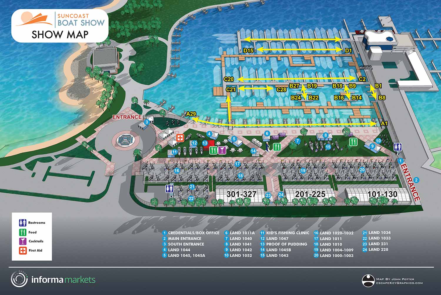
The publication of this illustrated map represents a long and meaningful journey. For many years, I actively pursued the opportunity to create a map for the Suncoast Boat Show, even producing early concept work on speculation to demonstrate both interest and capability. When approval was first granted, unforeseen circumstances halted the project. The following year, the map was nearly complete when the COVID pandemic led to the cancellation of the show. After multiple attempts and setbacks, seeing this map finally published feels especially rewarding. The process reflects persistence, adaptability, and a genuine commitment to producing high quality event graphics.
This project also carries personal significance due to my connection to Sarasota. I attended Ringling College of Art and Design, and while Sarasota is not my hometown, it played an important role in shaping my creative foundation. Having my work featured in a city where I studied and grew as an artist adds an emotional layer to the project. It is gratifying to know that the map is being used and seen within a community that influenced my career and continues to inspire my work as an illustrator and map designer.
From a functional perspective, this illustrated boat show map was designed to make navigating a large waterfront event clear and intuitive. The map includes Marina Jack’s and a portion of Bayfront Park, presented in a clean aerial view that highlights docks, exhibitor areas, entrances, and surrounding landmarks. Docks are clearly marked as spans of berths, helping attendees understand marina layout at a glance. Entrances are clearly labeled to support smooth visitor flow and reduce confusion in a busy event environment.
To further enhance usability, the map employs a numbered key system for points of interest along with a simple, consistent icon set to identify amenities. Recurring features such as restrooms, food areas, and services are represented with easily recognizable symbols, allowing visitors to quickly locate what they need. This combination of clear labeling, visual hierarchy, and approachable illustration style helps improve the attendee experience while also serving as a strong marketing asset for the event. The map demonstrates how custom illustrated boat show maps can balance clarity, visual appeal, and practical function for large scale waterfront events.
MAPS FOR SUNCOAST BOAT SHOW:


BROWSE MY WORK
- Illustration: Browse custom illustrations, book cover art, illustrated maps, and architectural renderings.
- Fine art: View original paintings and drawings, the Custom Halftone Series, and mural commissions.
- Graphic design & motion: See design projects, then watch motion reels and animated pieces.
- Maps by use case: Explore illustrated maps created for boat shows, resorts, marinas, real estate, transportation & parking, cities & towns, parks, and wayfinding.
- Specialty projects: Also check out cover design, vinyl & vehicle wraps, proposal renderings, and street art.
- Style & technique: Discover vector, isometric, painterly, monochrome, data-driven, bird's-eye, and halftone approaches.
- Tools I use: Everyday software includes Photoshop, Illustrator, SketchUp, and InDesign; motion work relies on Premiere & After Effects. Recently I have begun some work using AI as well.