
The Sanctuary - A map of the Four Seasons Resort on the island of Lanai City, Hawaii
I illustrated and designed this map. For more, and the latest, information on Four Seasons Resort Lanai please visit their official site.
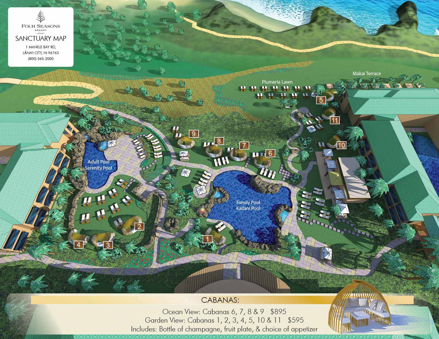
I recently completed my second illustrated map for Four Seasons Resort Lanai, and this one is all about the details.
While my first map captured the entire resort, this new project zooms in on The Sanctuary, which is the courtyard area with pools and lounge chairs where guests spend much of their time. It is the kind of space that looks effortless but requires an enormous amount of work to get right.
From the Ground Up
I built this and the previous map using digital 3D models, and since I already had the full resort modeled from the previous project, I assumed this would be a straightforward job. I was wrong. The Sanctuary required so much additional detail and accuracy that I ended up rebuilding the entire area from scratch. Getting every scale and position correct meant hours of studying photos, videos, and the resort’s existing map, with final adjustments coming directly from the staff on the ground.
Beauty Has a Cost
A resort like Four Seasons calls for a refined, luxurious look, and I achieved that in part by using a specialized rendering engine to achieve natural lighting and rich colors. The catch is that this software is a beast on my computer. I had to strip away every invisible detail and constantly manage the model’s complexity just to keep things running. When I added new elements, I found myself subtracting details elsewhere just to stay within my system’s limits.
What’s Next
If I ever update the full resort map, it will benefit from all this new detail. That will be a challenge, but I am already thinking through solutions.
You can see the final result and read the full story behind the map here. If your project needs a custom illustrated map, I would love to hear from you.


EXPLORE MY PORTFOLIOS
- Illustration: Find custom illustration, book covers, illustrated maps, and architectural rendering.
- Fine Art: Browse original paintings and drawings, the Custom Halftone Series, and murals.
- Graphic Design & Motion: See my graphic design work, plus motion design and animated illustrations.
- Maps by industry: Illustrated maps tailored for boat shows, resorts, marinas, real estate, transit & parking, towns & cities, parks, and wayfinding.
- Other project types: Also available: cover art, vehicle & vinyl wraps, proposal renderings, and street art.
- Techniques: Explore work in vector, isometric & axonometric, painting, black & white, GeoData, overhead, and halftone styles. Recently I have also begun to use AI for some specific solutions.
- Software: Primary tools: Photoshop, Illustrator, SketchUp Pro, and InDesign. Motion work uses Premiere Pro & After Effects.
