
A Custom Map for a Great Client
Client: Global Marine Travel
Project management by Julia Russell
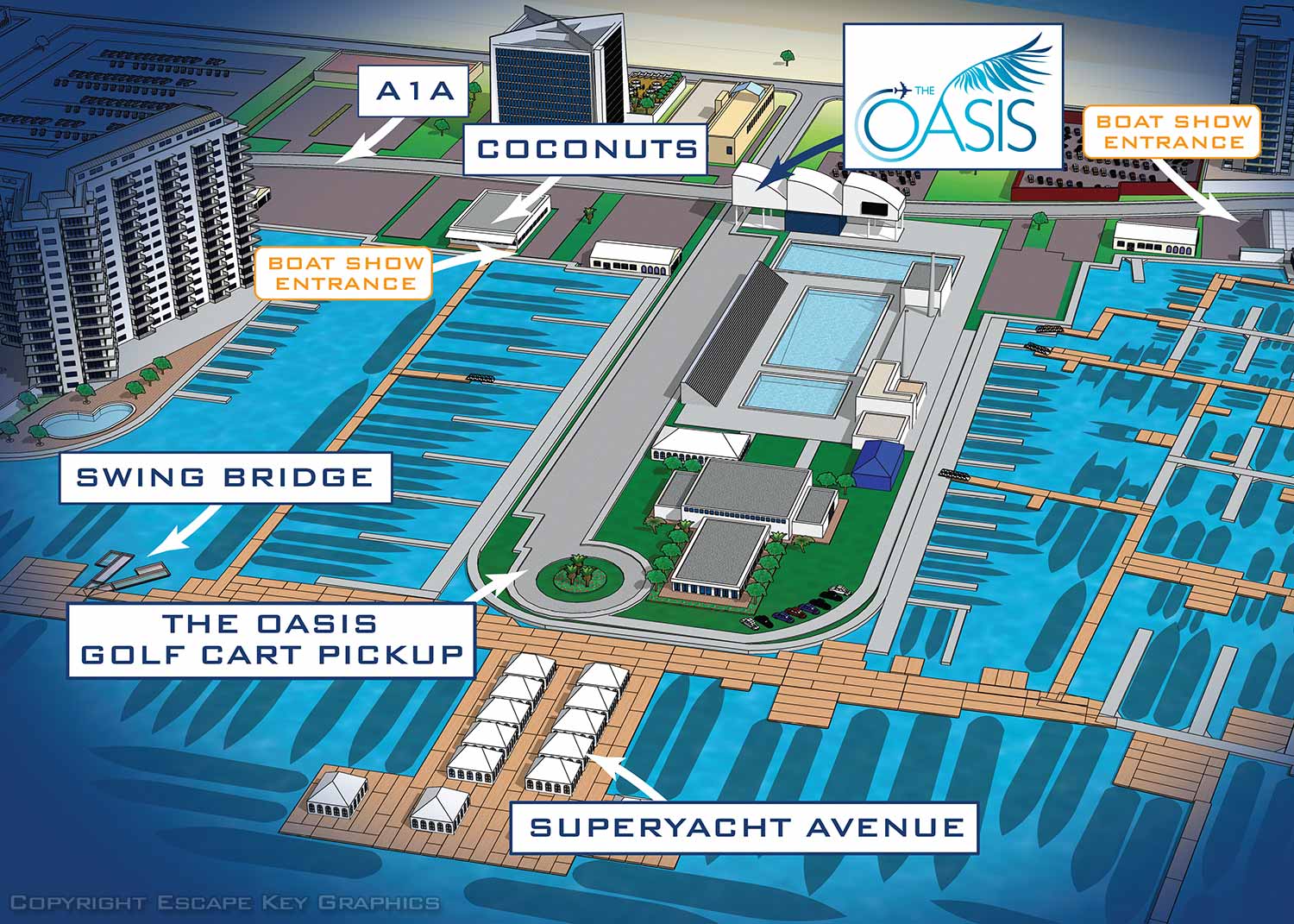
I created this map for Global Marine Travel to promote The Oasis Lounge at the 2018 Fort Lauderdale International Boat Show. The Oasis Lounge is the Official Hospitality Lounge for Superyacht Captains and Crew. They provide everything from gourmet boxed lunches and a fully stocked bar to live music, Wi Fi, and streaming of live sports. This was my first year working with Global Marine Travel, and they are great. I genuinely look forward to working with them every year.
How This Map Is Different
As you may know, I make the official maps for the Fort Lauderdale International Boat Show and most other major boat shows in the United States. All of those maps are based on three dimensional digital models of the venues that I keep on file. Each year I update dock locations, exhibitor locations, and all the supporting information like map keys to produce new, current maps for each event.
The same methods I use for the official maps can also be used to zoom in on specific areas or render the model from a completely different angle. In other words, I can create a very specific, customized map with your own branding to meet your own marketing and wayfinding goals. That is exactly what you are seeing here. A customized, personalized, branded map designed for the specific needs of my client.
For this project, Global Marine Travel wanted their area of the boat show rendered from a different angle than the main show map uses. I also added some custom styling, labeled everything for their specific needs, and included the surrounding area which no longer appears on the main show map. The result is a map that works for their audience and their audience only.
What Is Available To You
If you want a map showing the location of your booth, dock, or exhibit space at any of the shows I make maps for, please contact me. When you hire me to make a map of your area at a boat show, you can get a lot more than just a zoomed in version of the main map. Although simple zoomed in versions are also available if that is all you need. I can provide a different look and feel, render the venue from different angles, and focus on exactly what matters to your clients.
By the way, I have also used vector based axonometric drawings to make boat show maps in the past. I do not have any boat show clients requesting that style right now, but I still have the skills if you need them.
Your Custom Map
If you need a custom map for your space at a boat show, or any other event where I already have the venue modeled, contact me. I have done this work before and I would be glad to do it for you.
WORK FOR GLOBAL MARINE TRAVEL:


EXPLORE MY PORTFOLIOS
- Illustration: Find custom illustration, book covers, illustrated maps, and architectural rendering.
- Fine Art: Browse original paintings and drawings, the Custom Halftone Series, and murals.
- Graphic Design & Motion: See my graphic design work, plus motion design and animated illustrations.
- Maps by industry: Illustrated maps tailored for boat shows, resorts, marinas, real estate, transit & parking, towns & cities, parks, and wayfinding.
- Other project types: Also available: cover art, vehicle & vinyl wraps, proposal renderings, and street art.
- Techniques: Explore work in vector, isometric & axonometric, painting, black & white, GeoData, overhead, and halftone styles.
- Software: Primary tools: Photoshop, Illustrator, SketchUp Pro, and InDesign. Motion work uses Premiere Pro & After Effects.