
A map of a resort ranch in Clark, CO
For information on Home Ranch please visit their official site.
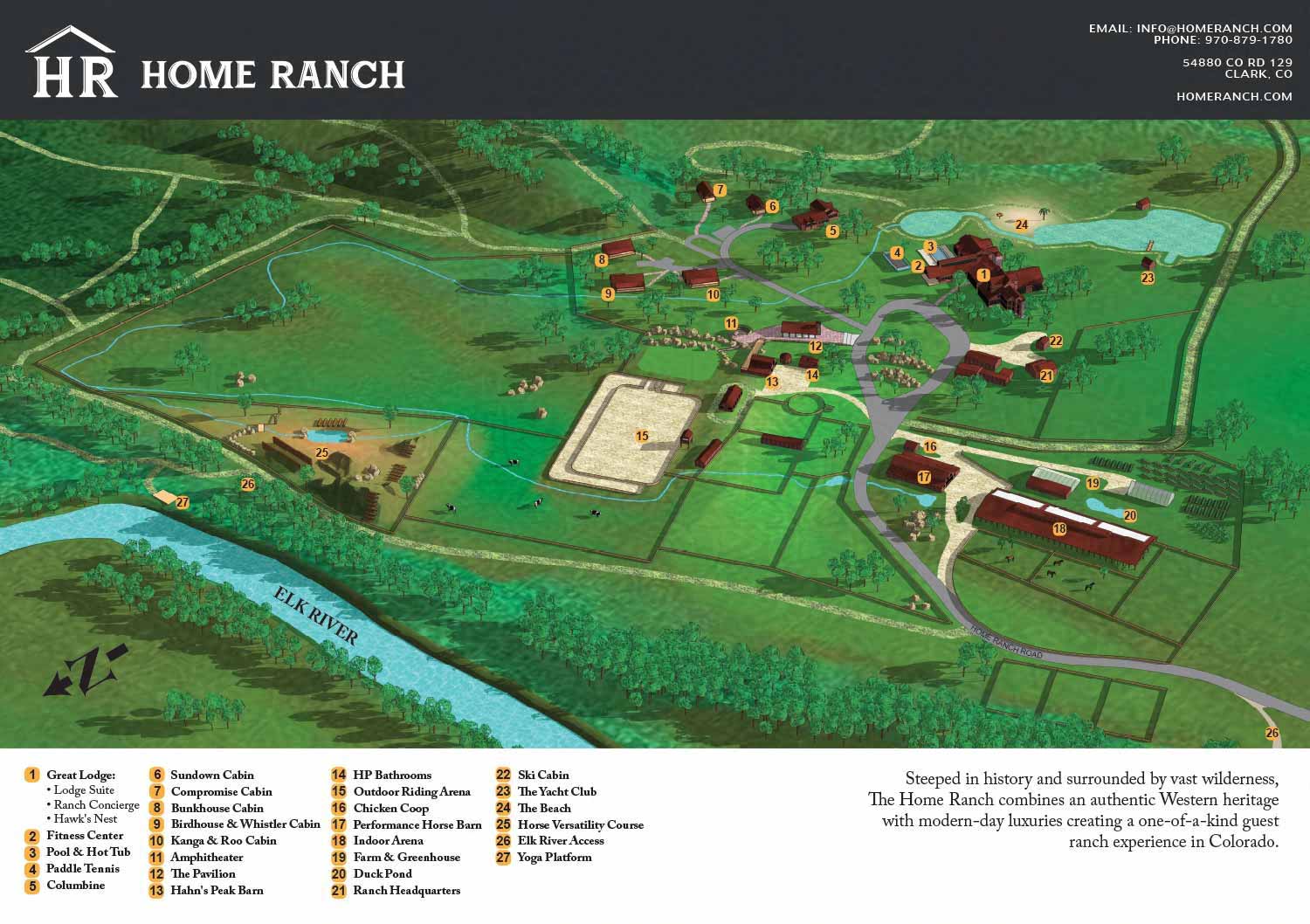
I created an illustrated aerial map for Home Ranch, a luxury guest ranch located in Clark, Colorado. Set in a wide open mountain valley, the ranch offers a mix of private cabins, shared lodge spaces, and wellness amenities designed to provide guests with a comfortable and immersive Western experience. The purpose of the map was to clearly show the layout of the property while reflecting the calm, high quality atmosphere that defines the ranch.
The map highlights the locations of guest cabins along with key amenities such as the main lodge, pool, spa, dining areas, and outdoor gathering spaces. By using an overhead perspective, the illustration helps guests understand how the different parts of the ranch relate to one another across the landscape. Care was taken to balance accuracy with a welcoming visual style so the map feels informative without becoming overly technical.
This type of illustrated map works especially well for inland resorts, guest ranches, and destination properties that want to improve wayfinding while also supporting marketing efforts. A clear and attractive map helps guests feel oriented before and during their stay and serves as a strong visual asset for websites, print materials, and welcome guides. This project demonstrates how custom map illustration can enhance both the guest experience and the overall presentation of a resort property.
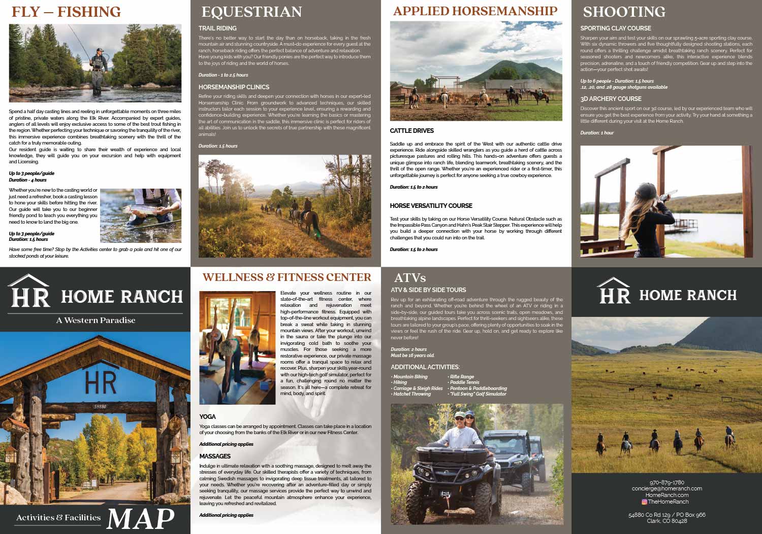
I also did the page layout for the reverse side of the map.
A lot of the great photography on the brochure is by Will Zimmermann.


ABOUT RESORT MAPS:
Clear wayfinding is essential to a positive guest experience, and a well designed resort map plays a major role in making that possible. When guests can easily locate amenities, lodging, dining, and recreation without confusion, they enjoy their stay more and place fewer demands on staff for directions. A custom illustrated resort map provides an immediate visual overview of the property, helping guests orient themselves quickly while reinforcing the resort’s brand and atmosphere.
I have created custom resort maps for a wide range of destinations, from waterfront properties and resort marinas to locations well inland. These projects include rustic cabin resorts set in wooded environments, luxury spa destinations adjacent to golf courses, and mixed use resort properties with complex layouts. In addition to full property maps, I have also produced detailed illustrated floor plans showing the interior layouts of rental apartments and resort accommodations, allowing guests to understand spaces before they arrive.
Clients consistently report that these illustrated maps become one of the most useful tools they provide to guests. They reduce confusion, minimize the need for staff to give repeated directions, and help visitors feel confident navigating the property on their own. Whether used in print, signage, mobile apps, or websites, custom resort illustrated maps offer both practical value and visual appeal, making them an effective investment for resorts focused on guest satisfaction and operational efficiency.
EXPLORE MY PORTFOLIOS
- Illustration: Find custom illustration, book covers, illustrated maps, and architectural rendering.
- Fine Art: Browse original paintings and drawings, the Custom Halftone Series, and murals.
- Graphic Design & Motion: See my graphic design work, plus motion design and animated illustrations.
- Maps by industry: Illustrated maps tailored for boat shows, resorts, marinas, real estate, transit & parking, towns & cities, parks, and wayfinding.
- Other project types: Also available: cover art, vehicle & vinyl wraps, proposal renderings, and street art.
- Techniques: Explore work in vector, isometric & axonometric, painting, black & white, GeoData, overhead, and halftone styles. Recently I have also begun to use AI for some specific solutions.
- Software: Primary tools: Photoshop, Illustrator, SketchUp Pro, and InDesign. Motion work uses Premiere Pro & After Effects.