
Crafting the Wahous Wilderness Lodge Map: A Topographic Journey
Clients: Wahous Wilderness Lodge
For information on Wahous Wilderness Lodge please visit their official site.
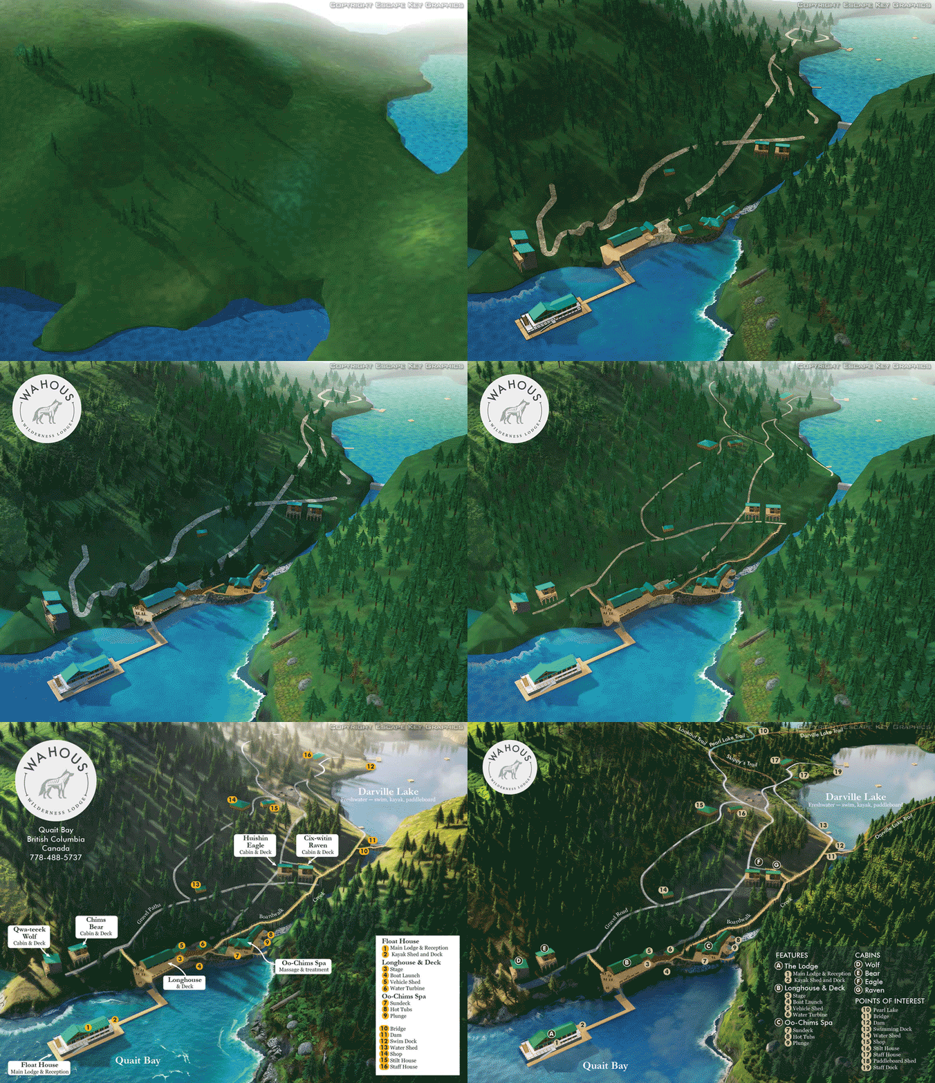
These are the daily (or close to it) updates the client saw
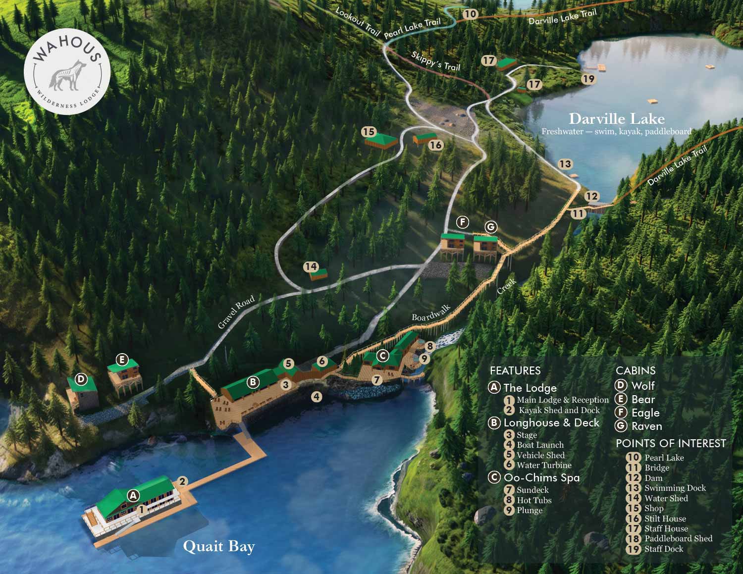
I just completed a new map for Wahous Wilderness Lodge, located on Vancouver Island in British Columbia. The lodge sits in a remote spot accessible only by boat and is owned by members of the Ahousaht Nation, one of the Nuu-chah-nulth Indigenous peoples of Vancouver Island's west coast. The setting is striking, with rugged coastline and dense forest meeting the water. The lodge runs on sustainable power, offers cabins and a spa, and gives guests access to rowboats, canoes, kayaks, paddleboards, and wildlife viewing. I will admit that working on this project while dealing with 100 degree heat (Fahrenheit or 38°C) where I live made the temperate marine climate and rugged beauty look especially appealing.
A Project of Personal and Professional Alignment
This is the map I have been waiting for. It feels good to work on a project I am morally and soulfully aligned with. This was an opportunity to try a more natural feeling map that captures the vibe of a place rather than just reproduces the angles, size and position of architecture and infrastructure accurately. It also presented some technical challenges I had been wanting to tackle. I think this project marks a leap forward in my map making process. The lessons learned can't be applied to every map or project but they will certainly be utilized when appropriate.
Mastering Topographic Terrain
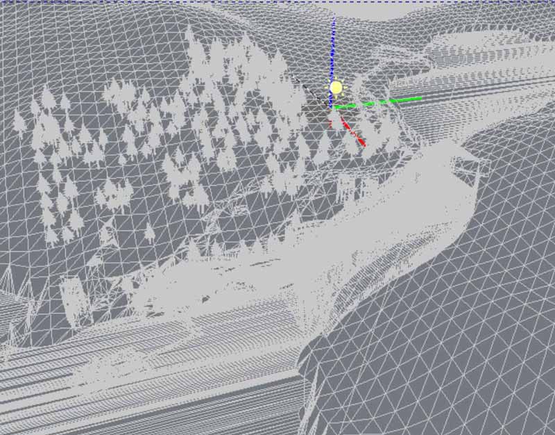
This venue is decidedly not flat. I have created maps in hilly areas before, but I always managed to keep the primary map area flat for easier construction and revisions. For this project, it was time to step up and create a truly topographic map. This meant building a shaped terrain to place the buildings and other features on, which was a significant new adventure for me.
I procured a topographic mesh from a data resource, but I found its resolution to be a little lacking. I ended up manually creating some mesh to compensate for those deficiencies. It was a valuable learning experience, and the final map looks much more accurate and realistic with enhanced shading than if I had kept it flat.
Navigating Technical Challenges with Artificial Intelligence
This complex mesh made the model much heavier than most of my maps, and I had to delete large areas to render it in Kerkythea. But I really wanted that high-quality look. I started researching alternatives. V-Ray is out of my budget considering how much I would use it, as were most competing products. I was beginning to research Blender as a potential solution or part of a complex workflow solution when I decided to try using artificial intelligence as if it were a rendering engine. Although a render engine can capture subtle nuances from a 3D mesh the artificial intelligence that I used worked from the already rendered (bitmap) image. For my computer that reduces the computing load dramatically, sped things up and reduced crashes. The results may also look more natural, even if not necessarily accurate.
The results are unpredictable, and there are many hallucinations to deal with, but the speed and convenience far exceeded any solutions I had considered. The fact that artificial intelligence can add textures and small details like rocks that I hadn’t specifically requested turned out to be a positive aspect of dealing with its unpredictability and sometimes wonky results. However, the original unrevised model had to be used for critical areas. Revisions were also very difficult and trying on the nerves. Suffice it to say, AI could not be entrusted with the entire project or even substantial parts of it, but it proved to be a great supplemental tool. This is a map and the accurate positioning of places and routes is the primary goal. At this point delivering that kind of accuracy is a significant artificial intelligence weakness.
Designing an Intuitive User Experience
For the graphical elements of the map, the client initially wanted labels only, with no key. I created two versions: one with all labels and one hybrid of labels and keyed map features. The client requested an only-keyed version immediately upon seeing them. I organized the keyed items by major features with letters and minor features with numbers, which allowed me to create an intuitive hierarchy in the map key that is easy to follow.
The Final Product: A Functional and Atmospheric Map
The final product has a mood and an atmosphere while still serving all the practical functionality expected of a resort map. This map marks a new look and feel made possible by new techniques. I can now offer maps of natural areas with a more warm, realistic and inviting feel. This map combines the ambiance and energy of a locale with the technical accuracy necessary to make a map a useful tool. It will serve as both a wayfinding tool and a marketing tool for Wahous Wilderness Lodge, helping to introduce visitors to the wonders of Vancouver Island, Quait Bay, and this sacred hahoulthee (territory).


BROWSE MY WORK
- Illustration: Browse custom illustrations, book cover art, illustrated maps, and architectural renderings.
- Fine art: View original paintings and drawings, the Custom Halftone Series, and mural commissions.
- Graphic design & motion: See design projects, then watch motion reels and animated pieces.
- Maps by use case: Explore illustrated maps created for boat shows, resorts, marinas, real estate, transportation & parking, cities & towns, parks, and wayfinding.
- Specialty projects: Also check out cover design, vinyl & vehicle wraps, proposal renderings, and street art.
- Style & technique: Discover vector, isometric, painterly, monochrome, data-driven, bird's-eye, and halftone approaches.
- Tools I use: Everyday software includes Photoshop, Illustrator, SketchUp, and InDesign; motion work relies on Premiere & After Effects.