Broward County Convention Center Map for FLIBS 2022
Design by John Potter - Escape Key Graphics
Broward County Convention Center Map for the 2022 Fort Lauderdale International Boat Show. Visit their official site at FLIBS.com for information on the show and more up to date information.
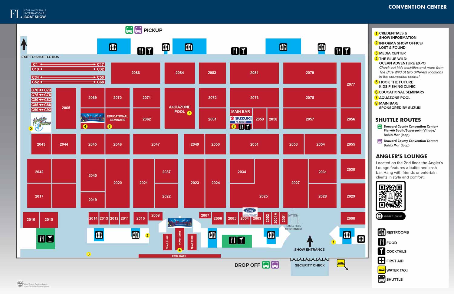
This is a simple overhead map that gets you where you want to go.
Fort Lauderdale International Boat Show Maps:
- Bahia Mar, Swimming Hall of Fame & Las Olas Marina: 2023 | 2022 | 2020 | 2019 | 2018 | 2017 | 2016 | 2015 | 2014 | 2013 | 2012 | 2011 | 2010
- Transit Maps: 2023 | 2022 | 2020 | 2019 | 2018 | 2015 Bus | 2015 Water Taxi | 2014 | 2013 | 2012 | 2011
- Convention Center: 2023 | 2022 | 2016 | 2015 Ext | 2014 Ext | 2014 | 2013 Ext | 2013 | 2012 | 2011 | 2010
- Marinas Maps: 2023 | 2022 | 2016
- Program Layout: 2023 | 2022
- Signs: 2013 looking north | 2013 Engine Tent
- Video: 2013 54th Annual
- Illustration (not a map): 2014A | 2014B
OVERHEAD MAPS:

Transit/Parking Map

Docks Map

San Diego International Boat Show Map

RV Resort Map

Resort Overhead Map

MBCC Map

Bimini Docks Map

County Park Maps

Cabin & RV Resort Map

Transit & Parking Map

Pride Park Map

Parking Map Using GeoData

Bus Routes Map

Convention Center Map

Island Tourism Map

Botanical Gardens Map

Watercolor Map

Pet Resort Map

Sculpture Garden Map

Marina Siteplan

Beach Resort Siteplan

Color Resort Siteplan
MAPS FOR THE FORT LAUDERDALE INTERNATIONAL BOAT SHOW:

Fort Lauderdale International Boat Show Map
Convention Center Map

Illustrated Map of Marinas

Ft Lauderdale Boat Show Transit Map
Transit & Parking Map

FLIBS ISO / AXO
PORTFOLIOS:
- Illustration Portfolio
- Illustrated Maps Portfolio
- Fine Art
- Graphic Design Portfolio
- Motion Design
- Animated Illustrations
- Murals
- Architectural Rendering Portfolio
- Posters Portfolio
By Software Used:
By Application or Use:
- Boat Show Map Portfolio
- Resort Map Illustrations Portfolio
- Marina Maps Portfolio
- Transit, Parking and Transportation Maps Portfolio
- Town and City Maps Portfolio
- Cover Illustration Portfolio
- Vehicle Wrap & Vinyl Wrap Portfolio
- Illustrated Park Maps Portfolio
- Wayfinding Maps Portfolio
- Proposal Renderings Portfolio
- Street Art
- Real Estate Maps Portfolio