
San Diego International Boat Show in San Diego, California – Illustrated Map 2026
Client: Revel Republic
I am the illustrator and designer of this map. If you want the latest and most accurate information about attending the San Diego International Boat Show please visit their official site at SDIBS.com
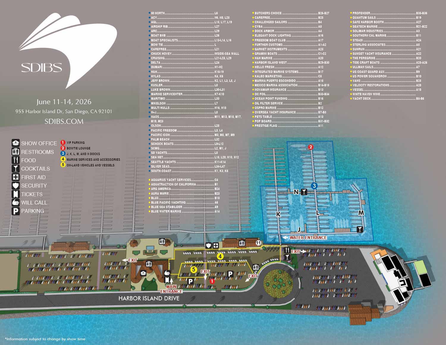
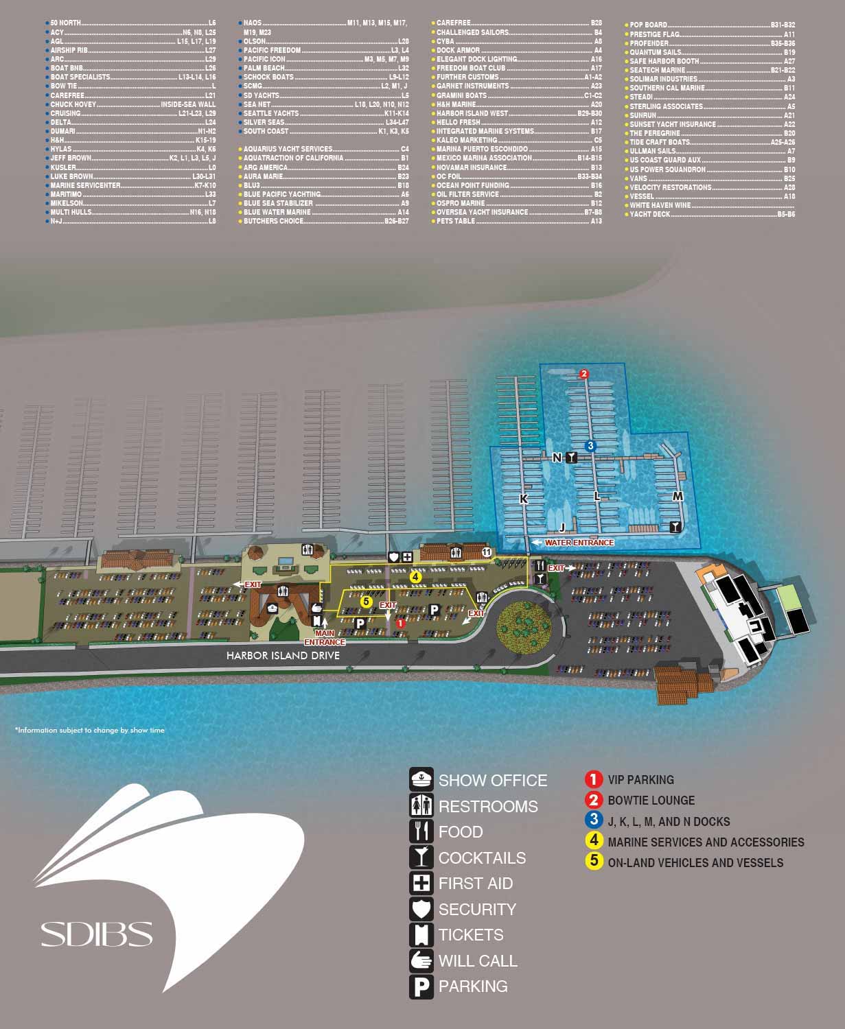
Every year, the San Diego International Boat Show brings together boating enthusiasts from all over California and beyond. The 2026 event will be held June 11 through 14 at Safe Harbor Sunroad, featuring an exciting mix of in water and on land exhibitions, interactive activities, and entertainment for all ages.
I am pleased to share that I was once again tasked by Revel Republic to create the illustrated map for this year’s show.
What Went Into This Year’s Edition
The 2026 map update focused mainly on text revisions. That may sound simple, but it actually speaks to something I am proud of. A well planned visual foundation can last for years without needing a full rebuild.
My process begins with a three dimensional digital model of the venue. I build this model myself so that I can render the scene from nearly any angle or zoom level. Once I refine those renderings in Adobe Photoshop, I move to Adobe Illustrator for the graphical work. Logos, map keys, and other crisp visual elements come together there. The final illustration is a bitmap image with vector graphics layered on top for clarity and style.
Making Navigation Intuitive
A boat show map needs to do two things at once. It has to be practical for attendees trying to find their way, but it also needs to function as a marketing tool.
For the 2026 map, exhibitor locations are grouped by color coded zones. Major points of interest such as VIP parking and The Pool Lounge are numbered for easy reference. Essential facilities like restrooms, will call, and food vendors are marked with clear icons. These small decisions make the map much easier to read at a glance.
A Smart Approach to Future Shows
Because I build the venue as a full virtual model, I have the freedom to make bigger changes down the road without starting over. If the event layout shifts or the organizers want a completely different perspective for a future year, I can adjust the model and generate new renderings. That flexibility saves time and keeps the illustration consistent over time.
Visit the Official Show Site
This map is designed to help attendees orient themselves quickly and enjoy everything the show has to offer. For the latest and most accurate information about tickets, schedules, and exhibitors, please visit the official San Diego International Boat Show website at SDIBS.com.
MAPS FOR THE SAN DIEGO INTERNATIONAL BOAT SHOW:
- About The San Diego International Boat Show
- Main Map: 2026 | 2025 | 2024
MAPS FOR BOAT SHOWS IN CALIFORNIA:


BROWSE MY WORK
- Illustration: Browse custom illustrations, book cover art, illustrated maps, and architectural renderings.
- Fine art: View original paintings and drawings, the Custom Halftone Series, and mural commissions.
- Graphic design & motion: See design projects, then watch motion reels and animated pieces.
- Maps by use case: Explore illustrated maps created for boat shows, resorts, marinas, real estate, transportation & parking, cities & towns, parks, and wayfinding.
- Specialty projects: Also check out cover design, vinyl & vehicle wraps, proposal renderings, and street art.
- Style & technique: Discover vector, isometric, painterly, monochrome, data-driven, bird's-eye, and halftone approaches.
- Tools I use: Everyday software includes Photoshop, Illustrator, SketchUp, and InDesign; motion work relies on Premiere & After Effects. Recently I have begun some work using AI as well.
