
Maps for Parks, Theme Parks and Similar Attractions
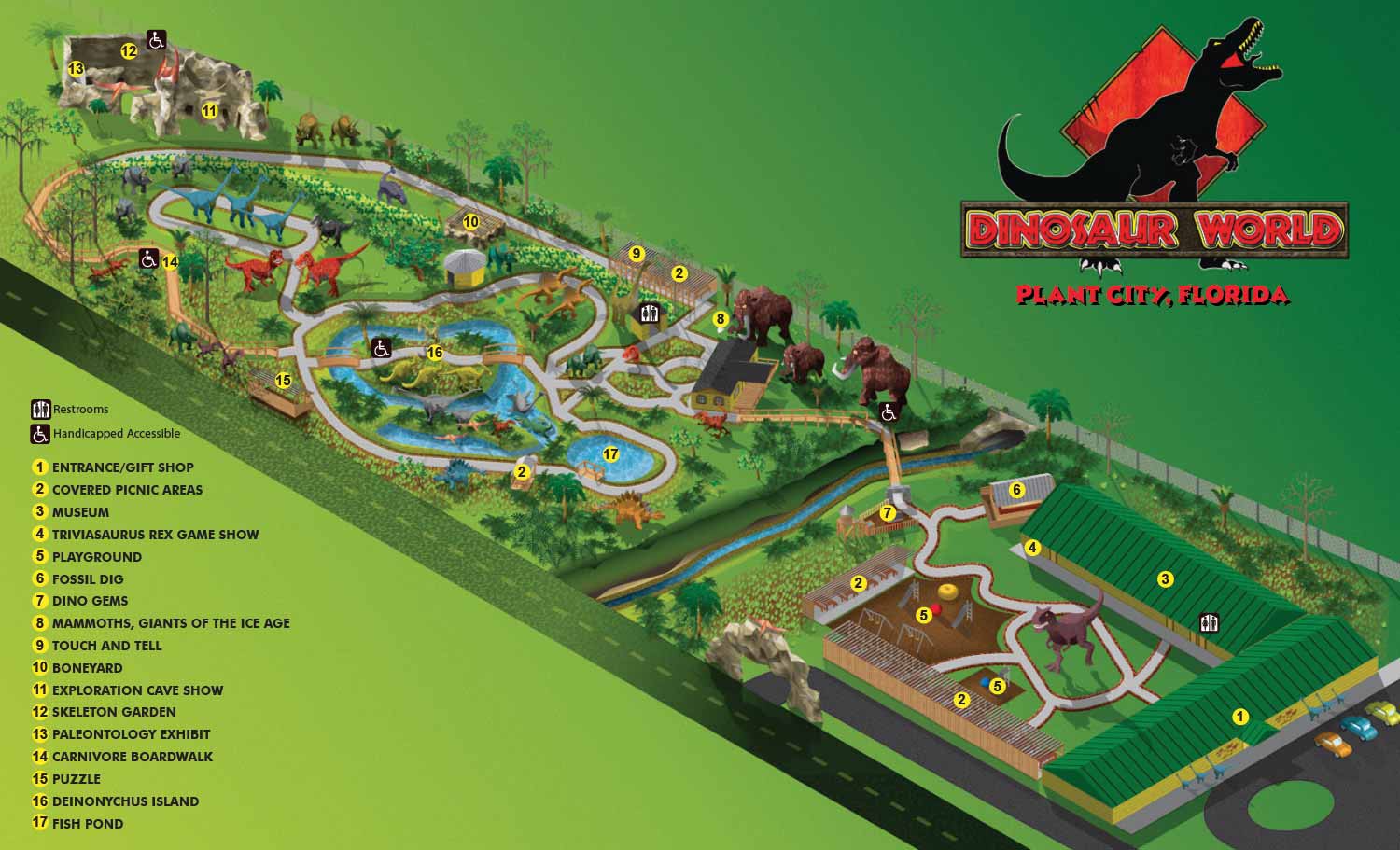
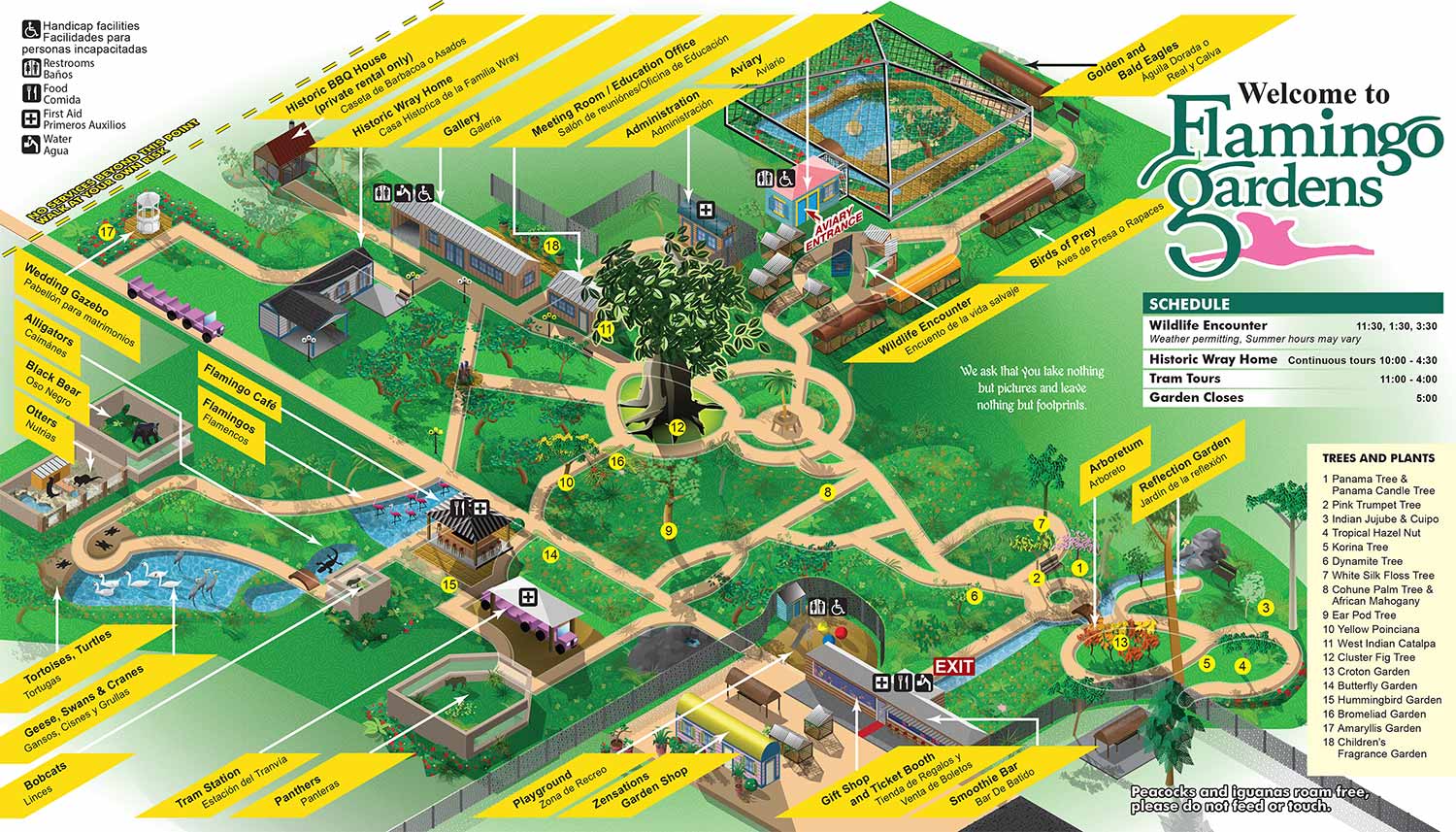
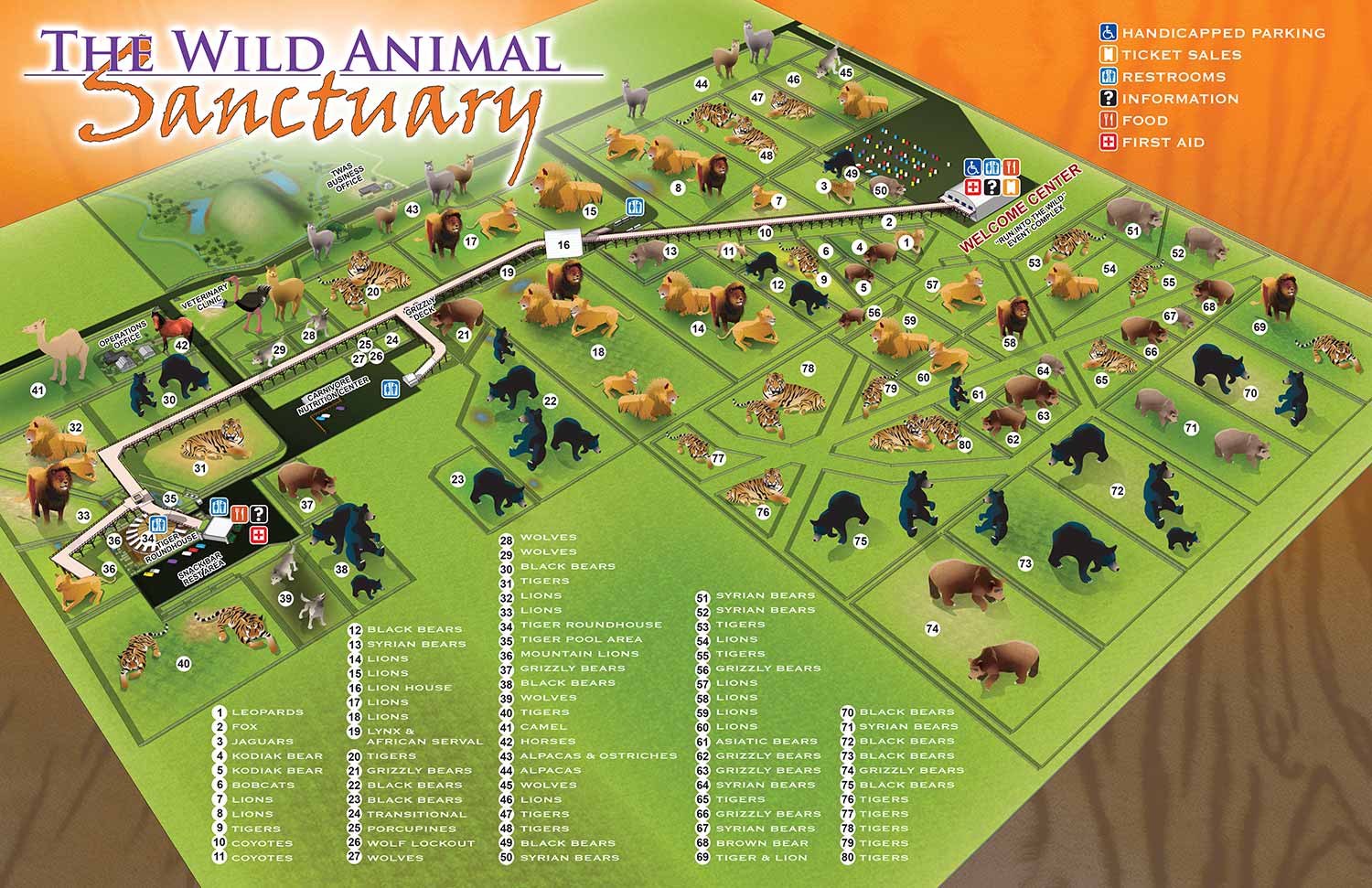
Maps for Parks, Gardens, and Attractions
I create illustrated maps for theme parks, nature preserves, botanical gardens, and public recreational spaces. My clients include municipal parks departments, tourism destinations, and privately operated attractions. Every project starts with a close look at the site layout and a clear understanding of who will be using the map. Visitors should feel invited. Navigation should feel natural. The finished piece should look like it belongs to that specific place.
Methods Matched to the Landscape
Different parks demand different visual approaches. Some maps work best as isometric or axonometric perspectives that show trees, buildings, and pathways in one scale with a kind of cartoon like look. Others call for architectural views built from three dimensional reference models. Traditional overhead maps based on geographic data remain a reliable choice for many sites. I also incorporate custom spot illustrations to highlight landmarks, restrooms, playgrounds, and unique features. These small drawings add personality while helping visitors lock onto their location instantly.
Built for Real World Use
Visitors rely on these maps to find trails, exhibits, food, and parking. Staff use them for daily operations and event planning. Marketing teams feature them in printed guides and on websites. I design each map to perform across all those applications. Large format signage demands different treatment than a mobile screen or a folded brochure. My files accommodate every format without losing clarity or character. Final artwork is delivered with the illustration fixed and all labels, legends, and graphic elements on editable layers. Seasonal updates and special event notations can be handled in house without disturbing the original drawing.
Parks of All Kinds
County parks, airboat attractions, botanical gardens, animal sanctuaries, theme parks, and golf courses have all been mapped in my studio. I have illustrated hiking trails and off road motorsports parks, you pick farms and tourist landmarks. Each project receives the same attention to accuracy, usability, and visual appeal regardless of size or budget.
Ready to Map Your Park
If you manage a park, garden, nature preserve, or recreational attraction, I am ready to discuss your mapping needs. Contact me through Escape Key Graphics to request a quote or begin a conversation about your site and audience.


I am currently accepting new commissions for . Tell me about your resort, marina, or event and I will let you know how I can help. Contact me.
PORTFOLIOS
- Illustration Portfolio: Start here for custom illustration and book covers. You can also browse illustrated maps and architectural rendering.
- Fine Art: I offer original paintings and drawings, including my Custom Halftone Series. You will also find mural work here.
- Graphic Design & Motion: View my graphic design portfolio. After that, explore motion design and animated illustrations.
- Maps by application: I create illustrated maps for boat shows, resorts, marinas, real estate, transportation, transit and parking, towns and cities, parks, and wayfinding.
- Additional project types: I also produce cover illustration, vehicle and vinyl wraps, proposal renderings, and street art.
- Illustration methods: My techniques include vector, isometric and axonometric, painting, black and white, GeoData maps, overhead maps, and custom halftones.
- Software portfolios: I work primarily in Adobe Photoshop, Adobe Illustrator, SketchUp Pro, and Adobe InDesign. For motion projects, I use Premiere Pro and After Effects.