A custom illustrated map for the SYBAss area at the Palm Beach International Boat Show
Client: Informa Markets for SYBAss
For all the latest event information and to be sure you are looking at the latest map revision please visit the official site of the boat show.
If you are interested in hiring me to create an original map or illustration for you please contact me.
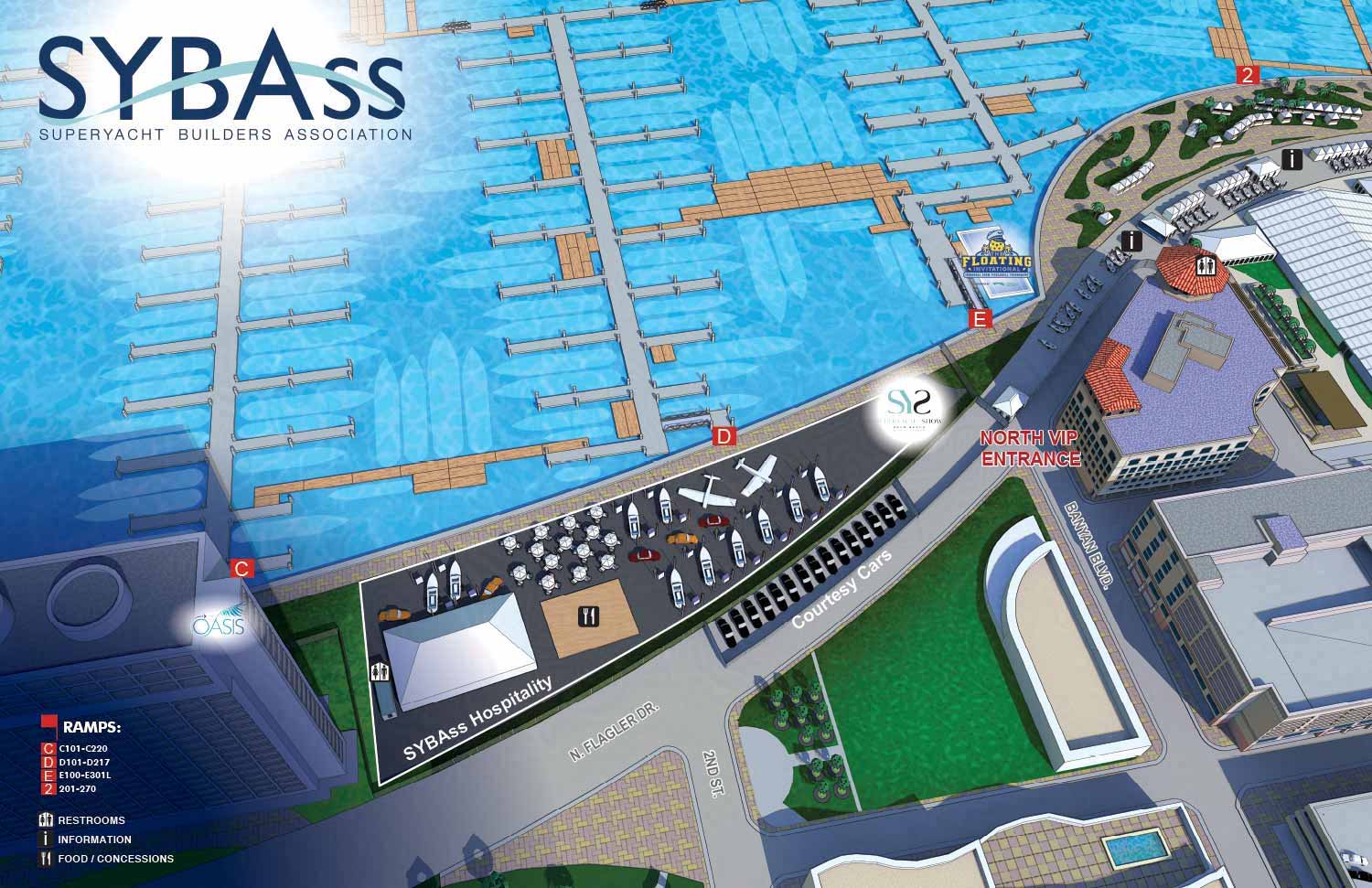
This map is built on a digital three dimensional model I created back in 2013. It covers the downtown West Palm Beach waterfront and surrounding area. Each year I update the model with the new locations of floating docks and exhibitor spaces.
SYBAss, the Superyacht Builders Association, wanted to highlight their specific area at the show. Because I already had the updated model, I could create a unique map focused just on their section. I used a standalone rendering engine to get more realistic lighting and material textures. On the larger show map those details would be too small to appreciate. Here they have room to show off.
LEARN MORE about this map.
If you need a map for a boat show, an event, or any other venue, contact me. I have done this work before and I would be glad to do it for you.
Maps For Palm Beach International Boat Show:
- About The Palm Beach Boat Show
- Main Map: 2026 | 2025 | 2024 | 2023 | 2022 | 2021 | 2020 | 2019 | 2018 | 2017 | 2016 | 2015 | 2014 | 2013| 2012 | 2011
- Transit & Parking Map: 2026 | 2025 | 2024 | 2023 | 2022 | 2020 | 2019 | 2018 | 2016
- Program Layout: 2026 | 2025 | 2024
- Video: 2013
PORTFOLIO GALLERIES
- Illustration work: Start with custom illustration and cover design, then view illustrated maps and architectural renderings.
- Fine art: Discover original paintings and drawings, the Custom Halftone Series, and mural projects.
- Design & motion: Check out the graphic design gallery, then move on to motion graphics and animated illustration.
- Maps by sector: I produce illustrated maps for boat shows, resorts, marinas, real estate, transit & parking, towns & cities, parks, and wayfinding systems.
- More creative services: Additional offerings include cover illustration, vehicle wraps, proposal renderings, and street art.
- Artistic methods: My work spans vector art, isometric & axonometric views, traditional painting, black & white illustration, GeoData mapping, overhead perspectives, and halftone effects.
- Preferred software: I rely on Photoshop, Illustrator, SketchUp Pro, and InDesign, plus Premiere Pro & After Effects for motion projects.