Custom Illustrated Map - Map for The Palm Beach International Boat Show - 2018
Client: Informa Markets
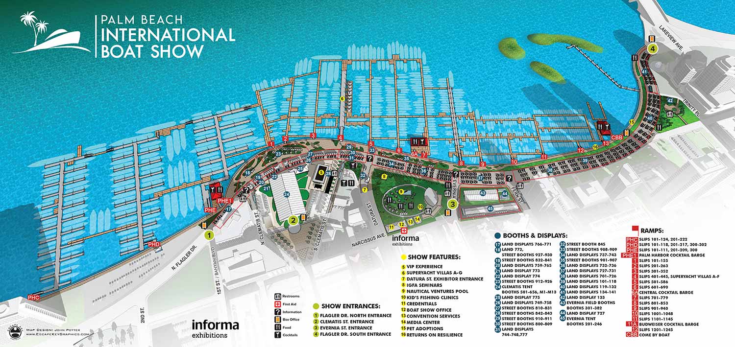
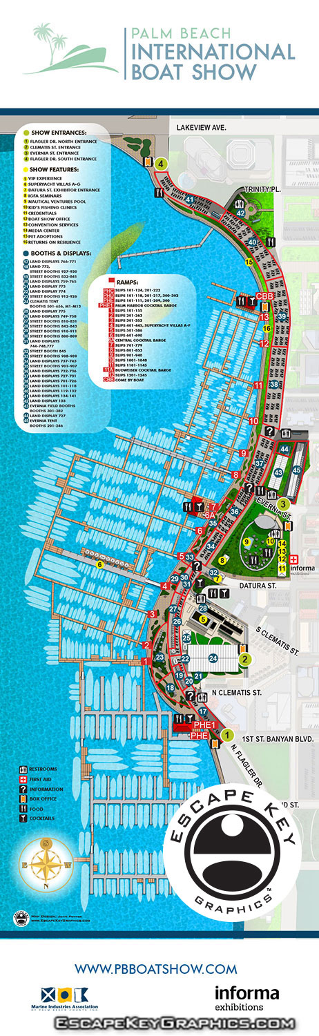
Illustrated Map for the 2018 Palm Beach International Boat Show
This illustrated aerial map was created for the 2018 Palm Beach International Boat Show at Waterfront Commons in West Palm Beach, Florida. I updated the map to reflect all the improvements and layout changes implemented by the event organizer, Informa, for that year's show. These maps continue to serve as a vital organizational tool, guiding guests to their preferred vendors, helping them discover new exhibits, and providing essential information such as the locations of amenities.
The map is produced annually using CAD drawings supplied by the client (and usually many notes and revisions). I adapt my existing three dimensional model, originally built in 2013, modifying the geometry as needed each year and adjusting the rendering style and perspective. The 2018 map does not represent a dramatic departure from the previous year's version, which is partly due to the success and effectiveness of the established design. The need for only minor revisions is a testament to good foundational design, and the resulting familiarity is appreciated by returning visitors. Collaborating with the dedicated staff at Informa to implement these updates was a smooth and productive process.
Beyond the main overview map, my work for the 2018 show encompassed several additional components. I created a new dedicated parking map, updated three detailed tent layout maps for the official program, produced new main map signage in two sizes for both north and south facing placement, designed a Seminar Schedule sign, and completed the page layout for the folding Z Card handout map.
Maps of this kind serve an important dual function. They allow potential attendees to clearly visualize the event before it occurs. While many promotional materials focus on conveying atmosphere, they often lack substantive information. An illustrated map provides a visually engaging format that also delivers practical, concrete details. It communicates the event's scale and location, outlines what to expect from exhibitors and amenities, and often includes essential planning information such as parking options, transportation routes, and the locations of key facilities like restrooms and food service areas.
For more examples of my illustrative cartography for events, please visit my Maps Portfolio.
Maps For Palm Beach International Boat Show:
- About The Palm Beach Boat Show
- Main Map: 2026 | 2025 | 2024 | 2023 | 2022 | 2021 | 2020 | 2019 | 2018 | 2017 | 2016 | 2015 | 2014 | 2013| 2012 | 2011
- Transit & Parking Map: 2026 | 2025 | 2024 | 2023 | 2022 | 2020 | 2019 | 2018 | 2016
- Program Layout: 2026 | 2025 | 2024
- Video: 2013
PORTFOLIOS
- Illustration Portfolio: Start here for custom illustration and book covers. You can also browse illustrated maps and architectural rendering.
- Fine Art: I offer original paintings and drawings, including my Custom Halftone Series. You will also find mural work here.
- Graphic Design & Motion: View my graphic design portfolio. After that, explore motion design and animated illustrations.
- Maps by application: I create illustrated maps for boat shows, resorts, marinas, real estate, transportation, transit and parking, towns and cities, parks, and wayfinding.
- Additional project types: I also produce cover illustration, vehicle and vinyl wraps, proposal renderings, and street art.
- Illustration methods: My techniques include vector, isometric and axonometric, painting, black and white, GeoData maps, overhead maps, and custom halftones.
- Software portfolios: I work primarily in Adobe Photoshop, Adobe Illustrator, SketchUp Pro, and Adobe InDesign. For motion projects, I use Premiere Pro and After Effects.