Illustrated map showing where to find street art
Client: Visit Minot
For information about the Minot, ND and the latest map version see VisitMinot.org
From KX News At 4
Finding the Art in Minot
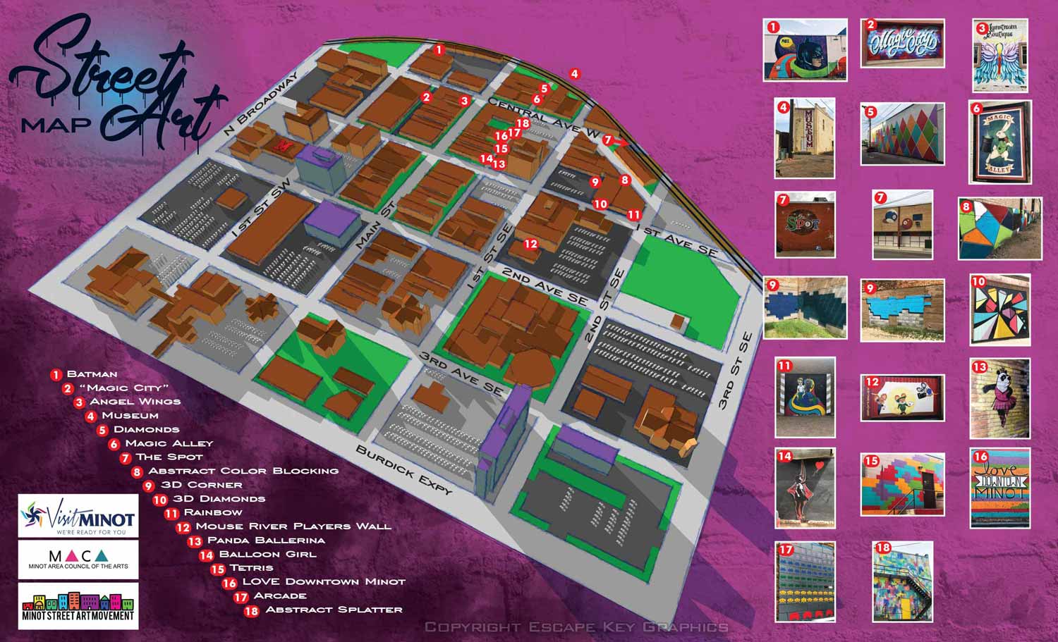
The street art movement has been spreading across the country, and Minot, North Dakota is right in the middle of it. Visit Minot recently published a street art map to help locals and visitors find every mural in the city. The map shows exactly where each piece is located, with numbers that match a list of names and pictures. When the project started, there were 16 murals to find. The map was designed from the beginning to grow as the art scene grew.
I built this map as a three dimensional digital model. This allows for experimentation with different angles and rendering methods. The client wanted a hand drawn look while still leveraging the advantages of a digitally based piece of art. Once the illustration or artwork part of the map was done keying and supplementary image placement were done in Illustrator.
What the Client Says
"We're excited to see what people do when they go downtown and the pictures that they share," said Rianne Kuhn, director of marketing and communications for Visit Minot. "You can check it out on Instagram and we actually regram or repost some of those things as well just because the user generated content is so unique."
Your Project
If you need a map for your city, your art district, or any other area that needs clear, engaging visual navigation, contact me. I have done this work before and I would be glad to do it for you.
(and maps of similar areas)


EXPLORE MY PORTFOLIOS
- Illustration: Find custom illustration, book covers, illustrated maps, and architectural rendering.
- Fine Art: Browse original paintings and drawings, the Custom Halftone Series, and murals.
- Graphic Design & Motion: See my graphic design work, plus motion design and animated illustrations.
- Maps by industry: Illustrated maps tailored for boat shows, resorts, marinas, real estate, transit & parking, towns & cities, parks, and wayfinding.
- Other project types: Also available: cover art, vehicle & vinyl wraps, proposal renderings, and street art.
- Techniques: Explore work in vector, isometric & axonometric, painting, black & white, GeoData, overhead, and halftone styles.
- Software: Primary tools: Photoshop, Illustrator, SketchUp Pro, and InDesign. Motion work uses Premiere Pro & After Effects.