Service Area Picture Map
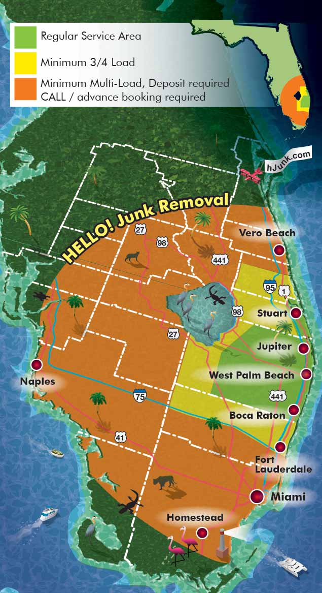
This illustrated map shows the service area of a company overlaid on a map of the state, clearly communicating the reach of its operations. Concentric colored zones indicate distances from the home office, with each zone corresponding to a specific pricing tier. This visual approach makes it easy for customers to understand service availability at a glance.
The map is presented from an overhead perspective, with a slight artistic distortion to enhance readability and visual interest. Textures and spot illustrations are incorporated to bring the map to life, intentionally exaggerated to create a playful, engaging style while still clearly conveying practical information. The result is a map that is both functional and visually memorable, helping the company communicate its service coverage effectively.


PORTFOLIOS
- Illustration Portfolio: Start here for custom illustration and book covers. You can also browse illustrated maps and architectural rendering.
- Fine Art: I offer original paintings and drawings, including my Custom Halftone Series. You will also find mural work here.
- Graphic Design & Motion: View my graphic design portfolio. After that, explore motion design and animated illustrations.
- Maps by application: I create illustrated maps for boat shows, resorts, marinas, real estate, transportation, transit and parking, towns and cities, parks, and wayfinding.
- Additional project types: I also produce cover illustration, vehicle and vinyl wraps, proposal renderings, and street art.
- Illustration methods: My techniques include vector, isometric and axonometric, painting, black and white, GeoData maps, overhead maps, and custom halftones.
- Software portfolios: I work primarily in Adobe Photoshop, Adobe Illustrator, SketchUp Pro, and Adobe InDesign. For motion projects, I use Premiere Pro and After Effects.