
Work for cities, towns and government agencies

Municipalities face a unique challenge when it comes to visual communication. You need materials that serve the public clearly and efficiently, but you also want them to reflect the character and pride of your community. I help cities, counties, and public agencies solve that problem through illustration, mapping, and design.
My work for municipal clients covers a range of needs, from large public art installations to functional wayfinding tools. Each project starts with the same question: what does your community need, and how can visual storytelling make it better?
Public Art for Civic Spaces
Public art creates shared experiences and makes everyday spaces more welcoming. When cities invest in artwork for streets, parks, and civic buildings, they strengthen community identity and give residents something to connect with.
The City of Pembroke Pines, Florida has been a longtime partner in this work. Over several years, I have created multiple public art projects for the city, each with its own purpose and audience.
Utility Box Wraps
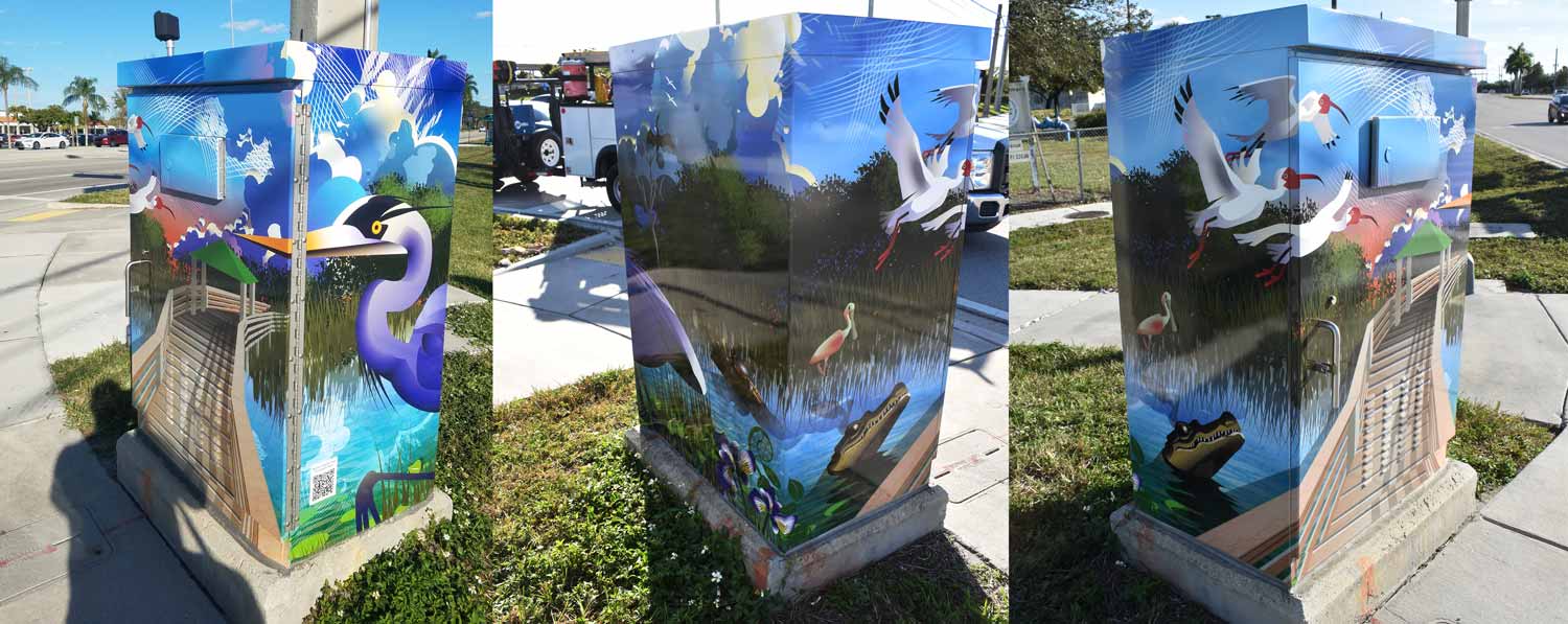
In 2019, the City of Pembroke Pines approached me about a project to beautify traffic signal boxes around the city. The Arts and Culture Advisory Board had chosen the theme "What Makes Pembroke Pines a Happy City," and I was commissioned to create designs for ten locations.
The resulting illustrations celebrate different aspects of city life. One box depicts the variety of youth sports offered throughout the community. Another references North Perry Airport and its long history with the U.S. Armed Forces. A third shows the city's vibrant park system with playgrounds and recreational equipment. Other pieces interpret the wetlands, the savannah wilderness, and the city center featuring City Hall and the Frank C. Ortis Art Gallery.
Six of these designs include QR codes that create an interactive experience. Residents can download a free app, hover their phone camera over the artwork, and watch the images come to life through animation. This blend of traditional illustration with digital engagement made the project especially popular and received coverage in the city's official publication. You can read more about it in this article from the City of Pembroke Pines.
Permanent Display at City Hall
A selection of these same illustrations now hangs permanently inside Pembroke Pines City Hall. Six works are on display in a gallery like setting within the civic building. Each piece functions both as a large format outdoor graphic and as a standalone work of fine art.
Having artwork displayed in a government building is meaningful because it shows that the city values its cultural identity and wants residents and visitors to experience it every day. The pieces help tell the story of Pembroke Pines through visual interpretation.
Memorial Commemoration
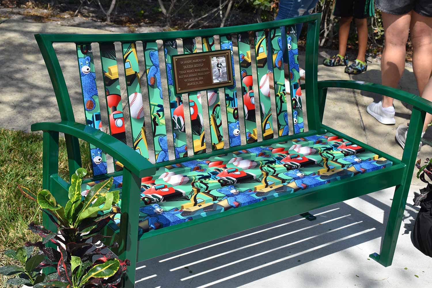
After a tragic accident in March 2021 claimed the life of four year old Taylor Bishop, the City of Pembroke Pines commissioned a memorial bench near the accident site. I was asked to create an illustration for the bench that honored Taylor's life and the things he loved most.
The city provided a list of meaningful elements, and my goal was to incorporate as many as possible into a cohesive design. The result is a visual tribute that transforms personal memories into a public touchstone for reflection. The bench sits just south of Paul J Maxwell Park, giving family, friends, and community members a place to remember.
Memorial projects are different from other municipal work, but they demonstrate how illustration can serve deeply personal purposes within a public setting.
Wayfinding and Maps
Clear navigation is essential for parks, trails, historic districts, and downtown areas. Visitors need to know where they are and where they are going. Residents need maps that are easy to read and visually engaging.
My municipal map work focuses on clarity and usability without sacrificing visual appeal. Every project balances accurate geographic information with thoughtful illustration.
Park Trail Maps for Miami Dade County
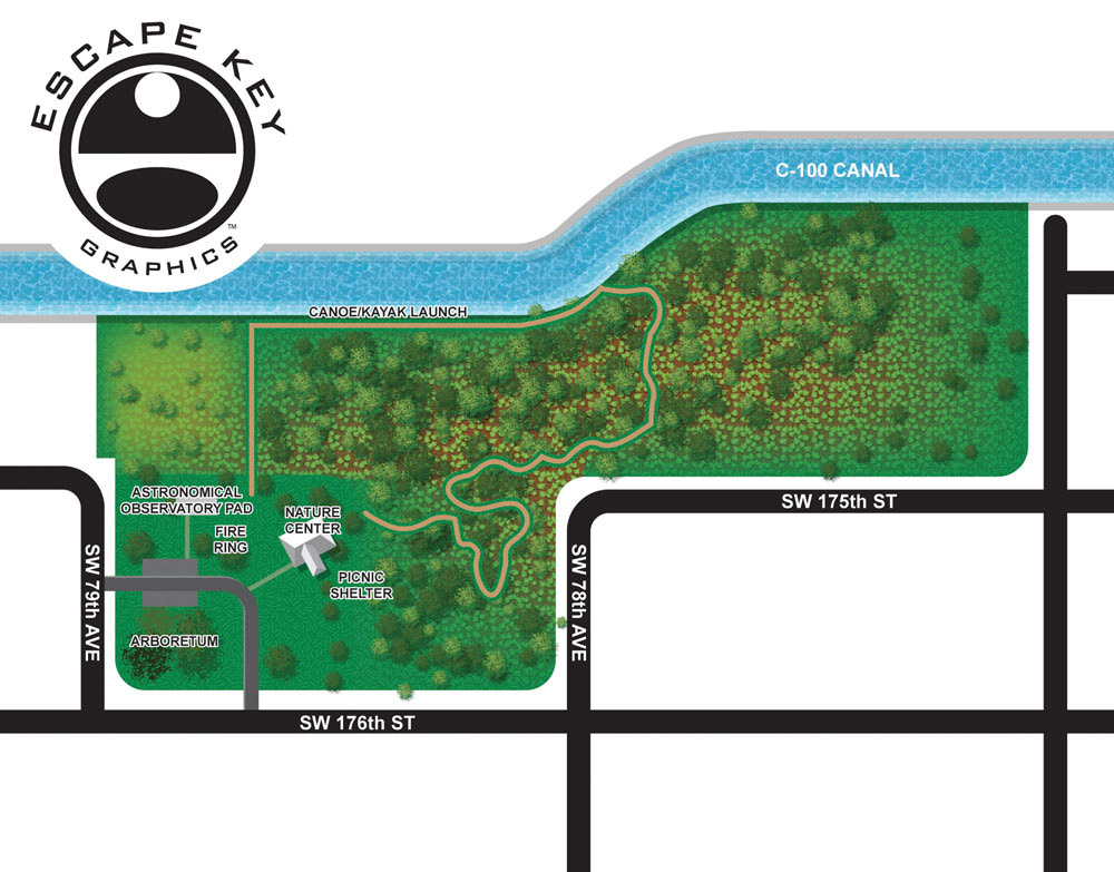
Miami Dade County Parks and Recreation needed trail maps for six county parks. The goal was straightforward: provide clear overhead maps that help visitors navigate trail systems while looking good on mobile devices and printed materials.
I developed a clean overhead style that focuses on trail layout, access points, and key features. Rather than overwhelming users with excessive detail, the maps emphasize what hikers actually need to orient themselves quickly. This approach is especially important for mobile phone apps, where clarity and readability are essential.
Each park presented its own layout and challenges, but consistent visual language helps users move easily from one park map to another. The overhead perspective makes trail networks familiar and intuitive, similar to how people naturally read traditional maps.
Illustrated City Maps
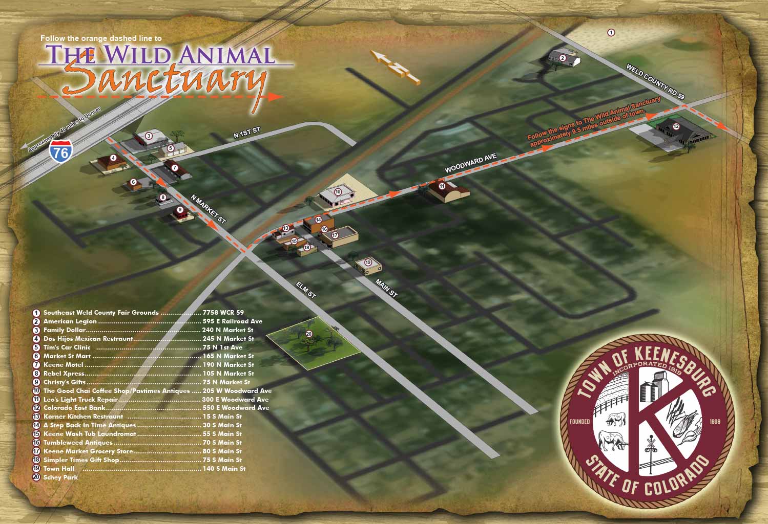
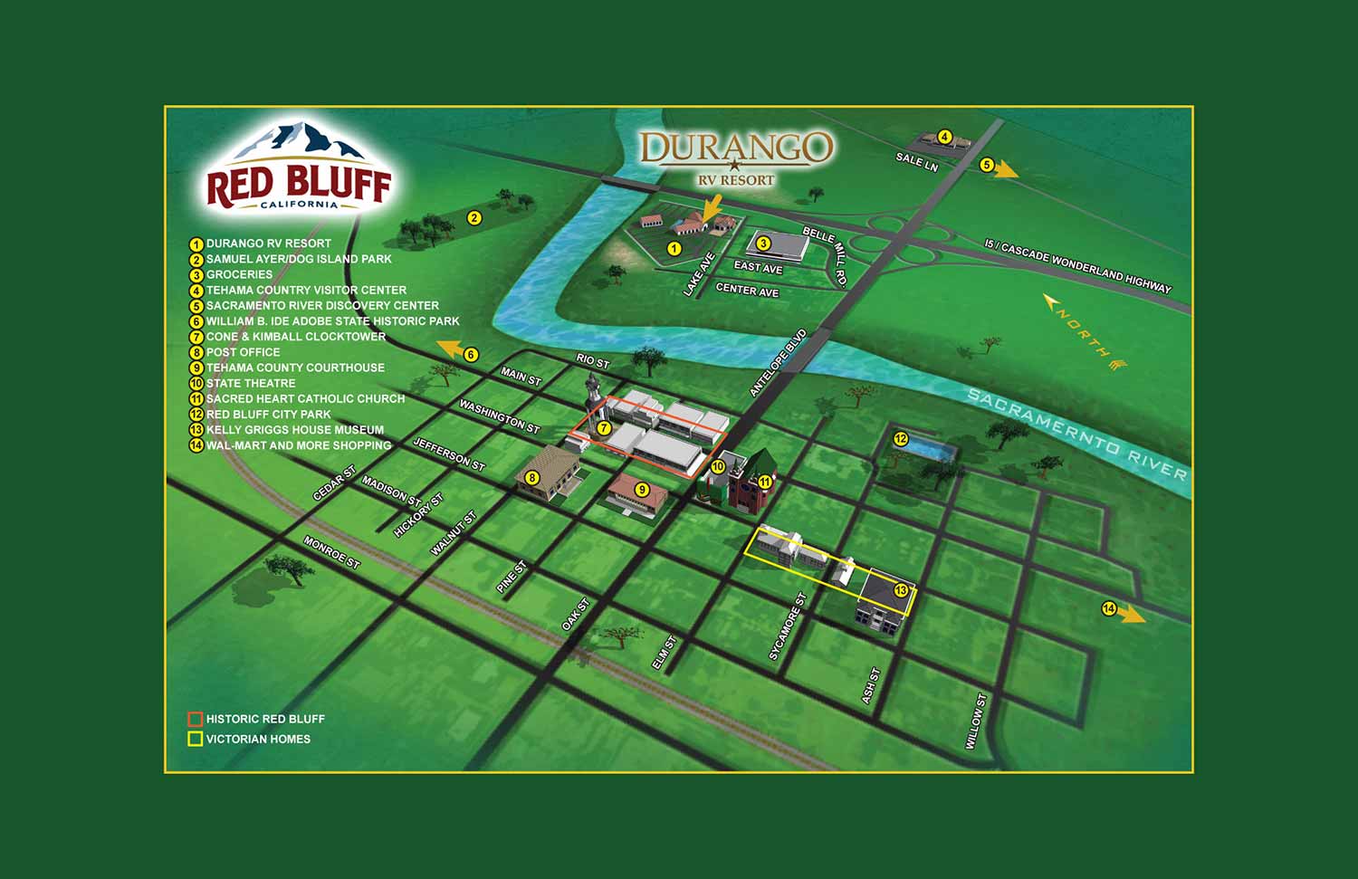
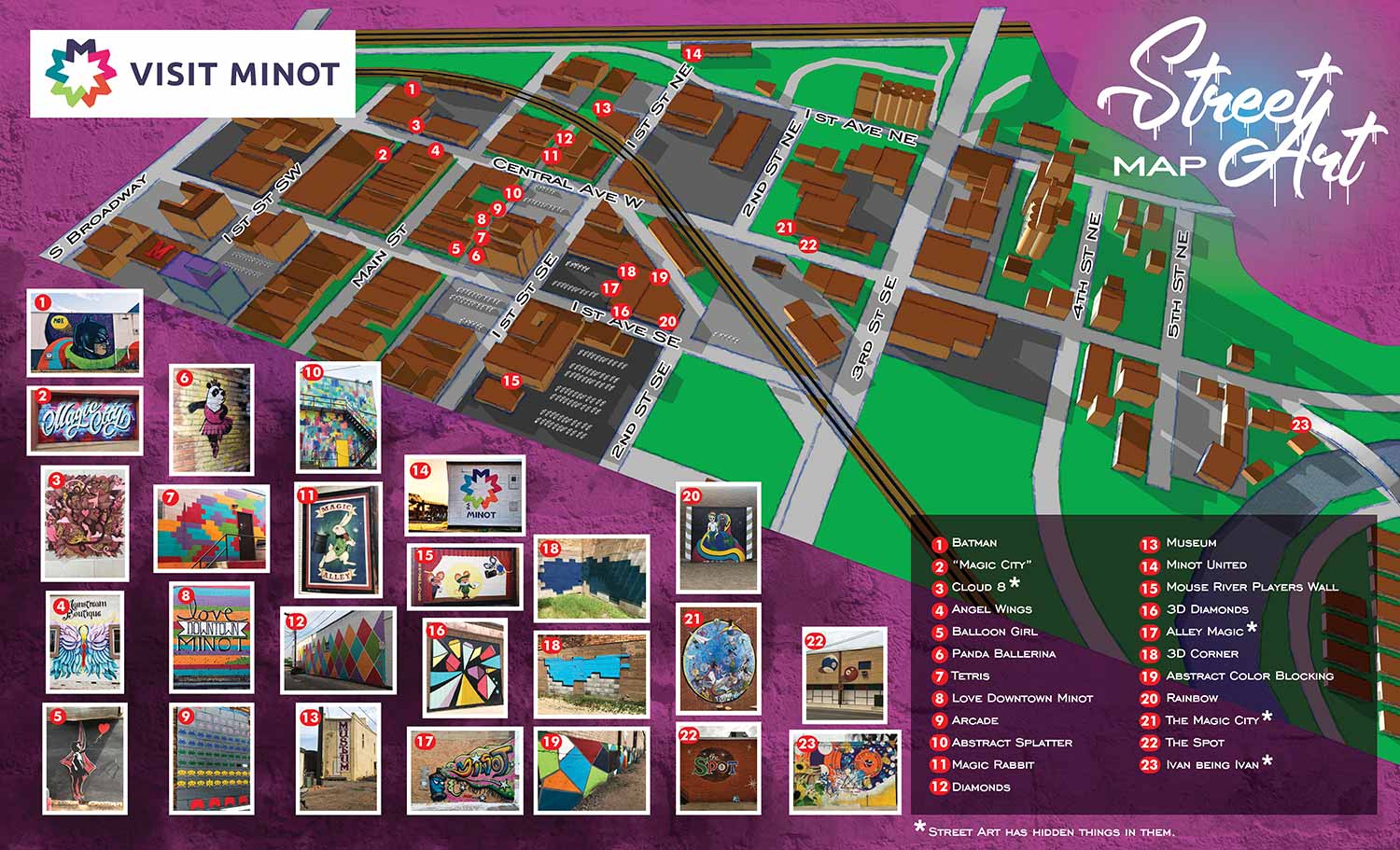
I have created many illustrated maps of downtowns, neighborhoods, and entire cities. The scale of the project determines the approach.
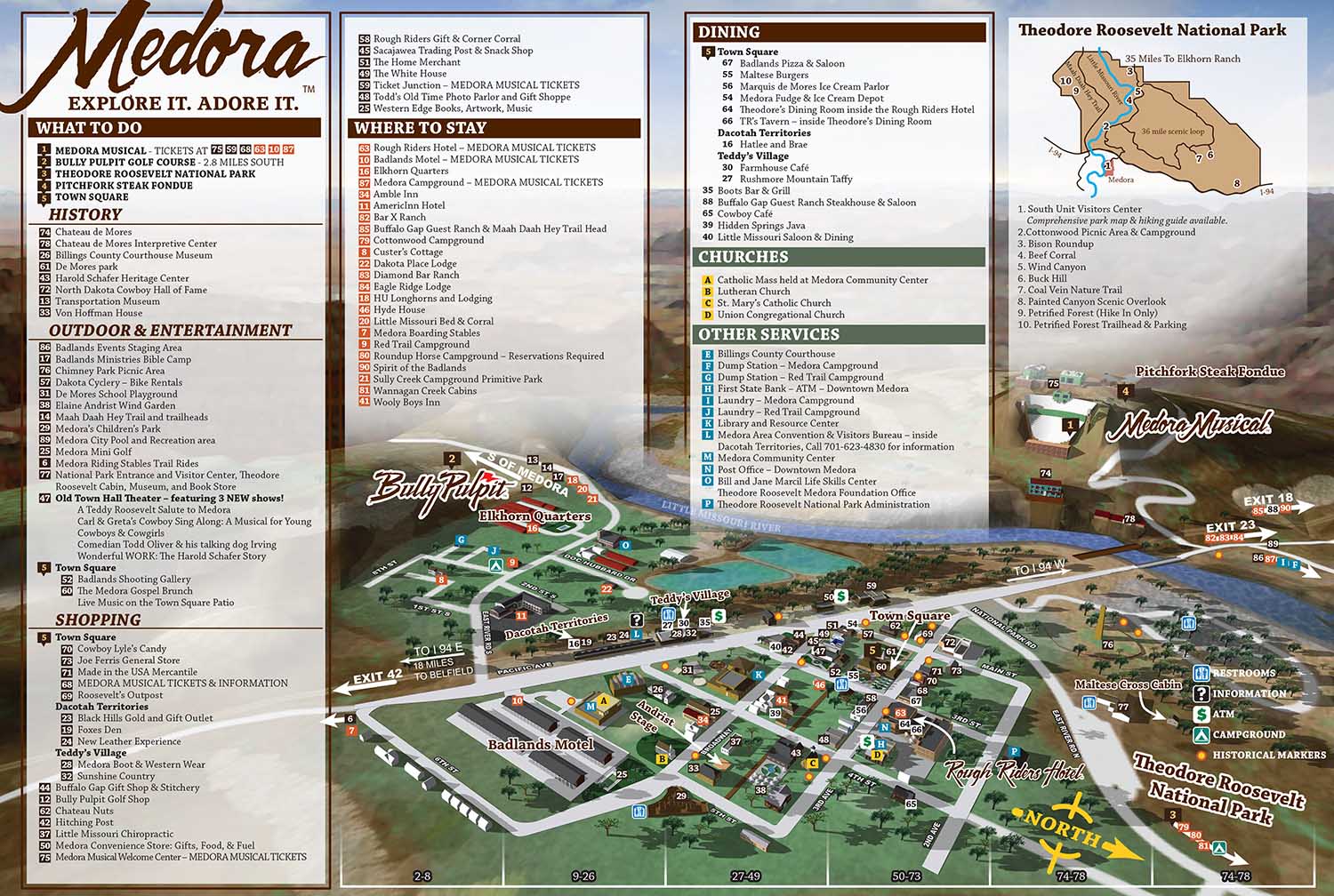
For areas spanning a few city blocks, I can include a high level of detail and use accurate scales for buildings. You can clearly tell what you are looking at. For larger areas covering many blocks, I sometimes need to take license with building scales or use more cartoon like renderings of points of interest. The Medora, North Dakota map is an example of a larger scale project that required careful handling of varied terrain, surrounding bluffs, and rolling hills.
I used a three dimensional modeling approach for Medora because the Badlands geography demanded it. More than twenty viewing angles were explored before settling on the final perspective that balanced clarity, accuracy, and visual appeal. Elevation changes and rock formations became central features, giving visitors a strong sense of place while keeping the town layout easy to read.
Red Bluff, California and Keenesburg, Colorado are similar projects, each adapted to the character and needs of the community.
Interactive and Digital Integration
Municipal projects increasingly need to work across formats. A piece of artwork might appear on a utility box, inside a government building, and on a mobile device. Maps might be printed for visitors and integrated into apps for residents.
My background in motion graphics and animation helps bridge these formats. I can create illustrations that animate through augmented reality, or maps that adapt from printed brochures to phone screens. This flexibility is especially valuable when a municipality needs a single visual asset to serve multiple purposes.
Collaborative Process
Every municipal project begins with conversation. I want to understand your community's character, the needs of your residents and visitors, and any specific challenges your location presents. Then I work through drafts and revisions, showing you the process from start to finish.
For public art, this means presenting concepts that reflect your city's identity and values. For maps, it means establishing accurate road layouts, selecting the right viewing angle, and testing different levels of detail. For memorials, it means handling sensitive subjects with care and respect.
Throughout the process, I stay in communication and make adjustments as needed. The goal is always the same: deliver work that serves your community well and stands up to daily use and public scrutiny.
Portfolio Examples
You can see more municipal work throughout my portfolios.
BROWSE MY WORK
- Illustration: Browse custom illustrations, book cover art, illustrated maps, and architectural renderings.
- Fine art: View original paintings and drawings, the Custom Halftone Series, and mural commissions.
- Graphic design & motion: See design projects, then watch motion reels and animated pieces.
- Maps by use case: Explore illustrated maps created for boat shows, resorts, marinas, real estate, transportation & parking, cities & towns, parks, and wayfinding.
- Specialty projects: Also check out cover design, vinyl & vehicle wraps, proposal renderings, and street art.
- Style & technique: Discover vector, isometric, painterly, monochrome, data-driven, bird's-eye, and halftone approaches.
- Tools I use: Everyday software includes Photoshop, Illustrator, SketchUp, and InDesign; motion work relies on Premiere & After Effects.
Starting a Conversation
If you represent a municipality and want to discuss a project, I would be glad to talk with you. Whether you need public art, wayfinding maps, park signage, or something I have not described here, I can help you think through the options.
Please contact me through the website with details about your project, and I will respond promptly.