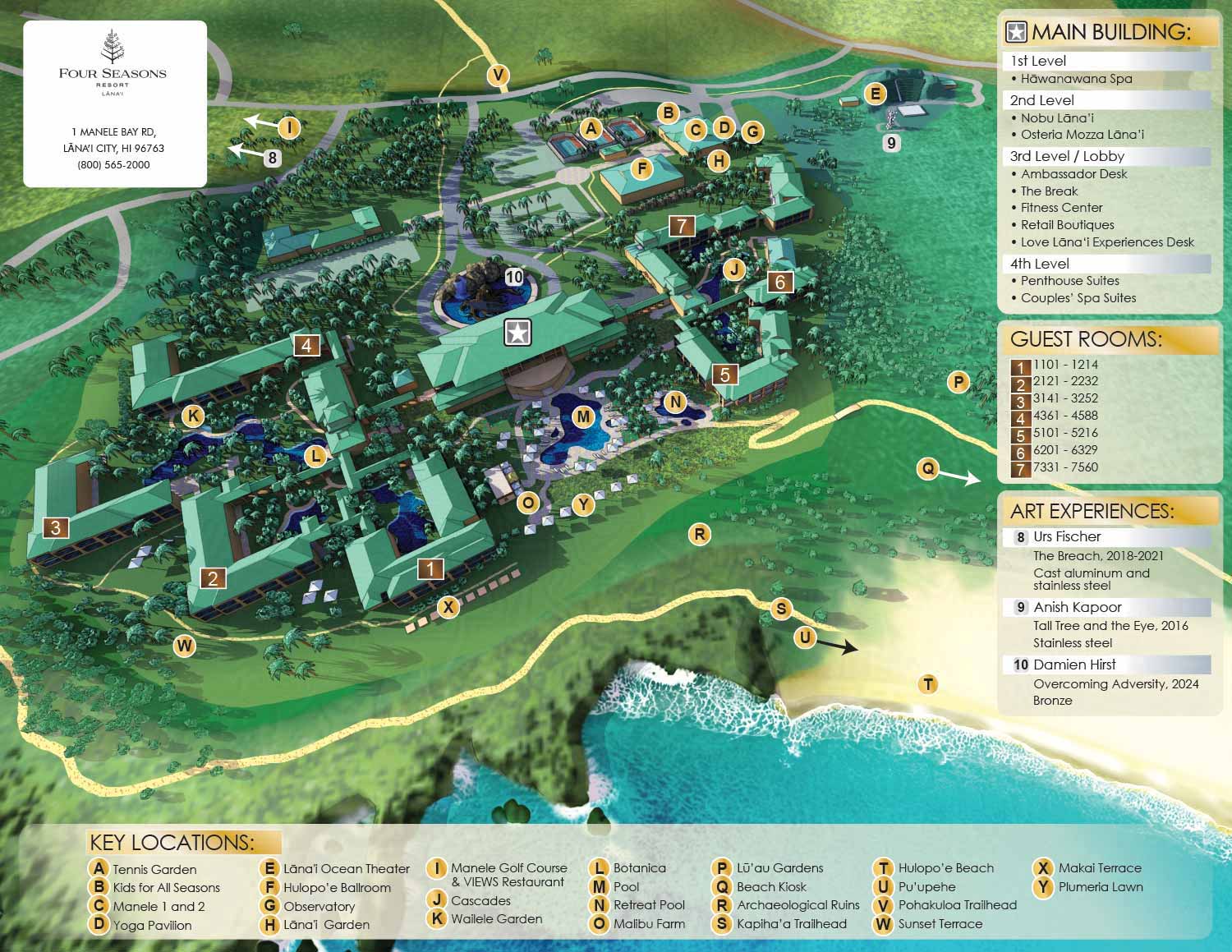
A map of a Four Seasons Resort on the island of Lanai City, Hawaii
Clients: Four Seasons Resort Lanai
Art Direction: Lori Holland - Senior Director of Public Relations and Marketing at Four Seasons Resorts Lanai
I illustrated and designed this map. For more, and the latest, information on Four Seasons Resort Lanai please visit their official site.
About the Resort
Four Seasons Resort Lanai sits on the southeastern coast of Lanai, the smallest and least inhabited of Hawaii's six major islands. Lanai was once known for its pineapple plantations, but today it offers a quieter, more private experience than some of the other islands. The resort underwent a major renovation from 2012 to 2016 and now features 168 rooms, 45 suites, and a Jack Nicklaus designed golf course. It is a five star, five diamond property close to many of the island's scenic spots. Guests can enjoy lagoon style pools, botanical gardens, The Hawanawana Spa, and cliff side Japanese cuisine at NOBU LANAI.
The Project
I was commissioned to create a new illustrated map for the resort after changes on the property made the previous map obsolete. The old map had a photographic quality and served the client well for years, but it no longer matched what was on the ground. My job was to create something fresh that would work for both marketing and wayfinding.
The map uses an aerial perspective, similar to a drone or helicopter view, to show the layout of key resort components. The main building, accommodation buildings, pools, golf facilities, spa and wellness areas, an observatory, and the pathways that connect everything are all clearly visible. The angled view helps guests and future visitors understand how the facilities relate to one another while also making an attractive presentation piece.
My Process
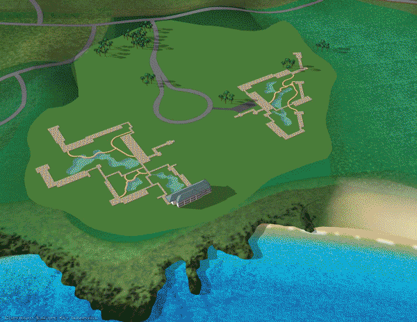
I started by sifting through lots of photos, site plans, and videos. The previous map provided useful reference, especially for the map key. My own approach tends toward idealized views. I omit superfluous details and selectively manipulate landscaping to show only what I want. My early axonometric maps looked almost like cartoons, and I have tried to retain the positive qualities of those while leveraging the more realistic results that 3D modeling provides.
The map was built as a three dimensional digital model and rendered using both the modeling software's built in renderer and a standalone rendering engine. The results were composited and refined in Photoshop. The dramatic, foamy beach break against the rocky shore was generated with Firefly AI through Photoshop. This is probably my highest profile use of AI to date.
The keying, labeling, logos, and graphics were layered onto the illustration in Illustrator. My initial designs used primary colors with icons similar to my boat show maps. At the client's request, I shifted to a more upscale metallic palette that better suited the resort's sophisticated character.
The Final Product
Although this map serves a practical purpose, it was created with a visually appealing style that reflects the quality of the resort. The result is a polished, engaging asset that enhances both the guest experience and the resort's promotional materials. Four Seasons Lanai will use it for both marketing and wayfinding, and I expect it will serve them well for years to come.
Your Map
If you need a map for your resort, marina, event, or any other property, contact me. I can bring your vision to life or, better yet, provide a vision beyond what you imagined. With decades of experience, I can make the map you want.


PORTFOLIOS
- Illustration Portfolio: Start here for custom illustration and book covers. You can also browse illustrated maps and architectural rendering.
- Fine Art: I offer original paintings and drawings, including my Custom Halftone Series. You will also find mural work here.
- Graphic Design & Motion: View my graphic design portfolio. After that, explore motion design and animated illustrations.
- Maps by application: I create illustrated maps for boat shows, resorts, marinas, real estate, transportation, transit and parking, towns and cities, parks, and wayfinding.
- Additional project types: I also produce cover illustration, vehicle and vinyl wraps, proposal renderings, and street art.
- Illustration methods: My techniques include vector, isometric and axonometric, painting, black and white, GeoData maps, overhead maps, and custom halftones.
- Software portfolios: I work primarily in Adobe Photoshop, Adobe Illustrator, SketchUp Pro, and Adobe InDesign. For motion projects, I use Premiere Pro and After Effects.