
Marina Map - Edgewater, Maryland
Client: Pier 7 Resort Marina
For information about Pier 7 Resort Marina see PierSevenMarina.com
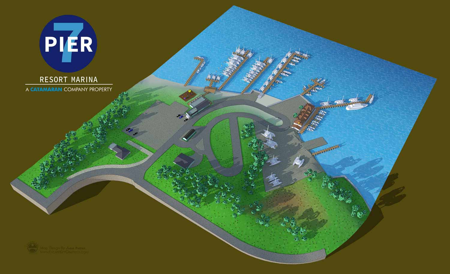
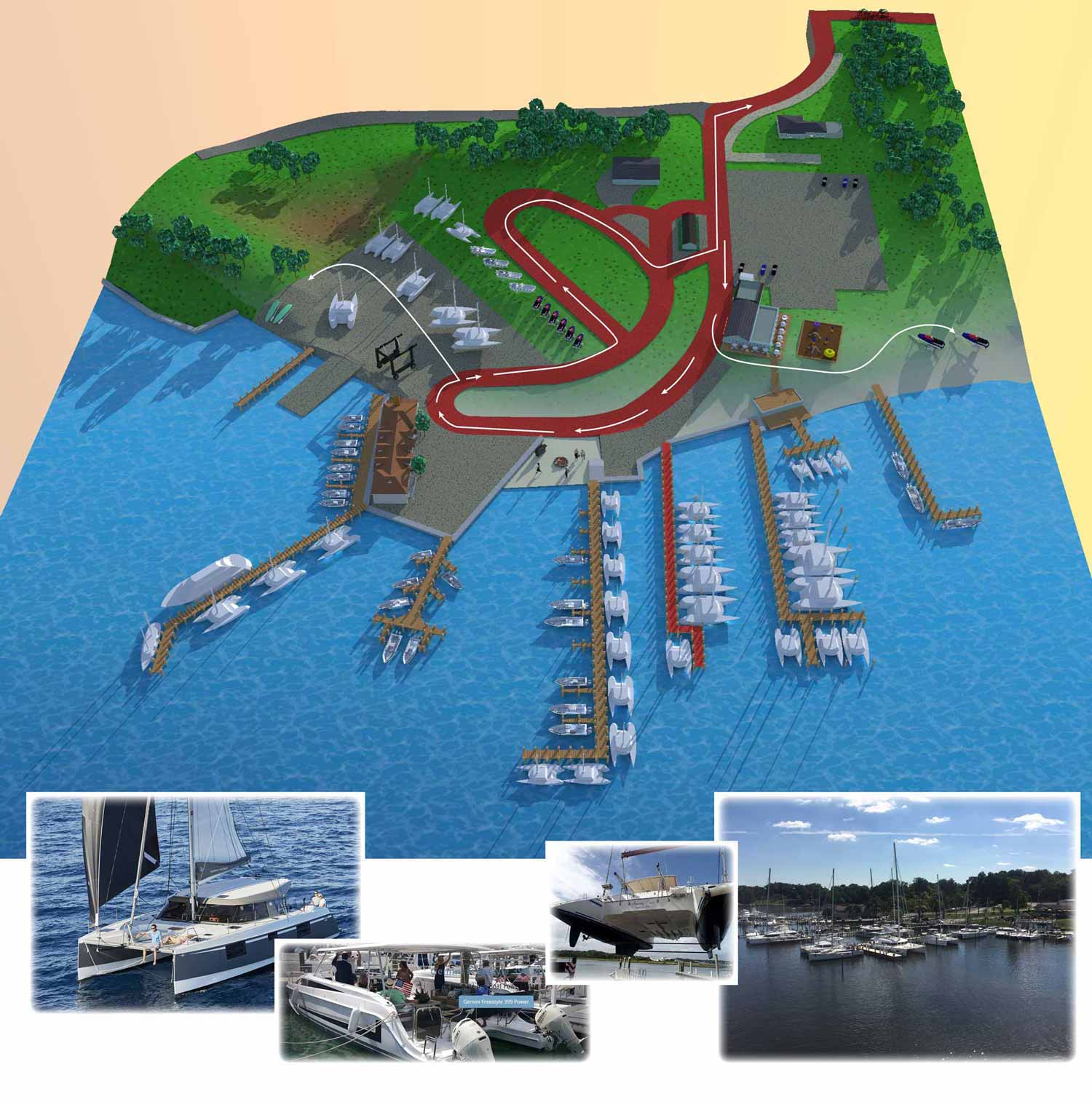
Pier 7 Resort Marina in Edgewater, Maryland commissioned Escape Key Graphics to create a custom illustrated map for several practical and marketing focused uses, including visualizing traffic flow throughout the marina. The property sits on gently rolling terrain, which presented an opportunity to show elevation changes in a clear and engaging way. Accurately representing the landform was an important part of the project, as it helps visitors better understand how roads, slips, and buildings relate to one another across the site.
To achieve this, land contour data was imported into SketchUp and used to build a three dimensional model of the marina and its surrounding landscape. This was the first contoured terrain map produced by Escape Key Graphics, and the process allowed the natural shape of the land to inform the final illustration. Realistic shadows cast across the sloped terrain add depth and clarity, making the map easier to read while also enhancing its visual appeal.
The renderings were further refined using Kerkythea and Adobe Photoshop to improve lighting, texture, and overall balance. Although the marina covers a relatively compact area, the added attention to detail gives the map a strong sense of place and character. The finished illustration functions as both a practical navigation tool and a polished visual asset that supports guest experience, operations, and marketing for Pier 7 Resort Marina.


Additional Portfolios:
- Augmented Reality Portfolio
- Racing Related Portfolio
- Medical Illustrations Portfolio
- Character Illustration Portfolio
- Portrait Portfolio
PORTFOLIO GALLERIES
- Illustration work: Start with custom illustration and cover design, then view illustrated maps and architectural renderings.
- Fine art: Discover original paintings and drawings, the Custom Halftone Series, and mural projects.
- Design & motion: Check out the graphic design gallery, then move on to motion graphics and animated illustration.
- Maps by sector: I produce illustrated maps for boat shows, resorts, marinas, real estate, transit & parking, towns & cities, parks, and wayfinding systems.
- More creative services: Additional offerings include cover illustration, vehicle wraps, proposal renderings, and street art.
- Artistic methods: My work spans vector art, isometric & axonometric views, traditional painting, black & white illustration, GeoData mapping, overhead perspectives, and halftone effects. Recently I have also begun to utilize AI in some cases.
- Preferred software: I rely on Photoshop, Illustrator, SketchUp Pro, and InDesign, plus Premiere Pro & After Effects for motion projects.