
Marina Area Map
Custom Illustration by John Potter - Escape Key Graphics
Visit The Conanicut Marina website at ConanicutMarina.com
Visit The Conanicut Marina website at ConanicutMarina.com
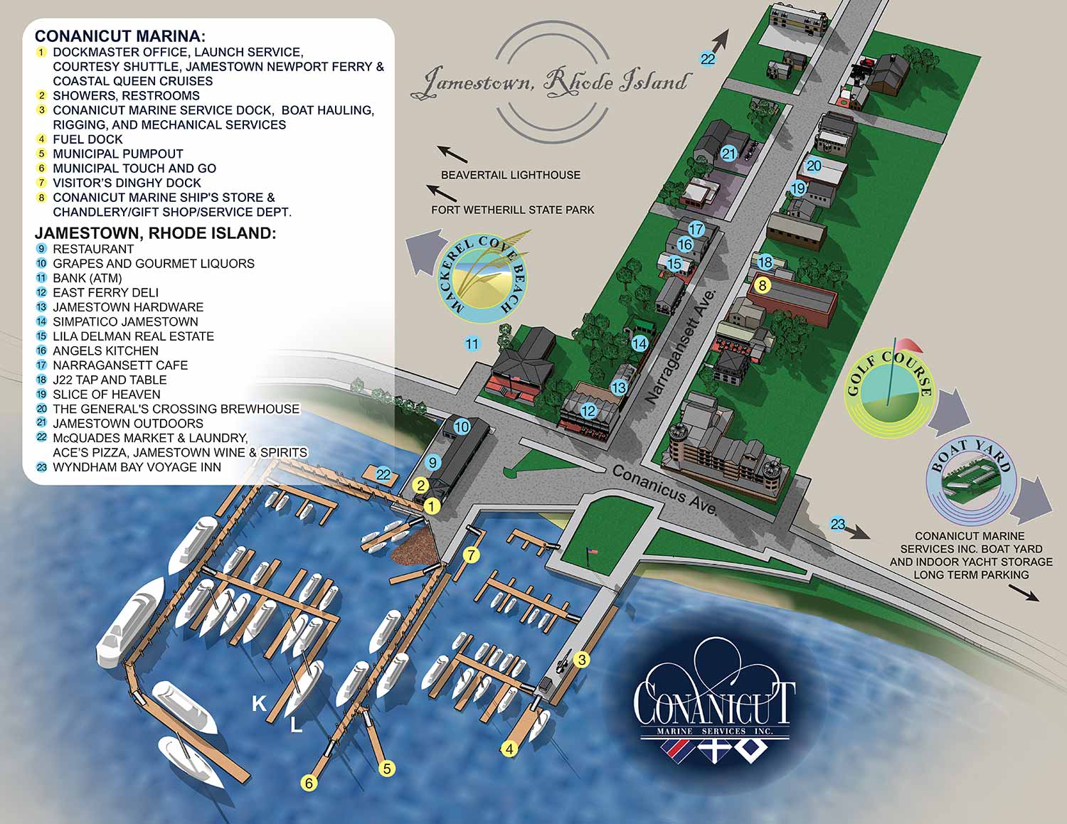
I just made some updates to both maps for Conanicut Marina. The Jamestown map that focuses in on downtown Jamestown and the marina docks and facilities. This map should be a great aide to sailors making landfall at the marina. This map gives a clear overview of dock arrangements, restaurant locations and local conveniences.
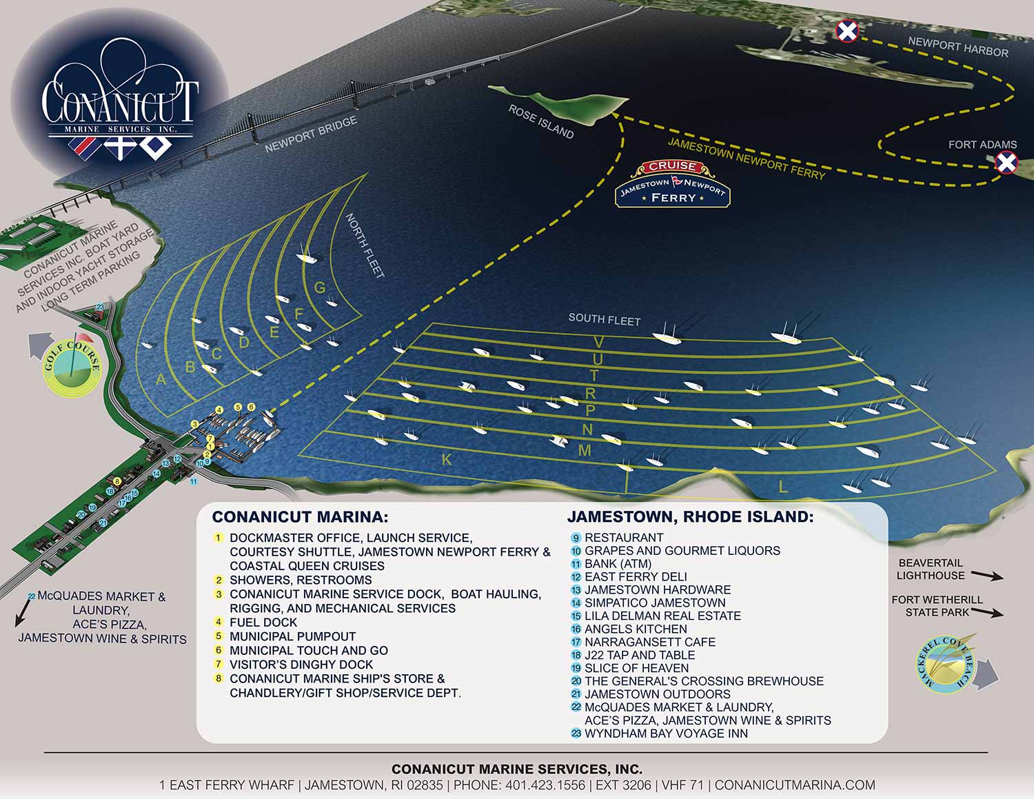
The main area map is a broad view map showing everything from Newport Harbor to the west side of Jamestown and The Newport Bridge to pretty far south. It's a good tool for general orientation and locating areas within the vast mooring fields operated by Conanicut Marina. It also gives a pretty good overview of the Jamestown/Newport Ferry.

Bimini Resort and Marina Map

Treasure Cay Resort and Marina Map

Marina Siteplan

Bimini Docks Map

Docks Map

Bahamas Marina Map

Panhandle Marina Map

Conanicut Marina Map

Maryland Marina Map

Resort Marina Map

Sarasota Marina Map

Florida Keys Resort Marina Map

Bahia Mar Marina Map

Newport Yachting Center

Boat Show at Three Marinas

Marina Flamenco Map

The Waterfront & City Commons

Marina Map

Illustrated Map of Marinas

Sea Isle Marina Map

Miami Marinas

Sea Isle and Genting Marina Rendering

Yacht Club Map

Lido Marina Village Boat Show Map

Safe Harbor Sunroad Map
EXPLORE MY PORTFOLIOS
- Illustration: Find custom illustration, book covers, illustrated maps, and architectural rendering.
- Fine Art: Browse original paintings and drawings, the Custom Halftone Series, and murals.
- Graphic Design & Motion: See my graphic design work, plus motion design and animated illustrations.
- Maps by industry: Illustrated maps tailored for boat shows, resorts, marinas, real estate, transit & parking, towns & cities, parks, and wayfinding.
- Other project types: Also available: cover art, vehicle & vinyl wraps, proposal renderings, and street art.
- Techniques: Explore work in vector, isometric & axonometric, painting, black & white, GeoData, overhead, and halftone styles. Recently I have also begun to use AI for some specific solutions.
- Software: Primary tools: Photoshop, Illustrator, SketchUp Pro, and InDesign. Motion work uses Premiere Pro & After Effects.
