The first in a long series of maps for this historic show
Client: The Newport Exhibition Group
About the Show
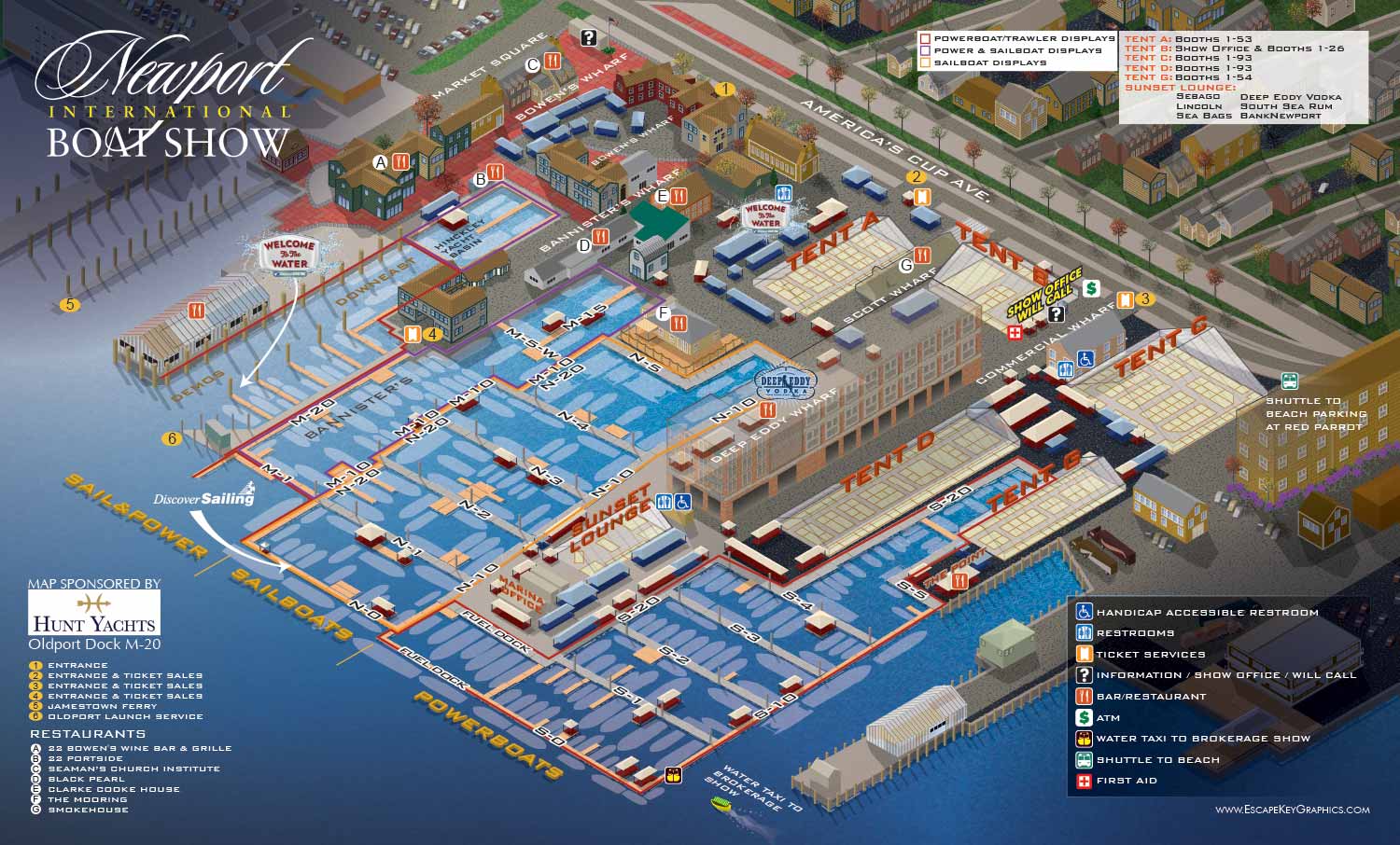
The Newport International Boat Show takes place along the historic waterfront in Newport, Rhode Island. It is one of the oldest and most respected shows on the East Coast. The venue is dense with small, charming buildings, and the line between the show and the surrounding neighborhood is softer than at most other shows I work on.
About This Map
This was my first year working on the map for the Newport International Boat Show. The client was The Newport Exhibition Group, and this project marked the beginning of a long relationship.
I created an axonometric map from a flat overhead drawing I made. This took many hours of meticulous work in Adobe Illustrator. I built the venue and surrounding area by hand, carefully placing each building and street.
That investment paid off in the years that followed. The resulting axonometric vector illustration became the foundation for future maps. From that point on, most years only required updating the show features like dock layouts and exhibitor tents, not rebuilding the whole thing from scratch.
Over time the map has evolved. Early versions like this one were oriented from Newport Harbor. Later the orientation shifted to a more inland viewpoint to improve clarity and wayfinding. In 2025 the map was fully rebuilt using a three dimensional model to align with other major shows while still keeping the character of the Newport waterfront. But it all started here in 2012.
Be sure to check out the video below.
What I Can Do For You
If you need a custom illustrated map for a boat show, an event, or any other venue, contact me. I can create something similar to this early Newport map, or I can provide a detail of an existing map for your specific marketing or wayfinding needs. I have been doing this work for over a decade and I would be glad to do it for you.
Maps For Newport International Boat Show:
- About Newport International Boat Show
- Main Map: 2025 | 2024 | 2023 | 2022 | 2021 | 2019 | 2018 | 2017 | 2016 | 2015 | 2014 | 2013 | 2012
- Tent Details Map: 2017 | 2016 | 2015 | 2014 | 2013 | 2012
- Video: 2012
PORTFOLIOS
- Illustration Portfolio: Start here for custom illustration and book covers. You can also browse illustrated maps and architectural rendering.
- Fine Art: I offer original paintings and drawings, including my Custom Halftone Series. You will also find mural work here.
- Graphic Design & Motion: View my graphic design portfolio. After that, explore motion design and animated illustrations.
- Maps by application: I create illustrated maps for boat shows, resorts, marinas, real estate, transportation, transit and parking, towns and cities, parks, and wayfinding.
- Additional project types: I also produce cover illustration, vehicle and vinyl wraps, proposal renderings, and street art.
- Illustration methods: My techniques include vector, isometric and axonometric, painting, black and white, GeoData maps, overhead maps, and custom halftones.
- Software portfolios: I work primarily in Adobe Photoshop, Adobe Illustrator, SketchUp Pro, and Adobe InDesign. For motion projects, I use Premiere Pro and After Effects.