
An early version of the map that set the foundation for years to come
Client: The Newport Exhibition Group
About the Show
The Newport International Boat Show takes place along the historic waterfront in Newport, Rhode Island. It is one of the oldest and most respected shows on the East Coast. The venue is dense with small, charming buildings, and the line between the show and the surrounding neighborhood is softer than at most other shows I work on.
About This Map
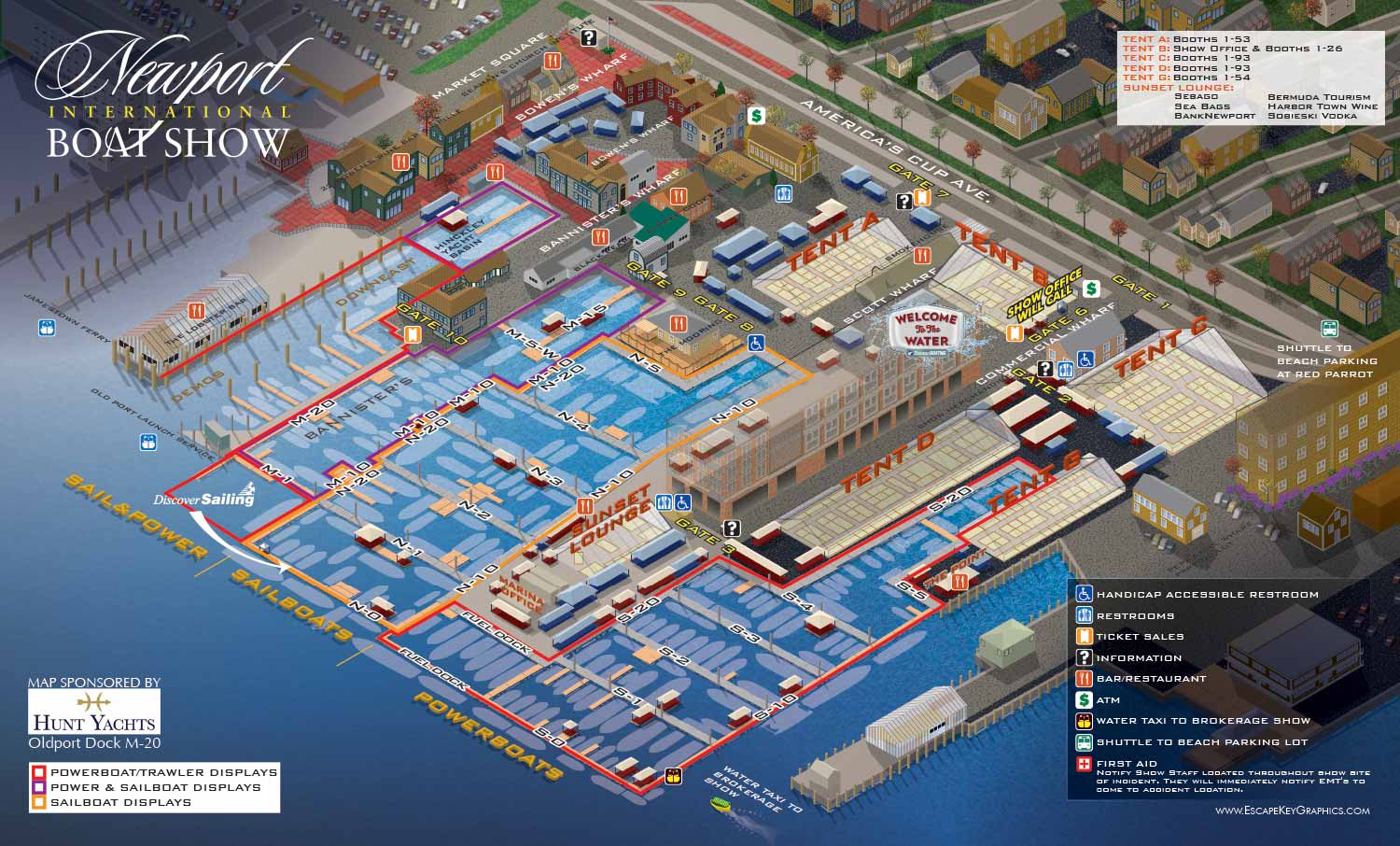
The 2013 Newport International Boat Show map was primarily an update of the previous year's version. I updated the floating dock and land exhibit locations and arrangements to reflect changes for the year. The surrounding area remained the same as the year before.
The year before, in 2012, I had created an axonometric map from a flat overhead drawing I made. That first version took many hours of meticulous work in Adobe Illustrator. But that investment paid off. The resulting axonometric vector illustration of the venue and surrounding area became the foundation for future maps. From that point on, most years only required updating the show features, not rebuilding the whole thing from scratch.
This 2013 map represents an early step in what became a long relationship with the Newport show. I have continued illustrating and designing their official maps ever since.
What I Can Do For You
If you need a custom illustrated map for a boat show, an event, or any other venue, contact me. I can create something similar to this Newport map, or I can provide a detail of an existing map for your specific marketing or wayfinding needs. I have done this work before and I would be glad to do it for you.
Maps For Newport International Boat Show:
- About Newport International Boat Show
- Main Map: 2026 | 2025 | 2024 | 2023 | 2022 | 2021 | 2019 | 2018 | 2017 | 2016 | 2015 | 2014 | 2013 | 2012
- Tent Details Map: 2026 | 2017 | 2016 | 2015 | 2014 | 2013 | 2012
- Video: 2012


EXPLORE MY WORK
- Illustration: Discover custom illustrations, book covers, illustrated maps, and architectural renderings.
- Fine Art: Browse original paintings and drawings, view the Custom Halftone Series, or check out mural projects.
- Graphic Design & Motion: See the graphic design collection, then dive into motion design and animated illustrations.
- Maps by industry: View illustrated maps tailored for boat shows, resorts, marinas, real estate, transportation, towns, parks, and wayfinding.
- More project types: Explore cover art, vehicle wraps, proposal renderings, and street art.
- Techniques & styles: Work spans vector, isometric, painting, black-and-white, GeoData, overhead maps, and halftones.
- Software expertise: Primary tools include Photoshop, Illustrator, SketchUp Pro, and InDesign, plus Premiere Pro & After Effects for motion. I am also supplementing some projects with AI.