
Custom detailed maps for land based exhibitors at the Newport International Boat Show
Client: The Newport Exhibition Group
About The Show
The Newport International Boat Show takes over more than thirteen acres of downtown Newport, Rhode Island, each September. It draws thousands of visitors to see a wide range of sailboats and powerboats. On land, hundreds of exhibitors fill tents and outdoor spaces with marine products, services, and accessories. The show also includes seminars, on water courses, and daily giveaways.
The setting in historic Newport is a big part of the appeal. The waterfront offers sweeping coastal views, and the surrounding streets are lined with shops and places to eat. A visit to the boat show pairs naturally with exploring the city and enjoying New England in the fall.
About This Map
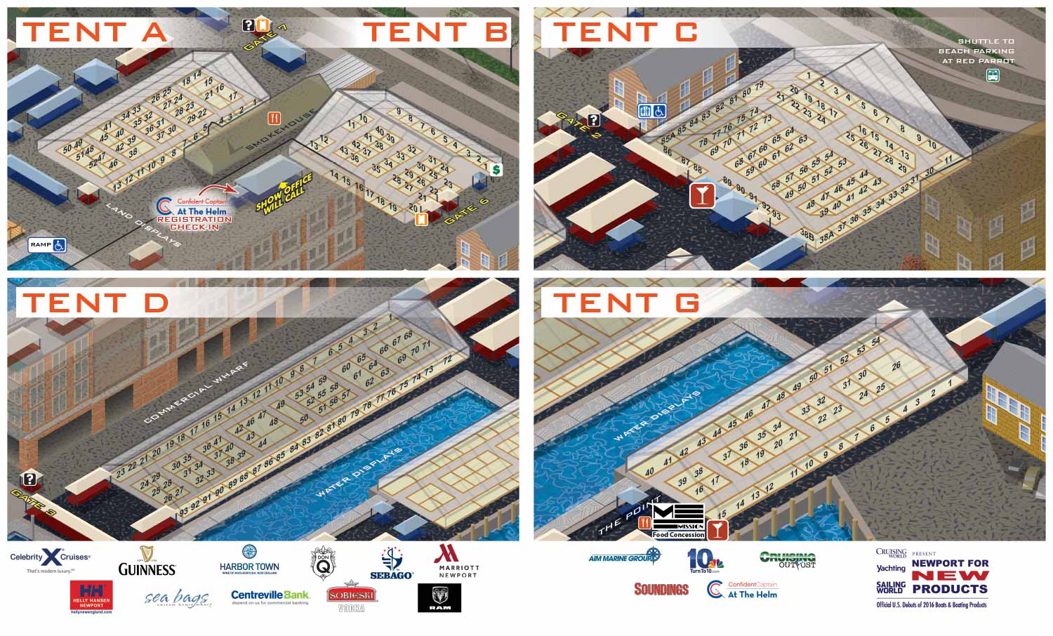
This map is a custom detail view of the land exhibit areas for the 2015 show. It was created from the main show map I illustrated that year.
Because the main map was built as a vector file, I could pull out specific sections and enlarge them without any loss of quality. The booth numbers and vendor locations, which would be too small to read on the full map, become clear and usable in these detailed views.
The style matches the main map exactly. That consistency helps visitors move between the overview and the detail without getting disoriented. They see the same buildings, the same angles, and the same visual language.
Custom Maps For Your Event
These tent maps are a good example of how custom illustration can solve real problems. The main map gives visitors the lay of the land. The detail maps help them actually find what they came for.
If your event has exhibitors in tents or inside a convention hall, custom detail maps are a simple way to improve the experience. They make navigation easier for attendees and make exhibitors easier to find.
What I Can Do For You
If you need custom illustrated maps for an event or venue, I can help. I have been doing this work since 2012 for boat shows, resorts, marinas, and more. Contact me and tell me about your project.
Maps For Newport International Boat Show:
- About Newport International Boat Show
- Main Map: 2026 | 2025 | 2024 | 2023 | 2022 | 2021 | 2019 | 2018 | 2017 | 2016 | 2015 | 2014 | 2013 | 2012
- Tent Details Map: 2026 | 2017 | 2016 | 2015 | 2014 | 2013 | 2012
- Video: 2012
BROWSE MY WORK
- Illustration: Browse custom illustrations, book cover art, illustrated maps, and architectural renderings.
- Fine art: View original paintings and drawings, the Custom Halftone Series, and mural commissions.
- Graphic design & motion: See design projects, then watch motion reels and animated pieces.
- Maps by use case: Explore illustrated maps created for boat shows, resorts, marinas, real estate, transportation & parking, cities & towns, parks, and wayfinding.
- Specialty projects: Also check out cover design, vinyl & vehicle wraps, proposal renderings, and street art.
- Style & technique: Discover vector, isometric, painterly, monochrome, data-driven, bird's-eye, and halftone approaches.
- Tools I use: Everyday software includes Photoshop, Illustrator, SketchUp, and InDesign; motion work relies on Premiere & After Effects. Recently I have begun some work using AI as well.