Visitor's illustrated guide map
Client: Show Management
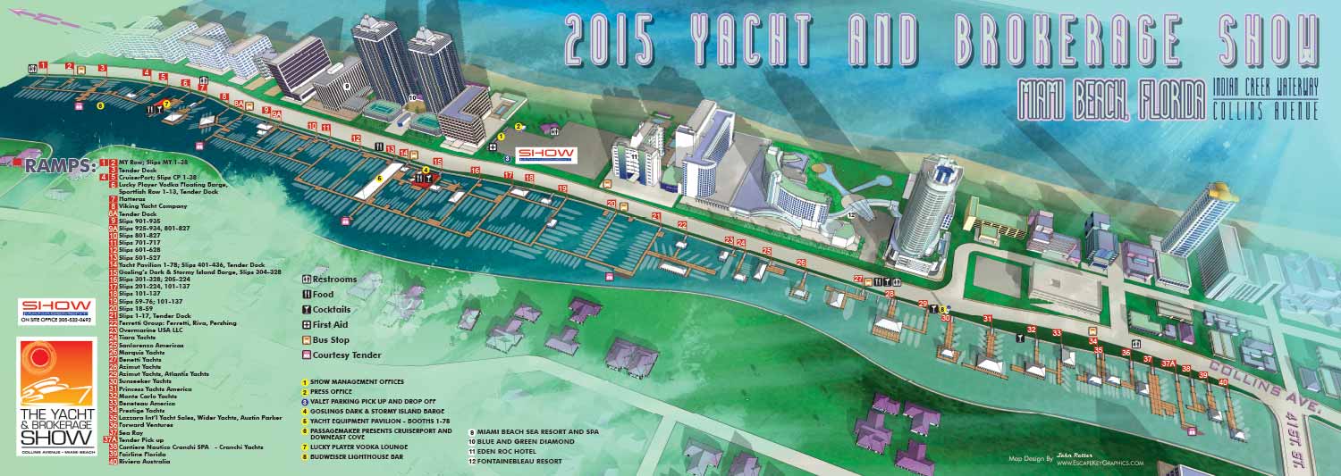
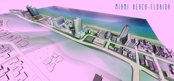
This Miami Beach map was the result of modification of the existing digital model created for previous years' show. For 2015 I introduced a painterly watercolor feel to the map.
The illustration features a distinctly Miami inspired color palette with soft pastels that reflect the character and energy of the area. The map was designed as a wide foldout piece for print use. The surrounding neighborhood rendered in this map remains largely unchanged, making the map a lasting visual record of the location and a resource I can return to if needed.
Wayfinding was handled through a clear and organized system. Ramps were keyed using numbered red rectangles, while additional points of interest were marked with colored, numbered dots. Recurring amenities were represented with simple icons for easy recognition. If no fault is found in a recurrent navigational system I am generally reluctant to alter it just for the sake of originality. The three dimensional model was created in SketchUp Pro, refined in Adobe Photoshop, and completed with final layout and graphic elements in Adobe Illustrator. This project demonstrates an ability to introduce minor design and rendering changes to add variety to a map that has recurrent use.
2015 Yacht and Brokerage Show in Miami Beach | 2015 Shuttle Bus Routes MapEXAMPLES OF MAPS CREATED FOR MIAMI BOAT SHOWS:


Maps For Boat Shows In Miami:
- About Miami Boat Shows
- Miami International Boat Show / Miami Yacht Show / Yachts Miami Beach / Miami Beach Yacht and Brokerage Show - Show Center/Primary Venue Maps: 2026 | 2025 | 2024 | 2023 | 2022 | 2020 | 2019 | 2018 | 2017 | 2016 | 2015 | 2014 | 2013 | 2012 | 2011
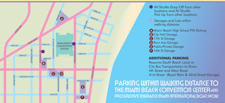
- Transportation Map: 2026 | 2025 | 2024 | 2023 | 2022 | 2020 | 2019 | 2016 | 2013 | 2012
- Program Layout: 2026 | 2025 | 2024 | 2023 | 2022
- Yacht Haven Grande at Island Gardens: 2026 | 2022 | 2020 | 2016
- Miami Beach Convention Center: 2026 | 2025 | 2024 | 2023 | 2022 | 2013 | 2012
- Sea Isle Marina Only: 2013 | 2012
- Miamarina at Bayside Only: 2013 | 2012 | 2011
- Bayfront Park: 2015
- Museum Park Marina: 2025 | 2024 | 2023 | 2022
- Illustration (not a map): 2014
- Video: 2013
Miami International Boat Show Maps 2013:
Miami Beach Convention Center Map | New Yacht & Power Boat Show at Sea Isle MarinaStrictly Sail Miami at Miamarina Bayside | Miami International Boat Show Transit | Miami Beach Convention Center Parking


EXPLORE MY WORK
- Illustration: Discover custom illustrations, book covers, illustrated maps, and architectural renderings.
- Fine Art: Browse original paintings and drawings, view the Custom Halftone Series, or check out mural projects.
- Graphic Design & Motion: See the graphic design collection, then dive into motion design and animated illustrations.
- Maps by industry: View illustrated maps tailored for boat shows, resorts, marinas, real estate, transportation, towns, parks, and wayfinding.
- More project types: Explore cover art, vehicle wraps, proposal renderings, and street art.
- Techniques & styles: Work spans vector, isometric, painting, black-and-white, GeoData, overhead maps, and halftones.
- Software expertise: Primary tools include Photoshop, Illustrator, SketchUp Pro, and InDesign, plus Premiere Pro & After Effects for motion.