A custom illustrated map for SYBAss at the Fort Lauderdale International Boat Show
Illustration and Design by John Potter - Escape Key Graphics
Client: SYBAss (Superyacht Builders Association)
Client: SYBAss (Superyacht Builders Association)
For all the latest information on SYBAss please visit their site at SYBAss.org.
If you are interested in hiring me to create an original map or illustration for you please contact me.
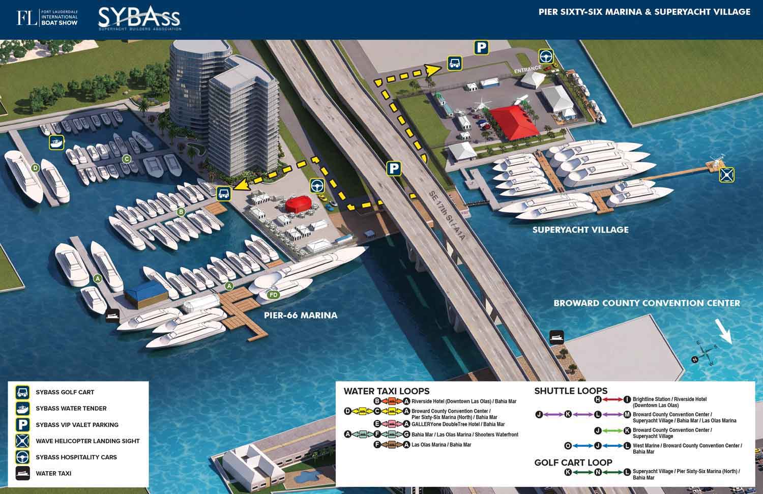
This map, like all of my current boat show maps, is built on a digital three dimensional model. This map covers the marinas immediately adjacent the 17th Street Causeway Bridge in Fort Lauderdale, Florida. Namely the Pier Sixty-Six Marina and Superyacht Village.
Each year I update this model with the new locations of floating docks and exhibitor spaces. I render it from the desired angle, then retouch and refine in Photoshop. Finally I add the logos, map key, and all other graphics in Adobe Illustrator.
SYBAss, which stands for Superyacht Builders Association, wanted to highlight their specific features at the show. Because I already had the updated digital model, I could create a unique map focused just on their section. Having a model to work from means I can change the angle, zoom level, and even the field of view to create a custom view that highlights an area in a way that a standard map cannot.
For this year’s map I used AI rather than a rendering engine to get the finished look with more realistic materials, shading and textures. The illustration was already complete. Artificial intelligence simply refined it into a more finished and realistic finished image.
I should mention that the information used to create these maps comes from the show managers. I only make these maps with the agreement of the show management company, in this case Informa Markets.
If you need a map for a boat show, an event, or any other venue that requires clear, detailed, and visually consistent navigation, contact me. I have done this work before and I would be glad to do it for you.


