
Convention Center Map Design 2016: The Hallmark of a Polished Event
Client: Show Management
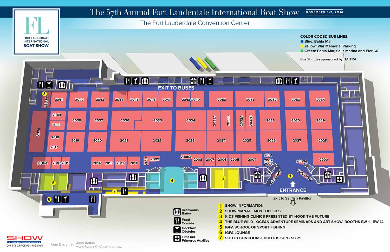
Map for the Fort Lauderdale International Boat Show 2016
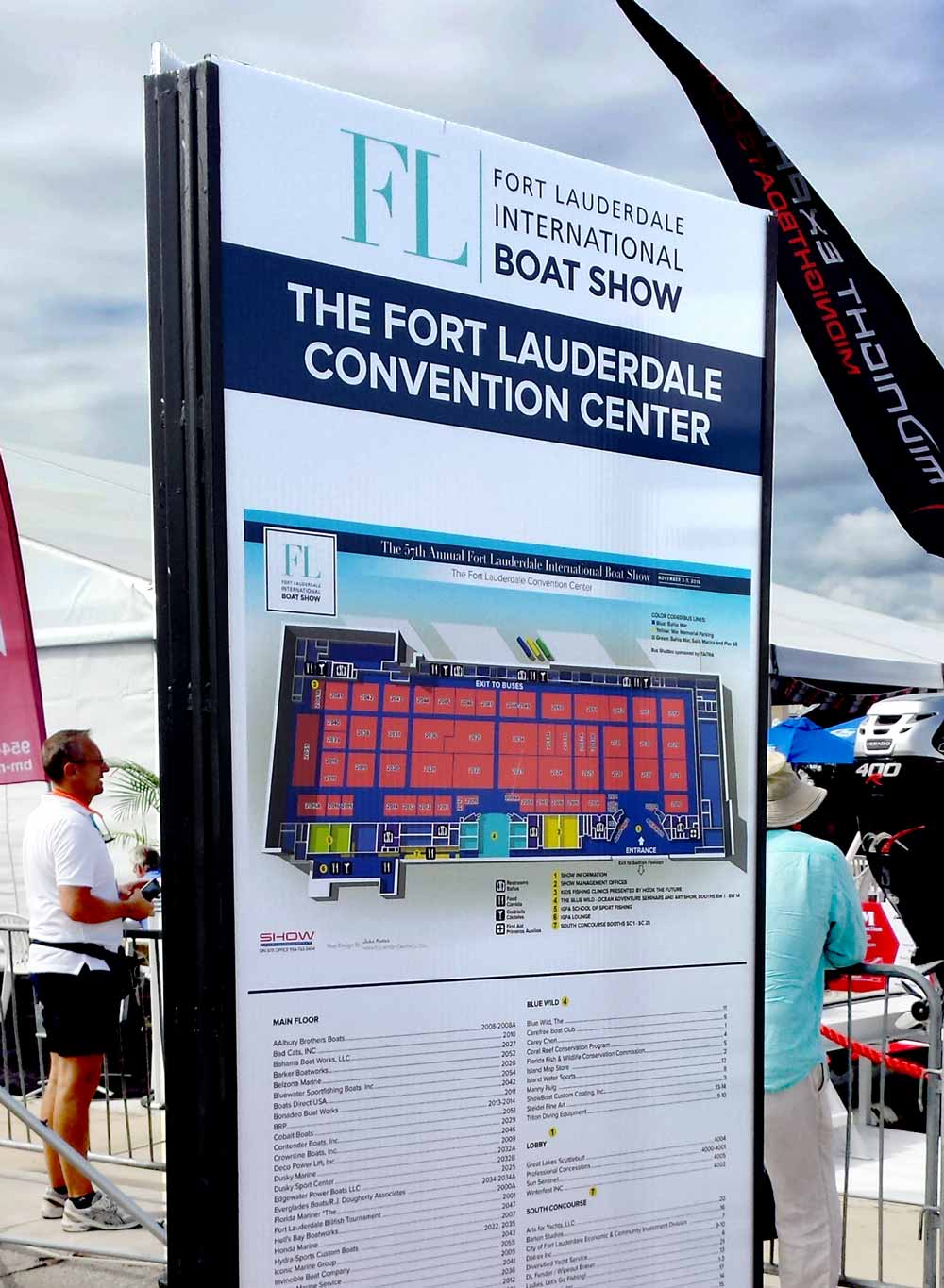
This 2016 map of the Broward County Convention Center for the Fort Lauderdale International Boat Show (FLIBS) represents the steady refinement of a trusted design. Building directly upon the successful, contemporary framework established the previous year, this iteration required the precise annual updates that ensure the map's continued role as an indispensable resource for attendees navigating one of the world's largest marine events.
The primary task involved the detailed revision of exhibitor information: updating the placement of each exhibitor space, adjusting the footprints of their areas on the convention floor, and meticulously revising all corresponding booth number spans. These updates, though seemingly routine, are critical. They transform a static venue illustration into a dynamic, event specific tool, guaranteeing accuracy for thousands of visitors seeking specific vendors and exhibits.
The visual presentation remained consistent, maintaining the clean, modern aesthetic with ample white space and an overhead perspective that had proven effective for clarity. The functional systems, being color coded transportation keys, intuitive graphical icons for amenities, and clear point of interest markers, were all retained to provide immediate familiarity for returning guests.
More Than a Map: A Foundational Marketing Asset
A professional illustrated map like this serves a purpose far beyond on site wayfinding. While it excels as a handout and environmental signage, guiding visitors seamlessly through a complex space, its value begins long before the doors open.
In the pre event phase, promotional materials often struggle to convey substance. A custom map solves this by offering tangible, meaningful content. It is a unique marketing asset that communicates organization, scale, and professionalism at a glance. It allows an event organizer to promote the experience with an aesthetically pleasing piece that genuinely informs and excites potential attendees, setting a premium tone and building anticipation. For any sizable conference, trade show, or public exhibition, a well designed map is not merely an accessory; it is a hallmark of a thoroughly planned and attendee focused event, blending essential utility with powerful visual communication.
This map continues an annual design series. To see the previous year's major redesign that established this visual style, please visit the Broward Convention Center 2015 Map.
For more examples of how custom illustration elevates event navigation and branding, please explore my full Maps Portfolio.
Fort Lauderdale International Boat Show Maps:
- About Fort Lauderdale International Boat Show
- Bahia Mar, Swimming Hall of Fame & Las Olas Marina Maps: 2025 | 2024 | 2023 | 2022 | 2020 | 2019 | 2018 | 2017 | 2016 | 2015 | 2014 | 2013 | 2012 | 2011 | 2010
- Parking and Transportation Maps: 2025 | 2024 | 2023 | 2022 | 2020 | 2019 | 2018 | 2015 Bus | 2015 Water Taxi | 2014 | 2013 | 2012 | 2011
- Broward County Convention Center Maps: 2025 | 2024 | 2023 | 2022 | 2017 Sailfish Pavilion | 2017 | 2016 Sailfish Pavilion | 2016 | 2015 Sailfish Pavilion | 2015 | 2014 Sailfish Pavilion | 2014 | 2013 Sailfish Pavilion | 2013 | 2012 | 2011 | 2010
- Marinas Maps: 2025 | 2024 | 2023 | 2022 | 2019 | 2016
- Program Layouts: 2025 | 2024 | 2023 | 2022
- Signs: 2013 looking north | 2013 Yachting Tent
- Video: 2013 54th Annual
- Illustrations (not maps): 2014A | 2014B


PORTFOLIOS
- Illustration Portfolio: Start here for custom illustration and book covers. You can also browse illustrated maps and architectural rendering.
- Fine Art: I offer original paintings and drawings, including my Custom Halftone Series. You will also find mural work here.
- Graphic Design & Motion: View my graphic design portfolio. After that, explore motion design and animated illustrations.
- Maps by application: I create illustrated maps for boat shows, resorts, marinas, real estate, transportation, transit and parking, towns and cities, parks, and wayfinding.
- Additional project types: I also produce cover illustration, vehicle and vinyl wraps, proposal renderings, and street art.
- Illustration methods: My techniques include vector, isometric and axonometric, painting, black and white, GeoData maps, overhead maps, and custom halftones.
- Software portfolios: I work primarily in Adobe Photoshop, Adobe Illustrator, SketchUp Pro, and Adobe InDesign. For motion projects, I use Premiere Pro and After Effects.