Illustrated Boat Show Guest Map
Client: The Newport Exhibition Group
Visit the show's website to learn more about The 46th Annual Newport International Boat Show at http://www.newportboatshow.com/
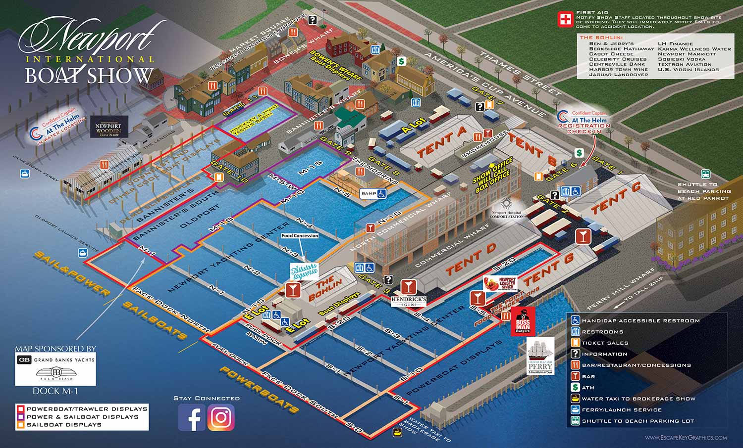
This project is the revised map for the 2017 Newport International Boat Show. Widely regarded as one of the most respected boat shows in the Northeast, the event covers more than seventeen acres in historic downtown Newport, Rhode Island. The show extends across several interconnected waterfront locations, including the Newport Yachting Center, Perry Mill Wharf, Bowen’s Wharf, Bannister’s Wharf, and Market Square, with additional programming such as educational seminars and demonstrations.
The map is an axonometric illustration designed to function as a clear and efficient wayfinding tool. For this project, the client preferred direct labeling rather than heavy reliance on numbered keys. Docks, tents, and major points of interest are labeled directly on the map, while recurring amenities are identified using simple, recognisable icons. Select areas of the show are defined with a colour coded system that helps visitors understand how the different sites relate to one another. The palette was chosen to reflect the character and maritime history of Newport while maintaining clarity at a dense scale.
This map was used across multiple formats, including printed handouts, on site signage, and digital platforms. It successfully balanced detailed information with visual appeal, supporting visitor navigation while also serving as a polished marketing asset for one of the region’s most prominent boating events.
I created the original map for The Newport Exhibition Group in 2012.
Maps For Newport International Boat Show:


